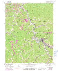
1964 Map of Williamson
USGS Topo · Published 1991About this map
The Tug Fork of the Tug River serves as the winding border between West Virginia and Kentucky, framing the commercial heart of Williamson. This industrial landscape is deeply influenced by the Norfolk and Western railway, which follows the riverbank to support a network of nearby mines, including those at Borderland and Nolan. The topographic detail reveals a region defined by its coal-rich hollows, such as Groundhog Hol and Oil Well Hol, where narrow valleys dictate the placement of local infrastructure.
Find a feature on this map
83 named features on this map. Tap any name to fly to it.
Don’t see what you’re looking for? This feature index may not catch every label — zoom into the map to look around manually.
Map Details
Editions of this 1964 Williamson Map
4 editions found
Other maps of this area

1887 · Warfield
USGS Topo · 1:125,000

1891 · Warfield
USGS Topo · 1:125,000

1909 · Matewan
USGS Topo · 1:48,000

1910 · Holden
USGS Topo · 1:48,000

1910 · Naugatuck
USGS Topo · 1:48,000

1912 · Naugatuck
USGS Topo · 1:62,500

1912 · Holden
USGS Topo · 1:62,500

1915 · Williamson
USGS Topo · 1:48,000

1915 · Naugatuck
USGS Topo · 1:48,000

1915 · Matewan
USGS Topo · 1:48,000