1990s Maps of Pikeville, Kentucky
Explore 3 historic maps of Pikeville from the 1990s. These maps offer a rare glimpse into what life looked like during the 1990s — showing old roads, neighborhoods, homes, and landmarks that have changed or disappeared over time.
Whether you're researching your family's past, planning a metal detecting trip, or studying how Pikeville's landscape evolved across the 1990s, these high-resolution maps are a powerful tool for exploring the history of this region.
- Focus on a specific era: All maps on this page are from the 1990s, giving you a focused view of this time period.
- See what’s changed: Compare century-old streets, trails, and buildings to today's modern landscape using overlays and satellite layers.
- Research with precision: Use these maps for genealogy, historical research, land use analysis, or educational projects.
- View, download, or print: Maps are fully viewable online in high resolution, and can be downloaded or printed for your own records.
Start exploring Pikeville's history through authentic maps from the 1990s. This is your window into the past.
Pikeville, KY maps
(3)- 1992 Map of Pikeville
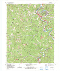 1992 Pikeville1992 Print · USGSPike County's coal country comes into sharp focus during the early nineties as the river and rail network supports a growing Pikeville. Genealogists and historians can trace family-named hollows and settlements like Kewanee, Little Dixie, and the Johnson Memorial Cem.
 - 1992 Map of Meta
 1992 Meta1992 Print · USGSPike County's coal country and narrow creek valleys come into focus in the early nineties, centered on the communities of Meta and Zebulon. Researchers can trace the legacy of resource extraction and local genealogy through numerous Mines, family-named hollows like Deskin Branch, and the Salem Ch.
 - 1992 Map of Broad Bottom
 1992 Broad Bottom1992 Print · USGSThe Levisa Fork valley shows its industrial character in the early nineties, with coal operations looming over a busy transport corridor. Trace family landmarks and rail stops from Blair Town and Coal Run to the Big Shoal Sta.
End of results
Showing maps 1-3 of 3
Top cities near Pikeville
- Prestonsburg historical maps
- Coal Run Village historical maps
- Wheelwright historical maps
- Elkhorn City historical maps
- Betsy Layne historical maps
- Martin historical maps
See more
Top neighborhoods of Pikeville
- Pleasant Valley historical maps
- Titan Siding historical maps
- Mayo Village historical maps
- Pauley historical maps
- Blair Town historical maps
- Yorktown historical maps
Frequently asked questions
- What are the different types of historical maps available for Pikeville?
- What is the oldest map of Pikeville?
- Where can I purchase historical maps of Pikeville for my home or office?
- Where can I download high-res historical maps of Pikeville?
- Are there historical topographic maps available for Pikeville?
- Is there historical aerial imagery available for Pikeville?
- Where are historical maps of Pikeville sourced from?