1900s (20th Century) Maps of Pikeville, Kentucky
Explore 24 historic maps of Pikeville from the 1900s (20th Century). These maps offer a rare glimpse into what life looked like during the 1900s — showing old roads, neighborhoods, homes, and landmarks that have changed or disappeared over time.
Whether you're researching your family's past, planning a metal detecting trip, or studying how Pikeville's landscape evolved across the 1900s, these high-resolution maps are a powerful tool for exploring the history of this region.
- Focus on a specific era: All maps on this page are from the 1900s, giving you a focused view of this time period.
- See what’s changed: Compare century-old streets, trails, and buildings to today's modern landscape using overlays and satellite layers.
- Research with precision: Use these maps for genealogy, historical research, land use analysis, or educational projects.
- View, download, or print: Maps are fully viewable online in high resolution, and can be downloaded or printed for your own records.
Start exploring Pikeville's history through authentic maps from the 1900s. This is your window into the past.
Pikeville, KY maps
(24)- 1914 Map of Laynesville
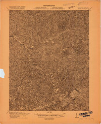
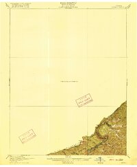
 1914 Laynesville1914 Print · USGSEastern Kentucky's river valleys and mountain hollows are meticulously mapped here in the years before the Great War. Genealogists can trace the locations of dozens of early schoolhouses, from School No 16 to the Sandy Valley Normal School, alongside river towns like Laynesville and Betsy Layne.
 - 1914 Map of Vergie
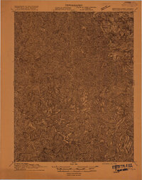
 1914 Vergie1914 Print · USGSPike County's coal hollows and creek-side settlements are captured here during the rail-driven expansion of the early twentieth century. Genealogists can locate family homesites near numerous numbered schoolhouses, the Sandy Valley & Elkhorn RR, and early post offices at Virgie and McDowell.
 - 1915 Map of Regina
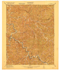
 1915 Regina1915 Print · USGSPike County at the dawn of the coal boom is defined by a dense river-and-rail network along the Levisa Fork. Genealogists and historians can trace old post offices and rail stops like Shelbiana P.O., Mouthcard, and Elkhorn City.2 unique versions available
 - 1915 Map of Williamson
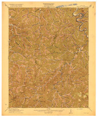
 1915 Williamson1915 Print · USGSThe borderlands of the Tug Fork river come alive in this early century survey of the Central Appalachian coal country. Genealogists and local historians can trace the early rail-side growth of Williamson, Chattaroy, and Nolan along the Norfolk and Western Ry.2 unique versions available
 - 1916 Map of Harold
 1916 Harold1916 Print · USGSEastern Kentucky's river valleys and railroad corridors come alive in this mid-1910s survey of the Big Sandy region. Researchers can trace the development of the Chesapeake and Ohio line through river towns like Betsy Layne and Laynesville, or locate family-centric sites like Woods Emma PO and the Sandy Valley Normal School.3 unique versions available
 - 1916 Map of Pikeville
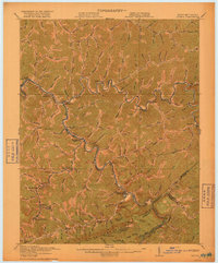
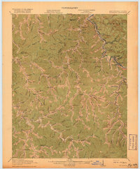
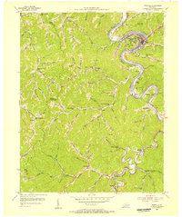
 1916 Pikeville1916 Print · USGSEastern Kentucky's coal and river country comes into focus in the mid-1910s as the railroad moves deep into the hollows. Genealogists and local historians can locate early family-named landmarks and mountain communities like Weeksbury, Virgie, and James Chapel.5 unique versions available
 - 1916 Map of Regina
 1916 Regina1916 Print · USGSThe Virginia and Kentucky borderlands are captured here in the years before the Great War, focusing on the dramatic river gorge country. Genealogists and hikers can trace the Carolina Clinchfield and Ohio rail route near The Breaks and The Towers.2 unique versions available
 - 1917 Map of Regina
 1917 Regina1917 Print · USGSThe Pike County coalfields and the winding Kentucky-Virginia border are captured here just before the close of the Great War. Genealogists can locate family homes and old post offices at Sutton PO, Regina PO, and Carmen PO along the steep hollows.3 unique versions available
 - 1918 Map of Williamson
 1918 Williamson1918 Print · USGSThe Tug Fork river valley at the Kentucky-West Virginia border comes alive in this survey from the era of the Great War. Researchers can trace the path of the Norfolk and Western RR through Williamson or locate rural schools like Hammon Manor School and the Pinson Fork P O Peg Sta.3 unique versions available
 - 1954 Map of Broad Bottom, 1955 Print
 1954 Broad Bottom1955 Print · USGSThe Levisa Fork valley in the mid-1950s shows a landscape transformed by the gas industry and the railroad. Researchers can trace family-named sites like Blair Town and Snivley Chapel or find vanished landmarks like the Drive-in Theater and Pikeville Airfield.
 - 1954 Map of Meta, 1955 Print
 1954 Meta1955 Print · USGSMid-century Pike County is captured here at a time when mountain life was centered around local hollow schools and churches. Genealogists can trace family footprints at Zebulon PO or locate ancestors near Salem Ch and the Johns Creek High Sch.2 unique versions available
 - 1954 Map of Pikeville, 1956 Print
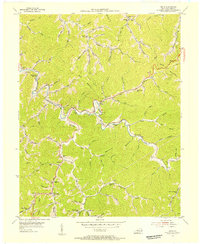
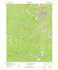
 1954 Pikeville1956 Print · USGSMid-century Pike County comes to life as the Chesapeake and Ohio railroad follows the winding Levisa Fork. Genealogists and local historians can trace rural schoolhouses and hollow settlements, from Mayo Village to the Little Dixie Sch and Island Creek Ch.2 unique versions available
 - 1954 Map of Millard, 1956 Print
 1954 Millard1956 Print · USGSThe Levisa Fork valley in the mid-1950s shows a landscape of mountain hollows and riverside rail towns. Genealogists can trace family names at Rest Haven Cem or locate historic local hubs like Justiceville, Shelbiana, and the Millard PO.
 - 1957 Map of Jenkins, 1974 Print
 1957 Jenkins1974 Print · USGSThe Cumberland Plateau in the mid-twentieth century reveals a complex landscape of winding river valleys and deep-seated industry. Genealogists and historians can trace the development of Hazard, Jenkins, and Pikeville alongside extensive Numerous Oil and Gas Fields and the routes of the Chesapeake & Ohio Railway.
 - 1960 Map of Jenkins
 1960 Jenkins1960 Print · USGSEastern Kentucky and the West Virginia borderlands are captured at a mid-century peak of the coal and rail era. Trace the industrial corridors of the Chesapeake and Ohio RR through mountain hubs like Hazard and Jenkins.
 - 1977 Map of Pikeville, 1983 Print
 1977 Pikeville1983 Print · USGSThe Central Appalachian coalfields and the rugged borders of Kentucky and Virginia come into focus during the late seventies. Researchers can trace the rail networks of the C & O and L & N through towns like Jenkins, Whitesburg, and Pikeville.
 - 1978 Map of Meta
 1978 Meta1978 Print · USGSEastern Kentucky coal country and the winding banks of Johns Creek appear here in the late seventies. Family historians and researchers can trace local roots through the Williamson Cem, Pilgrims Rest Ch, and the schools at Zebulon.
 - 1978 Map of Millard, 1979 Print
 1978 Millard1979 Print · USGSPike County in the late seventies reveals a landscape shaped by coal mining and major water projects. Local historians can trace the Chesapeake and Ohio rail lines connecting Shelbiana to Justiceville, or locate family landmarks like the Sutton Mansion and Rest Haven Cem.
 - 1978 Map of Pikeville, 1979 Print
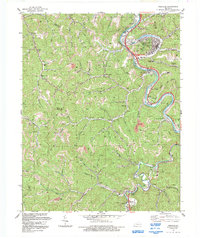
 1978 Pikeville1979 Print · USGSIn the late 1970s, the coal valleys of eastern Kentucky centered on Pikeville were shaped by heavy industry and rail. Genealogists and historians can trace family roots through the Johnson Memorial Cem and settlements like Mayo Village and Galveston.
 - 1979 Map of Broad Bottom
 1979 Broad Bottom1979 Print · USGSThe Levisa Fork valley in the late seventies is a complex landscape of coal mining and riverside communities. Researchers can trace the Chesapeake and Ohio rail lines as they serve Broad Bottom and the Coal Run Substation.
 - 1982 Map of Williamson, 1983 Print
 1982 Williamson1983 Print · USGSThe Central Appalachian coalfields of West Virginia and Kentucky come into sharp focus here during the early eighties. Genealogists and researchers can trace the valley rail networks of the Norfolk and Western RR through Matewan, Williamson, and Blackberry City.
 - 1992 Map of Pikeville
 1992 Pikeville1992 Print · USGSPike County's coal country comes into sharp focus during the early nineties as the river and rail network supports a growing Pikeville. Genealogists and historians can trace family-named hollows and settlements like Kewanee, Little Dixie, and the Johnson Memorial Cem.
 - 1992 Map of Meta
 1992 Meta1992 Print · USGSPike County's coal country and narrow creek valleys come into focus in the early nineties, centered on the communities of Meta and Zebulon. Researchers can trace the legacy of resource extraction and local genealogy through numerous Mines, family-named hollows like Deskin Branch, and the Salem Ch.
 - 1992 Map of Broad Bottom
 1992 Broad Bottom1992 Print · USGSThe Levisa Fork valley shows its industrial character in the early nineties, with coal operations looming over a busy transport corridor. Trace family landmarks and rail stops from Blair Town and Coal Run to the Big Shoal Sta.
End of results
Showing maps 1-24 of 24
Top cities near Pikeville
- Prestonsburg historical maps
- Coal Run Village historical maps
- Wheelwright historical maps
- Elkhorn City historical maps
- Betsy Layne historical maps
- Martin historical maps
See more
Top neighborhoods of Pikeville
- Pleasant Valley historical maps
- Titan Siding historical maps
- Mayo Village historical maps
- Pauley historical maps
- Blair Town historical maps
- Yorktown historical maps
Frequently asked questions
- What are the different types of historical maps available for Pikeville?
- What is the oldest map of Pikeville?
- Where can I purchase historical maps of Pikeville for my home or office?
- Where can I download high-res historical maps of Pikeville?
- Are there historical topographic maps available for Pikeville?
- Is there historical aerial imagery available for Pikeville?
- Where are historical maps of Pikeville sourced from?