1900s (20th Century) Maps of Bronston, Kentucky
Explore 6 historic maps of Bronston from the 1900s (20th Century). These maps offer a rare glimpse into what life looked like during the 1900s — showing old roads, neighborhoods, homes, and landmarks that have changed or disappeared over time.
Whether you're researching your family's past, planning a metal detecting trip, or studying how Bronston's landscape evolved across the 1900s, these high-resolution maps are a powerful tool for exploring the history of this region.
- Focus on a specific era: All maps on this page are from the 1900s, giving you a focused view of this time period.
- See what’s changed: Compare century-old streets, trails, and buildings to today's modern landscape using overlays and satellite layers.
- Research with precision: Use these maps for genealogy, historical research, land use analysis, or educational projects.
- View, download, or print: Maps are fully viewable online in high resolution, and can be downloaded or printed for your own records.
Start exploring Bronston's history through authentic maps from the 1900s. This is your window into the past.
Bronston, KY maps
(6)- 1932 Map of Burnside
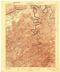 1932 Burnside1932 Print · USGSThe Cumberland River and its South Fork are captured here in the early 1930s, showing the intricate river-and-rail topography of southern Kentucky. Researchers can locate dozens of country landmarks like Roberts Mill, Lovells Chapel, and Pole Bridge Sch.2 unique versions available
 - 1954 Map of Burnside, 1955 Print
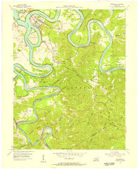 1954 Burnside1955 Print · USGSThe river loops and rugged ridges of Pulaski County are caught here in the mid-fifties, just as the Southern railroad served the timber and coal interests of the region. Researchers can locate vanished landmarks and family sites like Mt Union Sch, Owens Cem, and the old station at Sloans Valley.2 unique versions available
 - 1956 Map of Corbin, 1966 Print
 1956 Corbin1966 Print · USGSThe Kentucky and Tennessee borderlands are captured here in the mid-fifties, showing the region's shift toward modern interstate travel and reservoir development. Genealogists and historians can trace old community lines near Albany and Monticello or locate early rail junctions along the Southern and Tennessee Central lines.3 unique versions available
 - 1958 Map of Corbin
 1958 Corbin1958 Print · USGSThe Upper Cumberland borderlands appear in the late 1950s as massive reservoirs and early atomic-era growth reshape the region. Trace family roots and vanished landmarks near Lake Cumberland, Oak Ridge, and the Cumberland National Forest.
 - 1965 Map of Burnside, 1967 Print
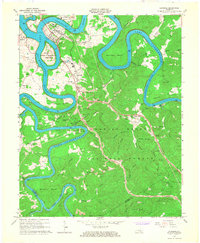 1965 Burnside1967 Print · USGSMid-century Pulaski County is defined by the winding waters of the Cumberland and South Fork rivers. Genealogists and hikers can locate family landmarks like Grave Hill Cemetery, the community at Sloans Valley, and the Alpine Recreation Area.3 unique versions available
 - 1981 Map of Corbin, 1984 Print
 1981 Corbin1984 Print · USGSThe Kentucky and Tennessee borderlands in the early eighties were characterized by coal towns and deep mountain ridges. Trace family history or rail routes through Stearns, Williamsburg, and the mining settlements near Jellico Mountain along the L & N RR.
End of results
Showing maps 1-6 of 6
Top cities near Bronston
- Somerset historical maps
- Monticello historical maps
- Ferguson historical maps
- Burnside historical maps
- Science Hill historical maps
Frequently asked questions
- What are the different types of historical maps available for Bronston?
- What is the oldest map of Bronston?
- Where can I purchase historical maps of Bronston for my home or office?
- Where can I download high-res historical maps of Bronston?
- Are there historical topographic maps available for Bronston?
- Is there historical aerial imagery available for Bronston?
- Where are historical maps of Bronston sourced from?