Old Maps of Eubank, Kentucky
Explore 10 old maps of Eubank, spanning from 1952 to today. These high-resolution historic maps reveal how streets, neighborhoods, landmarks, and natural features evolved over time — perfect for genealogy, metal detecting, research, and local history exploration.
What you can do with these maps:
- See how Eubank changed over time: Compare historical maps to modern-day views to trace roads, homesites, rail lines & more.
- View detailed metadata: Each map includes creators, publishers, year, scale, and archive source.
- Overlay maps with satellite & LiDAR: Visualize the past alongside modern tools to explore terrain & human change.
- Trusted historical sources: Maps sourced from the USGS, Library of Congress, and other archives.
- Access maps your way: View online, download high-res files, or order prints for personal or research use.
Start exploring old maps of Eubank to uncover forgotten places, hidden landmarks, and the deep history beneath your feet.
Eubank, KY maps
(10)- 1952 Map of Eubank, 1953 Print
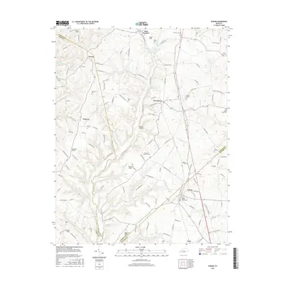
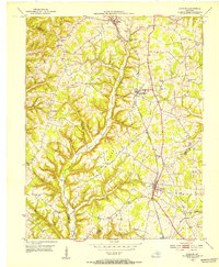 1952 Eubank1953 Print · USGSThe Eubank area and the southern Lincoln County borderlands appear here in the early fifties, following the path of the Southern railroad. Researchers can trace rural lineages through numerous landmarks like Phillips Chapel, Double Spring Cem, and Walnut Grove Sch.
 - 1957 Map of Winchester, 1968 Print
 1957 Winchester1968 Print · USGSCentral Kentucky's landscape in the mid-twentieth century features the sprawling Fort Knox and the early parkway system. Genealogists and historians can trace rail lines like the Southern Railway and find landmarks from Bernheim Forest to Pilot Knob.3 unique versions available
 - 1960 Map of Winchester
 1960 Winchester1960 Print · USGSCentral Kentucky's diverse landscape is shown here at mid-century, from the bluegrass plains to the rugged Pottsville Escarpment. Genealogists and historians can trace the rail-and-river network connecting towns like Bardstown and Stanford alongside landmarks like Lake Cumberland.
 - 1961 Map of Eubank, 1962 Print
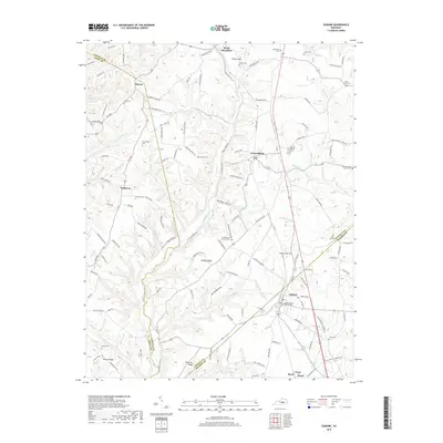
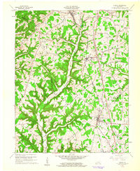 1961 Eubank1962 Print · USGSThe rural landscapes of Lincoln and Pulaski counties come alive in this early 1960s record of the Cumberland plateau. Genealogists can trace homesteads and local landmarks like Double Spring Cem, Phillips Chapel, and the old Pond Sch site.2 unique versions available
 - 1982 Map of Somerset, 1983 Print
 1982 Somerset1983 Print · USGSThe Lake Cumberland region and the Daniel Boone National Forest appear here in the early eighties. Researchers can trace rural lineages through Broughtontown, Science Hill, and Sinking Valley Church while exploring the rail lines of the Southern Railway.
 - 2010 Map of Eubank, 2010 Print
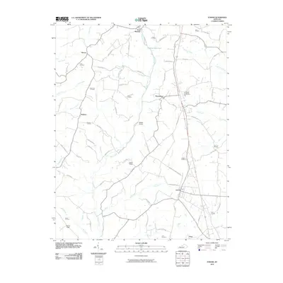 2010 Eubank2010 Print · USGSCovers Eubank, including Waynesburg, Kings Mountain, and other nearby areas
 - 2013 Map of Eubank, 2013 Print
 2013 Eubank2013 Print · USGSCovers Eubank, including Waynesburg, Kings Mountain, and other nearby areas
 - 2016 Map of Eubank, 2016 Print
 2016 Eubank2016 Print · USGSCovers Eubank, including Waynesburg, Kings Mountain, and other nearby areas
 - 2019 Map of Eubank, 2019 Print
 2019 Eubank2019 Print · USGSCovers Eubank, including Waynesburg, Kings Mountain, and other nearby areas
 - 2022 Map of Eubank, 2022 Print
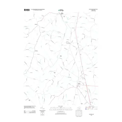
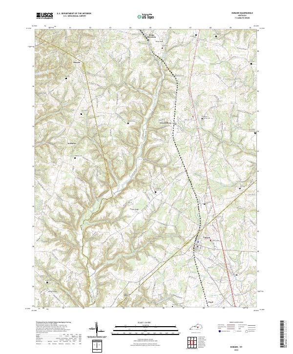 2022 Eubank2022 Print · USGSSmall Kentucky communities like Eubank and Waynesburg are captured here in the early 2020s amidst the hills of Lincoln and Pulaski counties. Genealogists can trace family landmarks and numerous burial sites including Double Spring Cem and Falconbury Cem.
End of results
Showing maps 1-10 of 10
Top cities near Eubank
- Somerset historical maps
- Brodhead historical maps
- Ferguson historical maps
- Crab Orchard historical maps
- Science Hill historical maps
- Hustonville historical maps
Frequently asked questions
- What are the different types of historical maps available for Eubank?
- What is the oldest map of Eubank?
- Where can I purchase historical maps of Eubank for my home or office?
- Where can I download high-res historical maps of Eubank?
- Are there historical topographic maps available for Eubank?
- Is there historical aerial imagery available for Eubank?
- Where are historical maps of Eubank sourced from?