
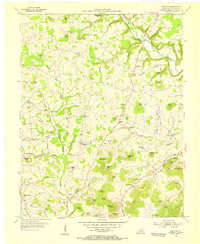
1952 Map of Eubank
USGS Topo · Published 1953About this map
Eubank serves as a primary hub along the Southern railroad line in this mid-century portrait of the borderlands between Lincoln, Casey, and Pulaski counties. The landscape is defined by the winding course of Fishing Creek and its many tributaries, such as Sims Branch and Lick Creek, which carve deep valleys around Elis Ridge and Brown Ridge. This rugged topography dictated a settlement pattern of small, isolated communities and family-named landmarks connected by winding ridge roads.
Find a feature on this map
45 named features on this map. Tap any name to fly to it.
Don’t see what you’re looking for? This feature index may not catch every label — zoom into the map to look around manually.
Map Details
Editions of this 1952 Eubank Map
This is the sole edition of this map. No revisions or reprints were ever made.
Other maps of this area

1935 · Somerset
USGS Topo · 1:62,500

1952 · Halls Gap
USGS Topo · 1:24,000

1952 · Crab Orchard
USGS Topo · 1:24,000

1952 · Hustonville
USGS Topo · 1:24,000

1952 · Yosemite
USGS Topo · 1:24,000

1952 · Woodstock
USGS Topo · 1:24,000

1953 · Mintonville
USGS Topo · 1:24,000
1954 · Bobtown
USGS Topo · 1:24,000

1954 · Science Hill
USGS Topo · 1:24,000

1957 · Winchester
USGS Topo · 1:250,000