Old Maps of Triplett, Kentucky for Hiking & Exploration
Hike through history with 10 historic maps of Triplett. Explore old trails, ghost towns, and forgotten backroads — perfect for outdoor adventurers and local explorers.
- Rediscover forgotten places: Map out old mining camps, roads, and footpaths that no longer exist on modern maps.
- Layer with modern tools: Combine with LiDAR or satellite views to plan hikes through historical terrain.
- Made for exploration: Popular among hikers, overlanders, and local history lovers.
Use these maps to find adventure and explore the hidden past of Triplett.
Triplett, KY maps
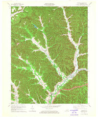
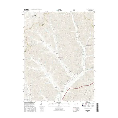
(10)- 1951 Map of Cranston, 1953 Print
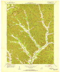 1951 Cranston1953 Print · USGSRowan County in the early fifties shows a landscape of deep hollows and rural outposts within the Cumberland National Forest. Genealogists can trace family lines through sites like McRoberts Cem and schools such as Rock Fork Sch.2 unique versions available
 - 1957 Map of Huntington, 1966 Print
 1957 Huntington1966 Print · USGSThe industrial heart of the Ohio River valley is captured here in the mid-sixties, showing the growth of Huntington and Ashland. Researchers can trace the extensive rail networks of the Chesapeake and Ohio RR and locate sites like the Chief Cornstalk Hunting Ground.3 unique versions available
 - 1960 Map of Huntington
 1960 Huntington1960 Print · USGSThe tri-state river valley thrived in the late fifties as a hub of heavy industry and Appalachian rail transit. Genealogists and historians can trace the connection between river towns like Ashland and Portsmouth or locate family homesteads near Coleman Ridge.
 - 1970 Map of Cranston, 1972 Print
 1970 Cranston1972 Print · USGSThe Daniel Boone National Forest in the 1970s reveals a landscape of isolated hollows and ridge-top lookouts. Genealogists can locate family landmarks like Evans Cem and rural centers such as Cranston, Smile, and the Hickory Flats Lookout Tower.
 - 1982 Map of Morehead, 1983 Print
 1982 Morehead1983 Print · USGSThe foothills of northeastern Kentucky come alive in the early eighties, showcasing a landscape defined by timber, limestone caves, and major reservoirs. Local researchers can trace the development of Morehead State University or locate old crossings at Plummers Mill and Salt Lick.
 - 2011 Map of Cranston, 2011 Print
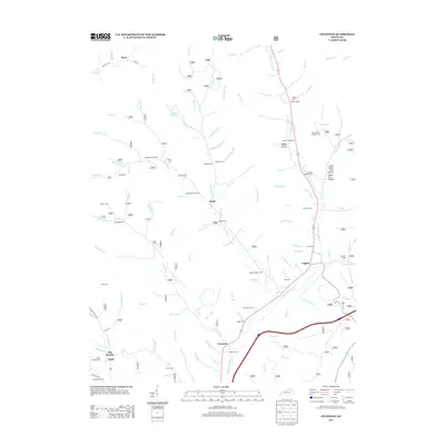
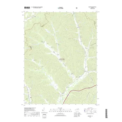
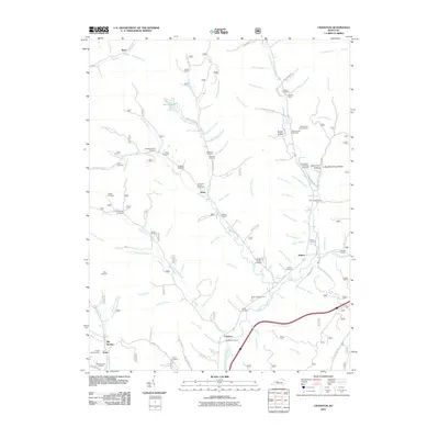 2011 Cranston2011 Print · USGSCovers Triplett, including Waltz, Ryan, and other nearby areas
 - 2013 Map of Cranston, 2013 Print
 2013 Cranston2013 Print · USGSCovers Triplett, including Waltz, Ryan, and other nearby areas
 - 2016 Map of Cranston, 2016 Print
 2016 Cranston2016 Print · USGSCovers Triplett, including Waltz, Ryan, and other nearby areas
 - 2019 Map of Cranston, 2019 Print
 2019 Cranston2019 Print · USGSCovers Triplett, including Waltz, Ryan, and other nearby areas
 - 2022 Map of Cranston, 2022 Print
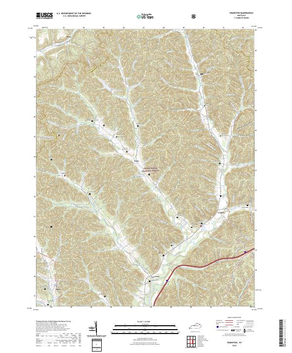 2022 Cranston2022 Print · USGSRowan County's deeply dissected hills and the North Fork Triplett Creek basin are captured here in the early twenty-first century. Genealogists can trace family heritage through numerous hillside burial sites like Cranston Cem, Sardis Cem, and the Anderson Family Cem.
End of results
Showing maps 1-10 of 10
Top cities near Triplett
- Morehead historical maps
- Olive Hill historical maps
- Salt Lick historical maps
- Lakeview Heights historical maps
Frequently asked questions
- What are the different types of historical maps available for Triplett?
- What is the oldest map of Triplett?
- Where can I purchase historical maps of Triplett for my home or office?
- Where can I download high-res historical maps of Triplett?
- Are there historical topographic maps available for Triplett?
- Is there historical aerial imagery available for Triplett?
- Where are historical maps of Triplett sourced from?