2020s Maps of Woodford County, Kentucky
Explore 8 historic maps of Woodford County from the 2020s. These maps offer a rare glimpse into what life looked like during the 2020s — showing old roads, neighborhoods, homes, and landmarks that have changed or disappeared over time.
Whether you're researching your family's past, planning a metal detecting trip, or studying how Woodford County's landscape evolved across the 2020s, these high-resolution maps are a powerful tool for exploring the history of this region.
- Focus on a specific era: All maps on this page are from the 2020s, giving you a focused view of this time period.
- See what’s changed: Compare century-old streets, trails, and buildings to today's modern landscape using overlays and satellite layers.
- Research with precision: Use these maps for genealogy, historical research, land use analysis, or educational projects.
- View, download, or print: Maps are fully viewable online in high resolution, and can be downloaded or printed for your own records.
Start exploring Woodford County's history through authentic maps from the 2020s. This is your window into the past.
Woodford County, KY maps
(8)- 2022 Map of Wilmore, 2022 Print
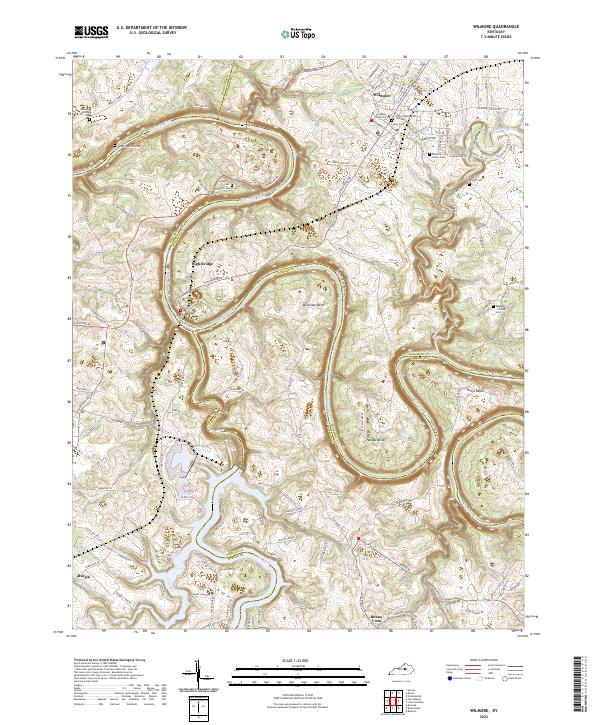 2022 Wilmore2022 Print · USGSWilmore and the dramatic Kentucky River palisades are captured here in the early twenty-first century as the region maintains its academic and river-town character. Genealogists and historians can trace small family plots like Rhorer Cem and Megee - Phillips Cem, or explore the steep terrain of Jessamine Gorge and High Bridge.
 - 2022 Map of Keene, 2022 Print
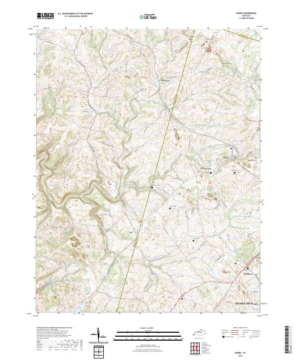 2022 Keene2022 Print · USGSThe rural landscape of Jessamine County comes into focus in this contemporary survey of the Bluegrass region. Genealogists can trace family footprints across Keene, Troy, and numerous burial sites like Price Cem and Russell Cem.
 - 2022 Map of Salvisa, 2022 Print
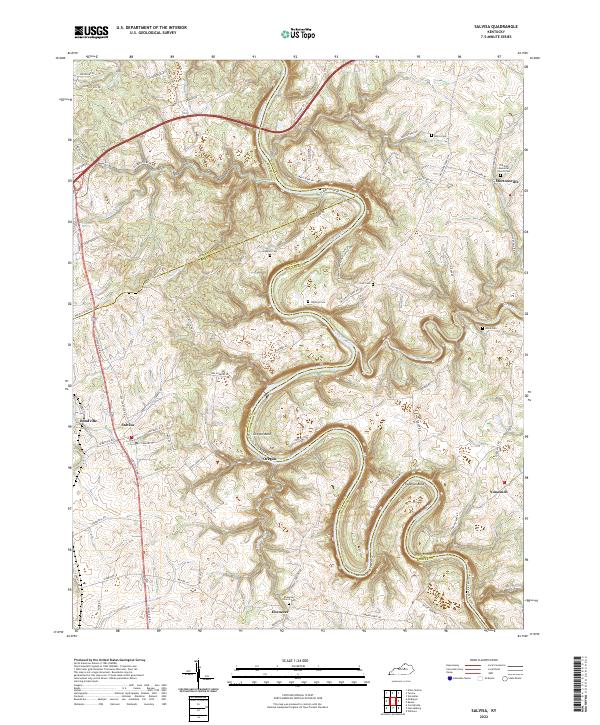 2022 Salvisa2022 Print · USGSCentral Kentucky's river-cut landscape is captured here in the early twenty-first century as the Kentucky River winds between Mercer and Woodford counties. Genealogists can locate family landmarks like Willhoyt Cem and the small settlements of Oregon and Nonesuch.
 - 2022 Map of Tyrone, 2022 Print
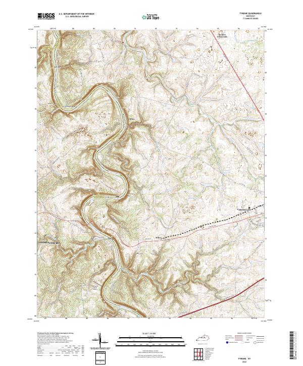 2022 Tyrone2022 Print · USGSThe Kentucky River corridor near the Anderson and Woodford county line is shown here in the early 2020s. Researchers can trace the river's path past Germany Bend, locate the river crossing at Tyrone, and find local landmarks like Buzzard's Roost Airport.
 - 2022 Map of Versailles, 2022 Print
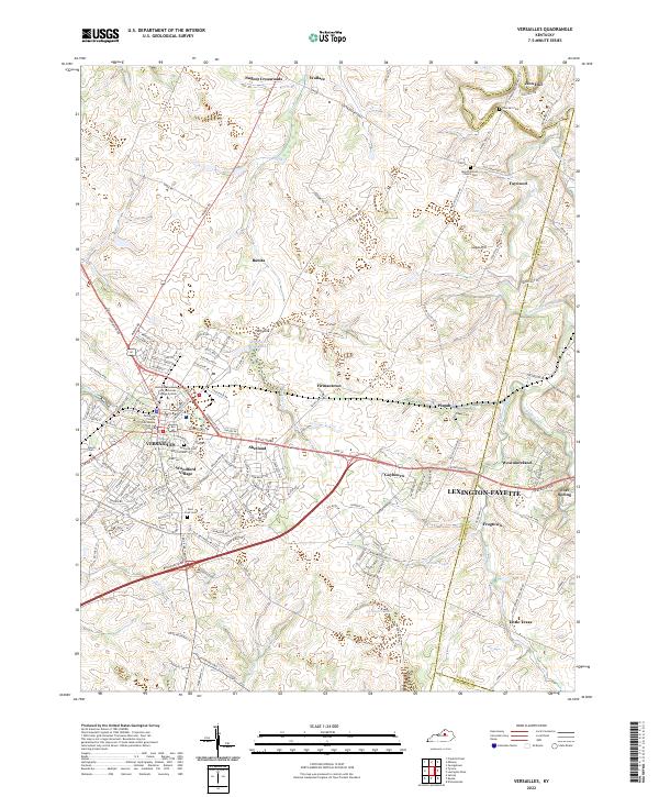 2022 Versailles2022 Print · USGSVersailles and the rolling Bluegrass horse country are captured here in the early twenty-first century. Researchers can trace local history through the Woodford County Courthouse and numerous burial sites like Simmons Cem and Pisgah Cem.
 - 2022 Map of Frankfort East, 2022 Print
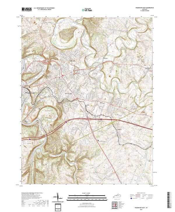 2022 Frankfort East2022 Print · USGSThe state capital and its surrounding Bluegrass hills are captured here in the early 2020s as the riverfront and suburbs continue to evolve. Researchers can locate the historic Frankfort Cem, trace the bends of Elkhorn Creek, and find smaller settlements like Duckers and Millville.
 - 2022 Map of Harrodsburg, 2022 Print
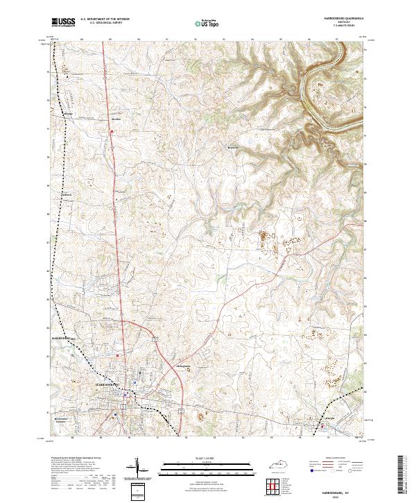 2022 Harrodsburg2022 Print · USGSHarrodsburg and the Mercer County landscape are documented here in the early 2020s, showing the intersection of historic bluegrass estates and modern civic growth. Genealogists can locate family landmarks and burial sites like Spring Hill Cem or the community of McAfee.
 - 2022 Map of Midway, 2022 Print
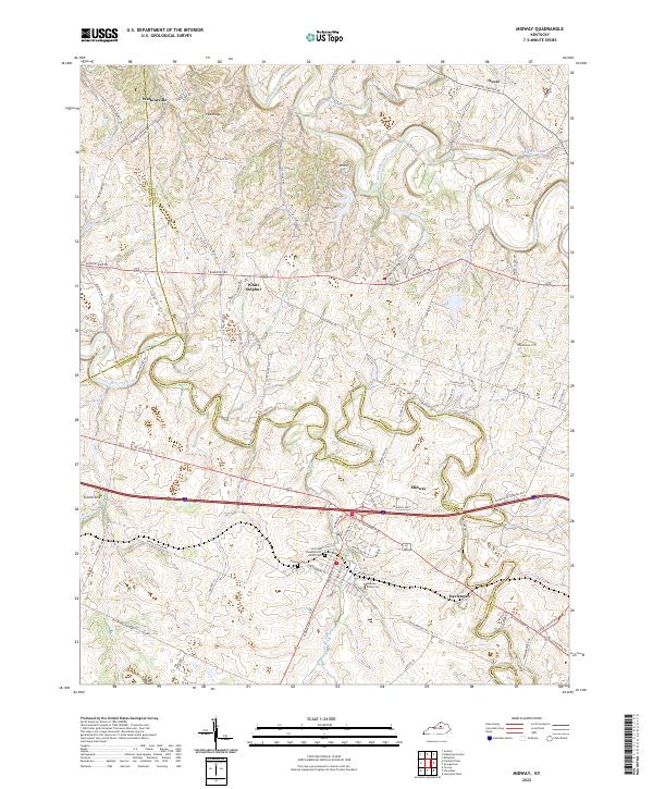 2022 Midway2022 Print · USGSMidway and the surrounding Bluegrass countryside are mapped here in the modern era, showing the intersection of Woodford, Scott, and Franklin counties. Genealogists can locate family landmarks like the Sons and Daughters of Relief Cem and trace the rural layouts of Watkinsville and Davistown.
End of results
Showing maps 1-8 of 8
Top cities of Woodford County
Frequently asked questions
- What are the different types of historical maps available for Woodford County?
- What is the oldest map of Woodford County?
- Where can I purchase historical maps of Woodford County for my home or office?
- Where can I download high-res historical maps of Woodford County?
- Are there historical topographic maps available for Woodford County?
- Is there historical aerial imagery available for Woodford County?
- Where are historical maps of Woodford County sourced from?