Old Maps of Wichita County, Kansas
Explore 105 old maps of Wichita County, spanning from 1939 to today. These high-resolution historic maps reveal how streets, neighborhoods, landmarks, and natural features evolved over time — perfect for genealogy, metal detecting, research, and local history exploration.
What you can do with these maps:
- See how Wichita County changed over time: Compare historical maps to modern-day views to trace roads, homesites, rail lines & more.
- View detailed metadata: Each map includes creators, publishers, year, scale, and archive source.
- Overlay maps with satellite & LiDAR: Visualize the past alongside modern tools to explore terrain & human change.
- Trusted historical sources: Maps sourced from the USGS, Library of Congress, and other archives.
- Access maps your way: View online, download high-res files, or order prints for personal or research use.
Start exploring old maps of Wichita County to uncover forgotten places, hidden landmarks, and the deep history beneath your feet.
Wichita County, KS maps
(105)- 1939 Map of Pence, 1971 Print
 1939 Pence1971 Print · USGSWestern Kansas farm life is meticulously documented in this late 1930s survey of the Logan, Wichita, and Scott county lines. Researchers can trace the locations of numerous rural schoolhouses like Liberty Sch and Prairie View Sch, along with the Pence Cem.2 unique versions available
 - 1941 Map of Modoc
 1941 Modoc1941 Print · USGSWichita and Scott counties are shown just before the war, when the rural school system and the Missouri Pacific railroad anchored the High Plains economy. Researchers can locate numerous local landmarks including St Marys Cem, Lydia Ch, and schools like Prairie Bell Sch.
 - 1941 Map of Pence
 1941 Pence1941 Print · USGSWestern Kansas high plains life is preserved here during the late Depression era, showing the intersection of Logan, Wichita, and Scott counties. Genealogists can trace early 20th-century rural life through landmarks like Pence Cem and a network of schools including Lone Corner Sch and High Prairie Sch.2 unique versions available
 - 1951 Map of Modoc, 1952 Print
 1951 Modoc1952 Print · USGSWestern Kansas farming communities are captured in the early fifties as the rural school system and steam-era rail lines still defined the landscape. Genealogists can locate family landmarks like St Marys Cem, Lydia Ch, and several country schools including Grandview Sch.
 - 1955 Map of Scott City, 1969 Print
 1955 Scott City1969 Print · USGSWestern Kansas in the mid-fifties is captured here as a landscape of rural schoolhouses and significant rail corridors. Family historians can trace the locations of Skyline and Beaver Creek Schools or follow the Union Pacific line through Oakley and Sharon Springs.4 unique versions available
 - 1958 Map of Scott City
 1958 Scott City1958 Print · USGSWestern Kansas at the peak of the post-war era reveals a landscape of high-plains agriculture and vital rail junctions. Genealogists and historians can trace old country school sites like Prairie Bell School, the landmark Chalk Pyramids, and small stops along the Union Pacific and Missouri Pacific.
 - 1968 Map of Russell Springs 3 SW, 1969 Print
 1968 Russell Springs 3 SW1969 Print · USGSWestern Kansas rangeland and the Ladder Creek valley appear in detail during the late sixties. Genealogists and local researchers can locate the Parks Ch and Carwood Cem along with remote section-line wells and a Gravel Pit.2 unique versions available
 - 1968 Map of Russell Springs 3 NW, 1969 Print
 1968 Russell Springs 3 NW1969 Print · USGSWestern Kansas rangeland at the end of the 1960s is preserved here, showing the sparse infrastructure of the High Plains. Genealogists and historians can trace property boundaries across Harrison and Augustine or follow the course of Chalk Creek.2 unique versions available
 - 1968 Map of Russell Springs 3 SE, 1969 Print
 1968 Russell Springs 3 SE1969 Print · USGSHigh Plains ranching and creek drainage define this Wichita County landscape during the late sixties. Genealogists and researchers can locate isolated rural landmarks like Pleasant Valley Ch, Coronado Cem, and the many Well sites across the Leoti terrain.3 unique versions available
 - 1968 Map of Sharon Springs 4 NE, 1969 Print
 1968 Sharon Springs 4 NE1969 Print · USGSThe high plains of Western Kansas appear here in the late sixties, where the deep incisions of Ladder Creek break the flat horizon. Researchers can trace the rural infrastructure of the day, from the West Bethany Ch to local industrial sites like a Sandpit and Gravel Pit.2 unique versions available
 - 1968 Map of Russell Springs 3 NE, 1970 Print
 1968 Russell Springs 3 NE1970 Print · USGSHigh plains ranching and farming define this western Kansas landscape in the late sixties. Researchers can trace rural life through the Beulah Cem, High Plains Sch, and the isolated Church of the Nazarene.2 unique versions available
 - 1970 Map of Sharon Springs 4 SE, 1971 Print
 1970 Sharon Springs 4 SE1971 Print · USGSWestern Kansas townships near the Greeley and Wichita county line are captured here in the early 1970s. Local researchers can locate family landmarks like St Theresa Ch, a community Cem, and the drainage of Ladder Creek in the townships of Tribune and Leoti.2 unique versions available
 - 1970 Map of Selkirk SE, 1971 Print
 1970 Selkirk SE1971 Print · USGSFour Kansas counties converge in the High Plains during the early seventies, revealing a landscape of large-scale agriculture and early energy development. Genealogists and historians can locate a rural Cem and trace the paths of a Pipeline and scattered Oil Wells.
 - 1970 Map of Selkirk, 1971 Print
 1970 Selkirk1971 Print · USGSThe High Plains of western Kansas are captured here in the early 1970s, centered on the railroad siding of Selkirk. Genealogists and historians can trace the Missouri Pacific rail line, find the local cemetery, and follow the path of White Woman Creek.
 - 1970 Map of Leoti, 1972 Print
 1970 Leoti1972 Print · USGSLeoti and the High Plains of western Kansas are documented here in the early seventies, centered on the railroad and local ranching interests. Genealogists and local historians can trace the Missouri Pacific line, the County Cem, and the small settlement of Coronado.2 unique versions available
 - 1970 Map of Lydia, 1972 Print
 1970 Lydia1972 Print · USGSWestern Kansas at the start of the 1970s shows a landscape of expansive section lines and vital watercourses. Genealogists and researchers can locate landmarks like Lydia, the Grand Union Sch, and the Kuhlmann Landing Field along the White Woman Creek.
 - 1970 Map of Leoti NW, 1972 Print
 1970 Leoti NW1972 Print · USGSWichita County in the early seventies is captured here as a landscape of high-plains agriculture and rail transport. Researchers can trace the winding course of White Woman Creek and locate historic industrial markers like the Missouri Pacific railroad and a local Gravel Pit.
 - 1970 Map of Leoti SW, 1972 Print
 1970 Leoti SW1972 Print · USGSHigh Plains ranching and irrigation define this Wichita County landscape in the early seventies. Genealogists and local historians can locate a small rural Cem and trace the path of Sand Creek near the Wichita Co Kearny Co line.
 - 1976 Map of Modoc SW, 1978 Print
 1976 Modoc SW1978 Print · USGSWichita County in the late 1970s shows a landscape of wide-open plains and seasonal drainages. Genealogists and local historians can locate the Lydia Ch and Cem near the county line, while tracing the paths of White Woman Creek and Sand Creek.
 - 1976 Map of Pence NW, 1978 Print
 1976 Pence NW1978 Print · USGSWestern Kansas at the height of the 1970s shows a landscape of agricultural utility and aviation transit at the county lines. Trace local infrastructure through private aviation sites like Kough Landing Strip and the winding course of Chalk Creek.
 - 1976 Map of Marienthal, 1978 Print
 1976 Marienthal1978 Print · USGSMarienthal and the surrounding High Plains are captured here during the mid-seventies, showing a landscape defined by the Missouri Pacific railroad. Genealogists and local historians can locate St Marys Cem and trace the deep drainage of Rocky Draw as it cuts through the prairie.
 - 1976 Map of Pence SW, 1978 Print
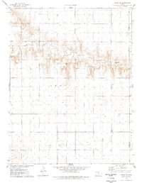 1976 Pence SW1978 Print · USGSWichita County and the Leoti township area are captured here during the mid-seventies, showing the rural Kansas landscape before modern shifts. Researchers can trace the winding path of Ladder Creek and locate early resource sites like the Gravel Pit and scattered Wells.
 - 1985 Map of Leoti
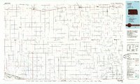 1985 Leoti1985 Print · USGSWestern Kansas at the mid-eighties was a landscape defined by its rail-side grain stops and a grid of rural section roads. Researchers can trace the path of the Missouri Pacific through Leoti or locate small landmarks like Mark Hoard Memorial Airfield and the County Cem.
 - 1985 Map of Sharon Springs
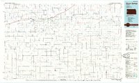 1985 Sharon Springs1985 Print · USGSWestern Kansas at the mid-eighties reveals a landscape shaped by the Union Pacific and the historic Butterfield Overland Trail. Researchers can trace the frontier legacy of the Fort Wallace (site) and explore rural landmarks from Weskan to Russell Springs.2 unique versions available
 - 1987 Map of Leoti, 1988 Print
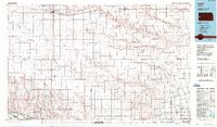 1987 Leoti1988 Print · USGSWestern Kansas at the close of the eighties shows a landscape defined by industrial gas fields and a sprawling railroad network. Researchers can trace small-town development and rural infrastructure near Leoti, Tribune, and the Mark Heard Memorial Airfield.
Showing maps 1-25 of 105
Frequently asked questions
- What are the different types of historical maps available for Wichita County?
- What is the oldest map of Wichita County?
- Where can I purchase historical maps of Wichita County for my home or office?
- Where can I download high-res historical maps of Wichita County?
- Are there historical topographic maps available for Wichita County?
- Is there historical aerial imagery available for Wichita County?
- Where are historical maps of Wichita County sourced from?