Old Maps of Jackson County, Kansas
Explore 158 old maps of Jackson County, spanning from 1888 to today. These high-resolution historic maps reveal how streets, neighborhoods, landmarks, and natural features evolved over time — perfect for genealogy, metal detecting, research, and local history exploration.
What you can do with these maps:
- See how Jackson County changed over time: Compare historical maps to modern-day views to trace roads, homesites, rail lines & more.
- View detailed metadata: Each map includes creators, publishers, year, scale, and archive source.
- Overlay maps with satellite & LiDAR: Visualize the past alongside modern tools to explore terrain & human change.
- Trusted historical sources: Maps sourced from the USGS, Library of Congress, and other archives.
- Access maps your way: View online, download high-res files, or order prints for personal or research use.
Start exploring old maps of Jackson County to uncover forgotten places, hidden landmarks, and the deep history beneath your feet.
Jackson County, KS maps
(158)- 1888 Map of Hiawatha
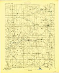
 1888 Hiawatha1888 Print · USGSNortheast Kansas in the late 1880s was a bustling corridor of competing rail lines and established tribal lands. Researchers can trace the path of the Kansas Central Railroad and locate early settlements like Powhattan, Baker, and Wetmore.
 - 1889 Map of Seneca
 1889 Seneca1889 Print · USGSNortheast Kansas was a bustling intersection of frontier rail lines in the late nineteenth century. Genealogists and local historians can trace the early development of towns like Seneca and Centralia along the Missouri Pacific Railroad and other historic transit corridors.
 - 1889 Map of Wamego
 1889 Wamego1889 Print · USGSNortheastern Kansas thrives along the river valleys in the 1880s, where rail networks and river crossings dictated the growth of the prairie. Genealogists can trace family roots in early hubs like Alma, St Marys, and Wamego, or find the path of the Union Pacific Railroad.
 - 1889 Map of Topeka
 1889 Topeka1889 Print · USGSEastern Kansas in the late nineteenth century was a landscape of rapid rail expansion and tribal land boundaries. Genealogists can trace family roots through the Pottawatomie Indian Reservation or old settlements like Holton, Rossville, and Agency.
 - 1894 Map of Seneca
 1894 Seneca1894 Print · USGSNortheastern Kansas is captured here in the late nineteenth century as a thriving rail and river corridor. You can trace early community sites like Guittard Station, Taylor Rapids, and America City along the Missouri Pacific Railroad.4 unique versions available
 - 1894 Map of Topeka
 1894 Topeka1894 Print · USGSTopeka and its northern reaches are captured here in the late nineteenth century, during a pivotal era of rail expansion and settlement. Local historians can trace the early layouts of Topeka and Silver Lake alongside the Pottawatomie Indian Reservation.5 unique versions available
 - 1894 Map of Hiawatha
 1894 Hiawatha1894 Print · USGSNortheastern Kansas was a bustling intersection of tribal lands and iron rails in the late nineteenth century. Genealogists and historians can trace the early development of Hiawatha, the boundaries of the Kickapoo Indian Reservation, and rail stops like Netawaka or Berwick.4 unique versions available
 - 1894 Map of Wamego
 1894 Wamego1894 Print · USGSThe Kansas prairie in the late nineteenth century was a world of steam and river crossings, where the iron horse reshaped the frontier. Genealogists can trace family roots in established towns like Wamego, Alma, or the small settlement of Moodyville along Rock Creek.5 unique versions available
 - 1950 Map of Kansas City
 1950 Kansas City1950 Print · USGSMid-century Kansas and Missouri are captured here during a period of industrial growth and shifting transportation. Genealogists and historians can trace rail lines like the Wabash RR or locate ancestral homes near the Potawatomi Indian Reservation and Horton.
 - 1952 Map of Rossville, 1953 Print
 1952 Rossville1953 Print · USGSThe rural borders of Shawnee and Jackson counties are captured here in the early fifties, a time when small country schoolhouses still dotted the prairie. You can trace family roots at Bohemian Cemetery, locate the Stone School, or follow the Union Pacific rail line.4 unique versions available
 - 1952 Map of Elmont, 1953 Print
 1952 Elmont1953 Print · USGSNorth of Topeka in the early fifties, this rural landscape reveals the enduring imprint of the Potawatomi Old Reservation Boundary East. Researchers can trace old family sites near Elmont or locate vanished country schools like Rock Sch and North Highland Sch.5 unique versions available
 - 1952 Map of Grove, 1953 Print
 1952 Grove1953 Print · USGSShawnee County's rural landscape is captured here in the early 1950s, showing a transition era for the Kansas prairie and its local schools. Genealogists can trace family landmarks like Bethel Chapel or locate the site of the Glen Valley Sch (Abandoned) along the banks of Soldier Creek.4 unique versions available
 - 1952 Map of Meriden, 1953 Print
 1952 Meriden1953 Print · USGSThe rural countryside around Meriden in the early fifties is mapped here in detail, showing the intersection of the Atchison Topeka and Santa Fe and local creek systems. Genealogists can trace historic school sites like Milligan Sch and Mt Bethel Sch.4 unique versions available
 - 1953 Map of St Marys, 1954 Print
 1953 St Marys1954 Print · USGSThe Kansas River valley in the early 1950s centered on the hub of St Marys, where the rail and river economies met. Genealogists and historians can trace local rural infrastructure through sites like St Marys Seminary, Turkey Creek Sch, and Mt Calvary Cem.2 unique versions available
 - 1954 Map of Kansas City
 1954 Kansas City1954 Print · USGSThe Missouri-Kansas borderlands flourished in the post-war era as river commerce and rail networks converged at the Missouri River. Genealogists and historians can trace the foundations of Kansas City and smaller rural hubs like Hiawatha or Sabetha.
 - 1955 Map of Manhattan, 1964 Print
 1955 Manhattan1964 Print · USGSNorth Central Kansas is captured here in the mid-fifties, just as major flood control projects began reshaping the river valleys. Genealogists can locate family sites near St. Joseph Church, Sunset Cemetery, or along the busy tracks of the Rock Island RR.4 unique versions available
 - 1956 Map of Manhattan
 1956 Manhattan1956 Print · USGSNorth-central Kansas in the mid-fifties reveals a landscape defined by the convergence of the Republican River and Smoky Hill River. Historians can trace the rail corridors of the Union Pacific RR and Missouri Pacific RR through towns like Manhattan and Clay Center.
 - 1956 Map of Kansas City, 1967 Print
 1956 Kansas City1967 Print · USGSThe Kansas-Missouri border region thrived during the mid-fifties, centered on the growing metropolitan cores and the busy river valleys. Researchers can trace the layout of significant government sites like Fort Leavenworth and the Lake City Army Ammunition Plant.4 unique versions available
 - 1957 Map of Manhattan
 1957 Manhattan1957 Print · USGSNortheast Kansas in the mid-1950s reveals a landscape of expanding military installations and new water projects. Genealogists and historians can trace the rail-to-river economy through the Union Pacific RR and old settlements like Clay Center or Marysville.
 - 1960 Map of Kansas City
 1960 Kansas City1960 Print · USGSMid-century Kansas and Missouri meet at the river forks, showing a sprawling rail-and-river economy during the 1950s growth era. Genealogists and researchers can trace tribal lands like the Kickapoo Indian Reservation or follow the early interstate corridors through Saint Joseph and Independence.3 unique versions available
 - 1960 Map of Mayetta, 1961 Print
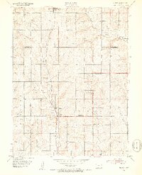
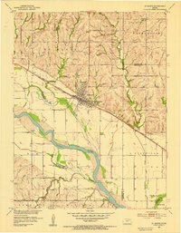
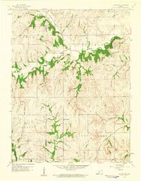
 1960 Mayetta1961 Print · USGSJackson County rural life is captured here in the early sixties, as the prairie landscape transitions across the Potawatomi Indian Reservation Boundary. Genealogists can trace family footprints at Mayetta Cem or the Point Pleasant Sch along the Chicago Rock Island and Pacific rail line.2 unique versions available
 - 1960 Map of Holton, 1961 Print
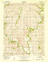
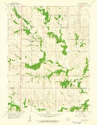
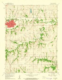 1960 Holton1961 Print · USGSJackson County at the start of the sixties reveals a landscape of established townships and significant historical borders. Genealogists and historians can trace family-named sites and public markers such as Brick Cem, the Potawatomi Indian Res Boundary, and the Grange Hall.3 unique versions available
 - 1960 Map of Arrington, 1961 Print
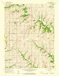
 1960 Arrington1961 Print · USGSNortheast Kansas in the early sixties reveals a landscape of rural crossroads and winding river valleys where three counties meet. Genealogists and local historians can trace family sites at Larkinburg Cem, the settlement of Nebo, and the small Landing Field near Arrington.3 unique versions available
 - 1960 Map of Holton SE, 1961 Print
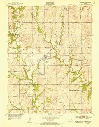
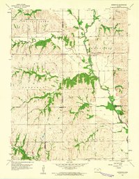
 1960 Holton SE1961 Print · USGSJefferson and Jackson Counties in the early sixties reveal a landscape of rural townships and family-named creek systems. Genealogists and researchers can trace the rail corridor of the Atchison Topeka and Santa Fe and locate sites like Griggs Chapel Cem and United Brethren Ch.2 unique versions available
 - 1960 Map of Horton NW, 1961 Print
 1960 Horton NW1961 Print · USGSThe Kickapoo Indian Reservation and the rural borderlands of Brown and Jackson counties are documented here in the early sixties. Researchers can trace the placement of the Kickapoo Indian Ch, School No 44, and the community of Greggs.
Showing maps 1-25 of 158
Top cities of Jackson County
- Holton historical maps
- Hoyt historical maps
- Mayetta historical maps
- Denison historical maps
- Whiting historical maps
- Delia historical maps
See more
Frequently asked questions
- What are the different types of historical maps available for Jackson County?
- What is the oldest map of Jackson County?
- Where can I purchase historical maps of Jackson County for my home or office?
- Where can I download high-res historical maps of Jackson County?
- Are there historical topographic maps available for Jackson County?
- Is there historical aerial imagery available for Jackson County?
- Where are historical maps of Jackson County sourced from?