2020s Maps of Jackson County, Kansas
Explore 23 historic maps of Jackson County from the 2020s. These maps offer a rare glimpse into what life looked like during the 2020s — showing old roads, neighborhoods, homes, and landmarks that have changed or disappeared over time.
Whether you're researching your family's past, planning a metal detecting trip, or studying how Jackson County's landscape evolved across the 2020s, these high-resolution maps are a powerful tool for exploring the history of this region.
- Focus on a specific era: All maps on this page are from the 2020s, giving you a focused view of this time period.
- See what’s changed: Compare century-old streets, trails, and buildings to today's modern landscape using overlays and satellite layers.
- Research with precision: Use these maps for genealogy, historical research, land use analysis, or educational projects.
- View, download, or print: Maps are fully viewable online in high resolution, and can be downloaded or printed for your own records.
Start exploring Jackson County's history through authentic maps from the 2020s. This is your window into the past.
Jackson County, KS maps
(23)- 2022 Map of Elmont, 2022 Print
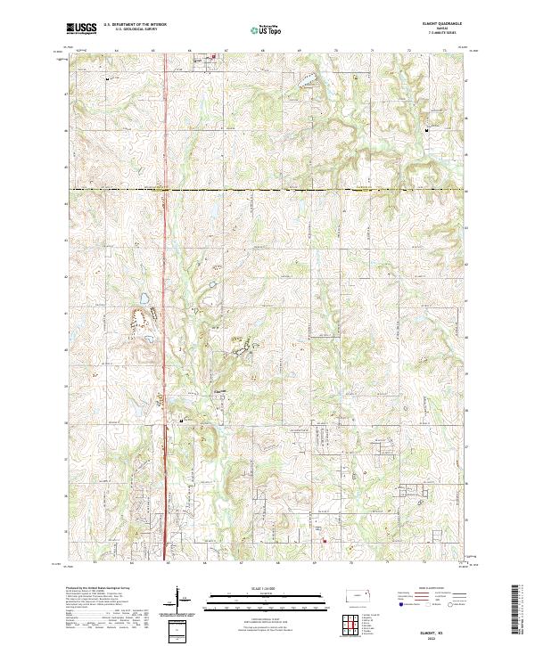 2022 Elmont2022 Print · USGSNortheast Kansas at the junction of Jackson and Shawnee Counties reveals a landscape of quiet rural communities and prairie stream valleys. Genealogists and historians can locate legacy burial sites including Half Day Cem and Steward Cem or trace the winding course of Halfday Cr.
 - 2022 Map of Onaga NE, 2022 Print
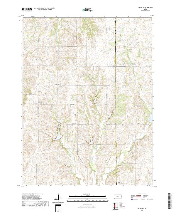 2022 Onaga NE2022 Print · USGSPottawatomie and Jackson counties appear in this recent survey of rural Kansas farmland and creek valleys. Genealogists and local historians can trace family roots at Bucks Grove Church Cem or follow the waters of Big Noxie Cr and Spring Cr.
 - 2022 Map of Holton, 2022 Print
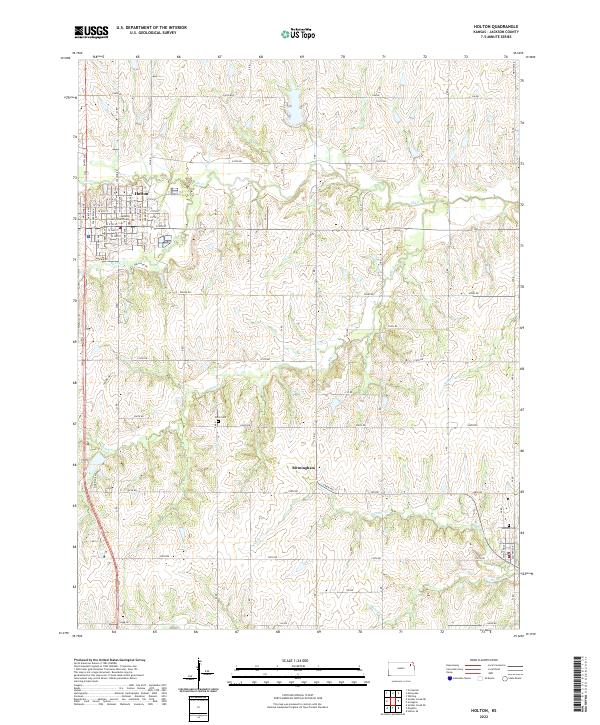 2022 Holton2022 Print · USGSJackson County during the early 2020s shows the enduring layout of Holton alongside the smaller settlement of Birmingham. Researchers can locate the County Courthouse and trace local family history through sites like Brick Cem and Denison Cem.
 - 2022 Map of Havensville, 2022 Print
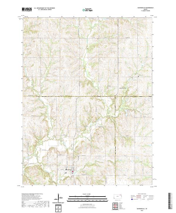 2022 Havensville2022 Print · USGSHavensville and the surrounding Pottawatomie County countryside are documented here in the early twenty-first century. Genealogists and historians can trace local family lineages through Havensville Cem, America City Cem, and the small community of America City.
 - 2022 Map of Arrington, 2022 Print
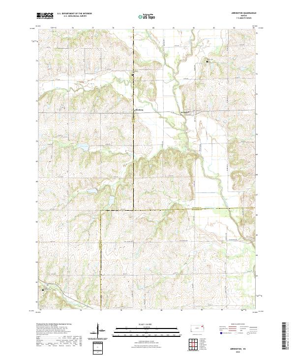 2022 Arrington2022 Print · USGSNortheastern Kansas farmland and the winding Delaware River define this region at the start of the 2020s. Researchers can trace rural cemeteries and water features across three county lines, including Larkinburg Cem, South Denison Cem, and Nebo Lake.
 - 2022 Map of Wetmore, 2022 Print
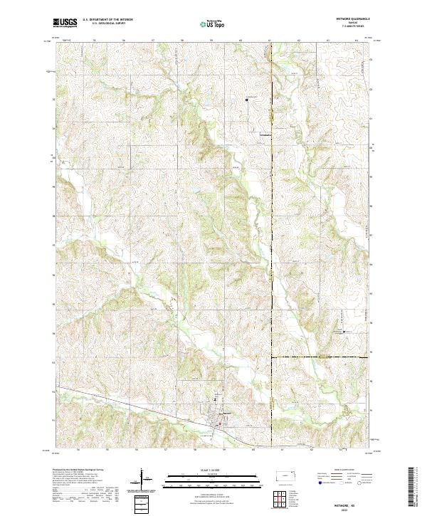 2022 Wetmore2022 Print · USGSNortheastern Kansas farm country is mapped here in the early twenty-first century, showing the borderlands of Nemaha, Brown, and Jackson counties. Local historians can trace family plots at Wetmore Cem and Granada Cem or follow the winding courses of Wolfley Cr and Muddy Cr.
 - 2022 Map of Circleville, 2022 Print
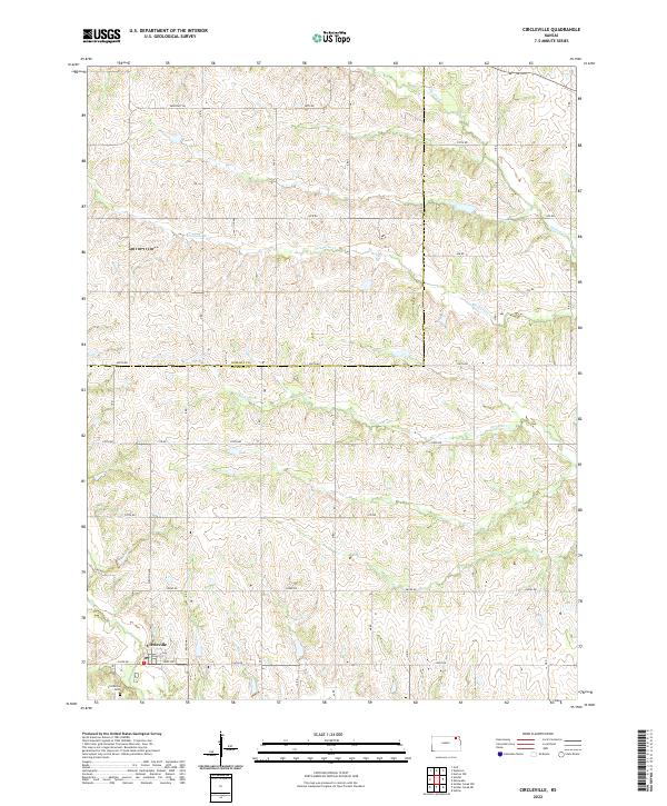 2022 Circleville2022 Print · USGSCircleville and the rolling prairie of northern Jackson County are documented here as they appeared in the early 2020s. Genealogists can locate the Circleville Cem and trace the local drainage of Straight Cr and Mosquito Cr.
 - 2022 Map of Holton SE, 2022 Print
 2022 Holton SE2022 Print · USGSThe rural border of Jackson and Jefferson counties comes into focus in this recent survey of the Kansas prairie. Genealogists can pinpoint family-named landmarks and historical burial sites like Bloomfield Cem and Graggs Chapel Cem alongside the waters of Rock Slough.
 - 2022 Map of Whiting, 2022 Print
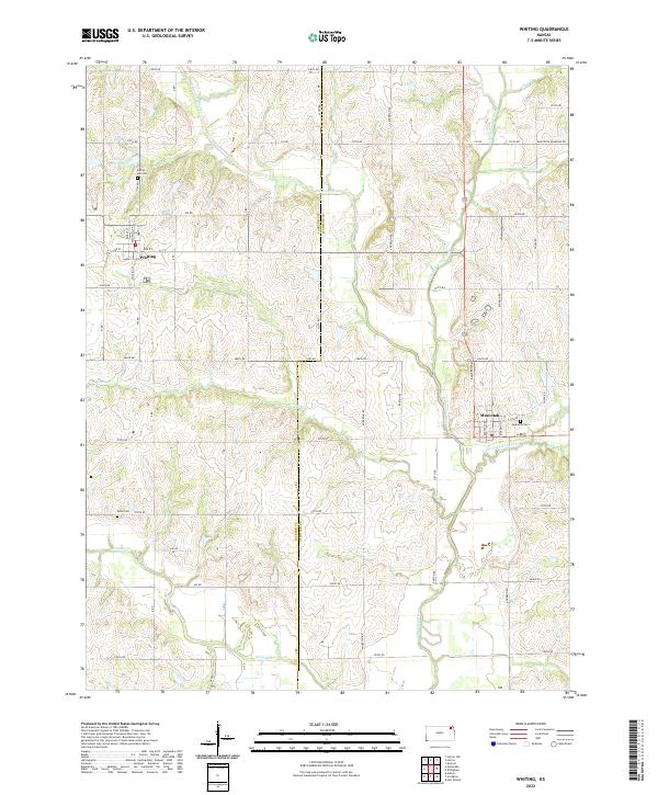 2022 Whiting2022 Print · USGSNortheast Kansas farmland along the Jackson and Atchison county line retains its traditional grid of rural sections and river valleys. Researchers can trace family ties at Spring Hill Cem and Estes Cem, or follow the waters of the Delaware River near Whiting.
 - 2022 Map of Meriden, 2022 Print
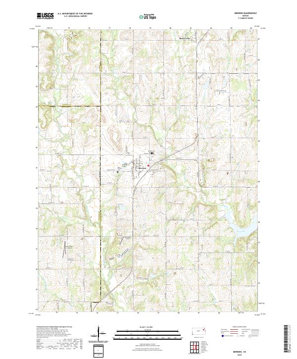 2022 Meriden2022 Print · USGSMeriden and its rural surroundings are captured here in the early twenty-first century, showcasing the township's intersection of farm roads and drainage basins. Researchers can trace local heritage at Saint Aloysius Cem or locate the Blackhawk Airport and Buena Terra Airport landing strips.
 - 2022 Map of Netawaka, 2022 Print
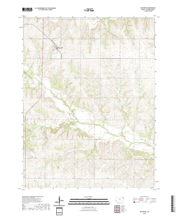 2022 Netawaka2022 Print · USGSIn the early twenty-first century, this Jackson County township remains centered on the quiet grid of Netawaka. Genealogists and researchers can locate the Netawaka Cem and trace the paths of Mosquito Cr and Straight Cr across the countryside.
 - 2022 Map of Grove, 2022 Print
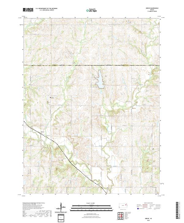 2022 Grove2022 Print · USGSThe rural border of Jackson and Shawnee counties comes into focus during the early 2020s, showing a landscape defined by prairie agriculture and prairie streams. Genealogists and local historians can locate the Grove settlement and Walnut Hill Cemetery near the banks of Soldier Creek.
 - 2022 Map of Emmett, 2022 Print
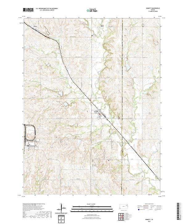 2022 Emmett2022 Print · USGSThe border of Pottawatomie and Jackson Counties comes alive in this study of rural Kansas settlement and drainage. Genealogists and local historians can trace the family lands surrounding Emmett, Saint Clere, and historical burial sites like Mount Olive Cem.
 - 2022 Map of Soldier Creek NW, 2022 Print
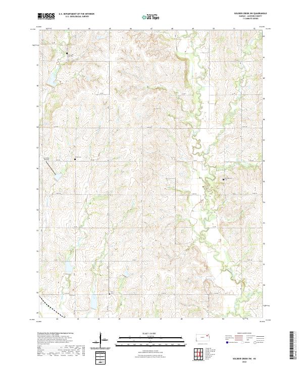
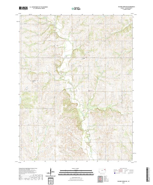 2022 Soldier Creek NW2022 Print · USGSNortheast Kansas farmland is defined by the winding course of Soldier Cr and rural section roads in this recent survey. Local historians can locate small family burial grounds like Olive Hill Cem and Boan Cem or trace the geography of Oak Mills Bend.
 - 2022 Map of Saint Marys, 2022 Print
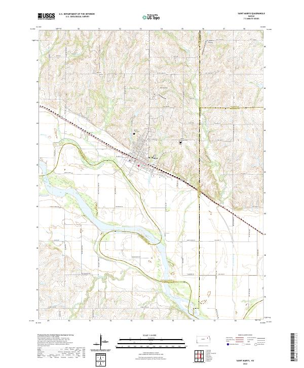 2022 Saint Marys2022 Print · USGSNear the convergence of Pottawatomie, Shawnee, and Jackson counties, this area reflects a landscape shaped by the Kansas River and historic pioneer routes. Genealogists and local researchers can locate Valley View Cem, trace the path of Oregon Trail Rd, and explore river access points like JMJ Landing.
 - 2022 Map of Soldier Creek SE, 2022 Print
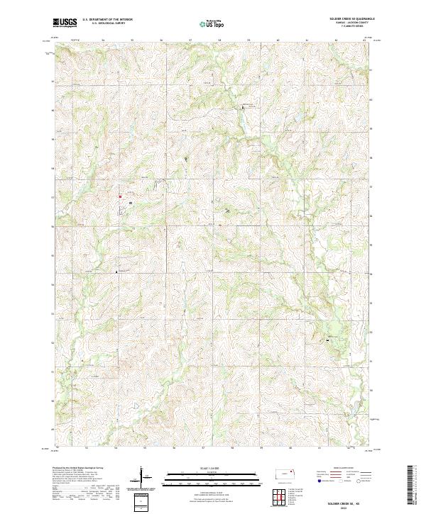 2022 Soldier Creek SE2022 Print · USGSJackson County in the early twenty-first century remains a landscape of rolling prairie and winding creeks. Researchers can trace family history through local landmarks like Mitchell Cemetery, Shipshee Cemetery, and the banks of Little Soldier Creek.
 - 2022 Map of Soldier, 2022 Print
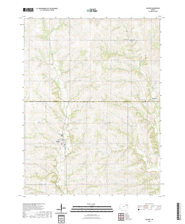 2022 Soldier2022 Print · USGSThe rural landscape of northern Kansas is captured here as it appeared in recent years, showing the enduring grid of agricultural life. Researchers can locate family heritage sites like Soldier Cem or trace the early settlement footprints of Bancroft and Ontario.
 - 2022 Map of Rossville, 2022 Print
 2022 Rossville2022 Print · USGSThe Kansas prairie north of the Kaw River comes into focus in this recent survey of the Shawnee and Jackson county borderlands. Genealogists can locate family sites near Rossville and Delia, or trace ancestral plots at the Czech - Moravian Cem and Olive Branch Cem.
 - 2022 Map of Mayetta, 2022 Print
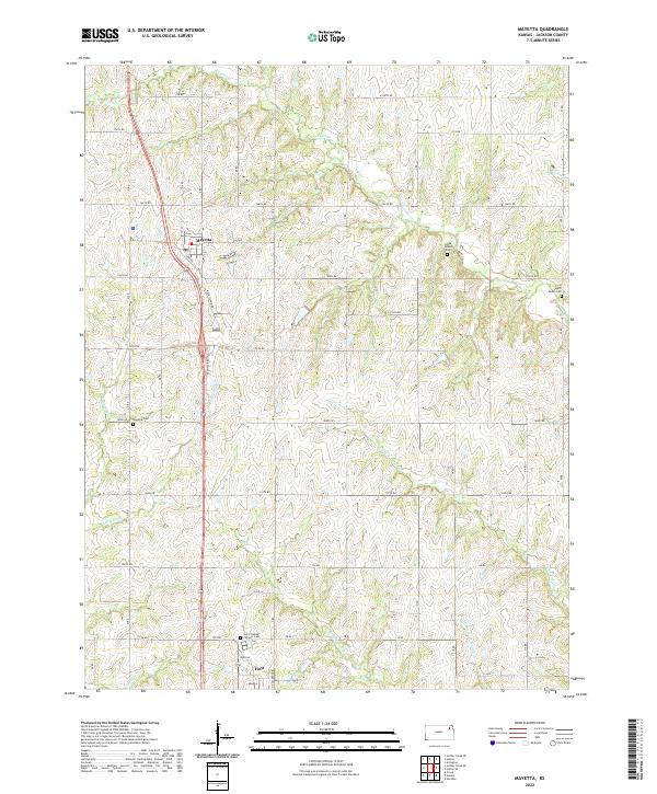 2022 Mayetta2022 Print · USGSThe rural landscape of Jackson County is captured here in the early twenty-first century, centered on the settlements of Mayetta and Hoyt. Genealogists and researchers can trace local family landmarks such as Saint Joseph's Catholic Cem and Cedar Grove Cem.
 - 2022 Map of Soldier Creek SW, 2022 Print
 2022 Soldier Creek SW2022 Print · USGSJackson County is shown in this recent survey of its rolling agricultural heartland and winding creek valleys. Researchers can locate family burial sites at Adrian Cem and Danceground Cem or trace the riparian corridors of Sullivan Cr and Soldier Creek.
 - 2022 Map of Soldier Creek NE, 2022 Print
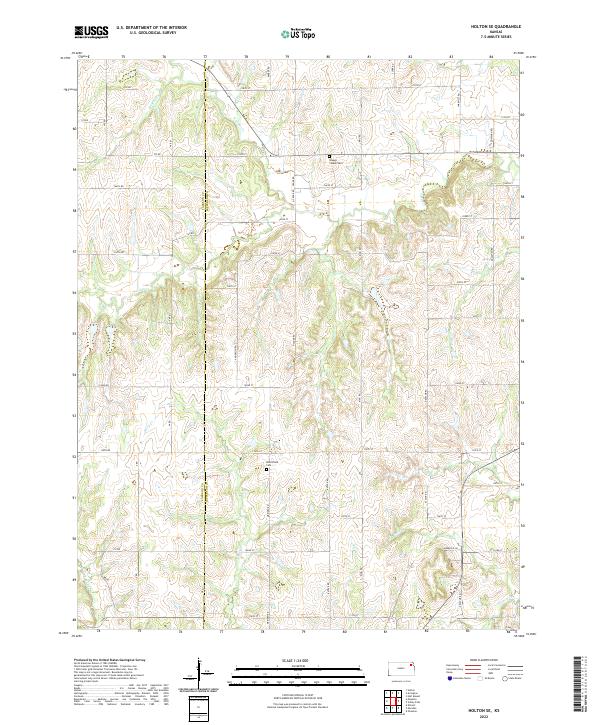
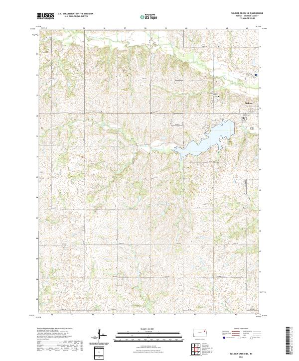 2022 Soldier Creek NE2022 Print · USGSJackson County at the start of the 2020s shows the growth of Holton alongside the extensive reservoir formed by Banner Cr. Researchers can locate family burial sites at Haas Cem or trace the rural headwaters of Little Soldier Cr.
 - 2022 Map of Horton, 2022 Print
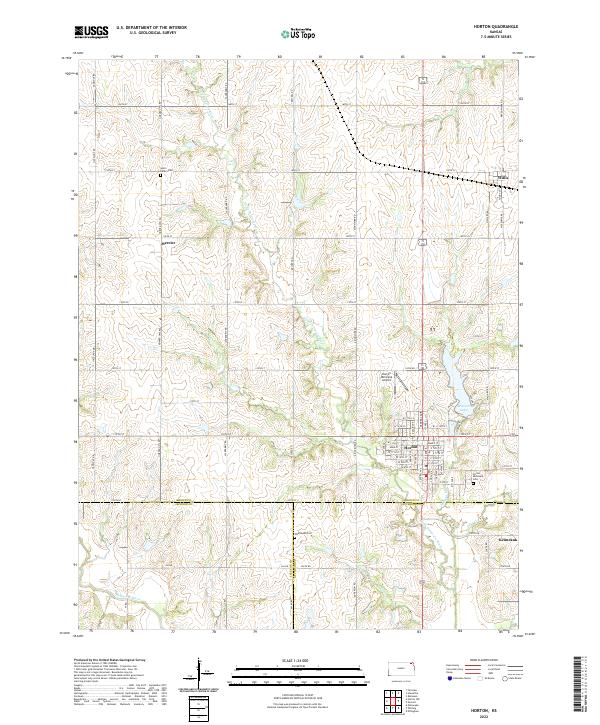 2022 Horton2022 Print · USGSHorton and its surrounding Kansas prairie townships appear here in the early twenty-first century as the tri-county corner of Brown, Jackson, and Atchison. Genealogists can locate family burial sites at Saint Peter's Cem and Wheatland Cem or trace the early paths of Mercier and Willis.
 - 2023 Map of Horton NW, 2023 Print
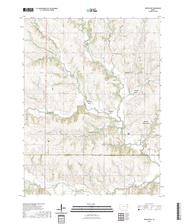 2023 Horton NW2023 Print · USGSThe Kickapoo reservation lands in Kansas are documented here in the early twenty-first century, showing the intersection of tribal locations and river valley topography. Researchers can pinpoint the Kickapoo Tribal Center and numerous community sites such as Kickapoo Site 6 along the Delaware River.
End of results
Showing maps 1-23 of 23
Top cities of Jackson County
- Holton historical maps
- Hoyt historical maps
- Mayetta historical maps
- Denison historical maps
- Whiting historical maps
- Delia historical maps
See more
Frequently asked questions
- What are the different types of historical maps available for Jackson County?
- What is the oldest map of Jackson County?
- Where can I purchase historical maps of Jackson County for my home or office?
- Where can I download high-res historical maps of Jackson County?
- Are there historical topographic maps available for Jackson County?
- Is there historical aerial imagery available for Jackson County?
- Where are historical maps of Jackson County sourced from?