Old Maps of Morse, Louisiana for Hiking & Exploration
Hike through history with 36 historic maps of Morse. Explore old trails, ghost towns, and forgotten backroads — perfect for outdoor adventurers and local explorers.
- Rediscover forgotten places: Map out old mining camps, roads, and footpaths that no longer exist on modern maps.
- Layer with modern tools: Combine with LiDAR or satellite views to plan hikes through historical terrain.
- Made for exploration: Popular among hikers, overlanders, and local history lovers.
Use these maps to find adventure and explore the hidden past of Morse.
Morse, LA maps
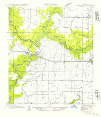
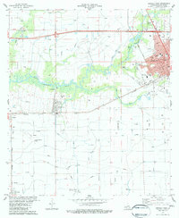
(36)- 1946 Map of Morse
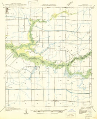 1946 Morse1946 Print · USGSCoastal Louisiana at the end of the Second World War reveals a landscape defined by its bayous and early irrigation networks. Genealogists and researchers can locate old rail stops like Haire Sta and settlements such as Morse, Gueydan, and Lyons Point.
 - 1946 Map of Mermentau
 1946 Mermentau1946 Print · USGSAcadia Parish in the mid-1940s centers on the critical rail and water junction at the Mermentau river crossing. Genealogists and local historians can trace family locations near Quibodeau Cem, the Sand Mill, and the rail stops at Midland or Egan.
 - 1949 Map of Gueydan
 1949 Gueydan1949 Print · USGSThe coastal prairies of Vermilion Parish meet the bayous of Acadia in the late 1940s. Genealogists can locate the Legia Cem and trace the Southern Pacific rail line through Riceville and into the streets of Gueydan.
 - 1949 Map of Estherwood
 1949 Estherwood1949 Print · USGSAcadia Parish in the late 1940s reveals a landscape defined by industrial rice farming and rail-line commerce. Genealogists and historians can trace the growth of Crowley, the Tartue Siding, and the irrigation network of Estherwood Canal.
 - 1952 Map of Lake Charles
 1952 Lake Charles1952 Print · USGSSouthwest Louisiana is captured here in the mid-fifties, showing a landscape defined by the rise of the petrochemical industry and deep-water navigation. Researchers can trace family roots through numerous small-town settlements and oil developments like Nibletts Bluff, the Lockport Oil Field, and Starks.
 - 1954 Map of Mermentau
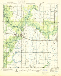
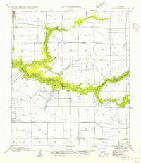
 1954 Mermentau1954 Print · USGSLouisiana's southwestern parishes are documented here during the mid-1930s as the river-and-rail economy thrived. Researchers can locate family landmarks like Quibodeau Cem or trace the early paths of US Highway No 90 and the Southern Pacific railroad through Mermentau.
 - 1954 Map of Morse
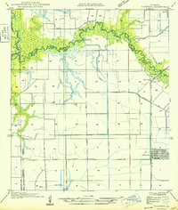
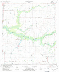
 1954 Morse1954 Print · USGSCoastal prairie life in the mid-1950s is defined by the railroad and the complex irrigation systems of Acadiana. Genealogists and historians can trace rail stops like Haire Sta and early settlements such as Morse or Lyons Point.
 - 1954 Map of Lake Charles, 1964 Print
 1954 Lake Charles1964 Print · USGSSouthwest Louisiana in the mid-fifties is defined by its massive petroleum industry and its complex network of bayous and rail lines. Researchers can trace the development of the Sulphur Mines Oil Field or locate historic settlements like Longville and De Quincy.3 unique versions available
 - 1955 Map of Crowley, 1956 Print
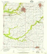 1955 Crowley1956 Print · USGSAcadia Parish and the northern edge of Vermilion Parish are shown in the mid-fifties, during a period of agricultural and industrial expansion. Researchers can trace family history through numerous rural landmarks like Hebron Ch, Woodlawn Cem, and Simon Cem.4 unique versions available
 - 1955 Map of Jennings, 1956 Print
 1955 Jennings1956 Print · USGSSouthwestern Louisiana's parish boundaries and bayous are captured here in the mid-fifties, showing the intersection of the oil industry and river life. Researchers can find old rural schoolhouses like Klondike Sch, early energy hubs like the Jennings Oil and Gas Field, and the Southern Pacific rail line.4 unique versions available
 - 1983 Map of Crowley West
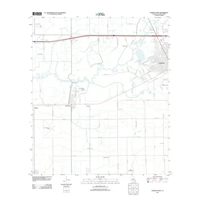
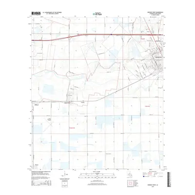
 1983 Crowley West1983 Print · USGSAcadia Parish in the early 1980s reveals a sophisticated network of canals and flumes supporting the prairie rice country. Researchers can trace family history at Leger Cem or explore the rail-based growth of Estherwood, Midland, and the western edge of Crowley.2 unique versions available
 - 1983 Map of Wright
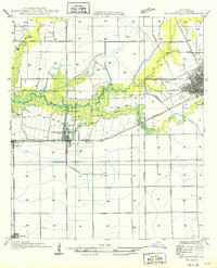
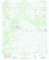
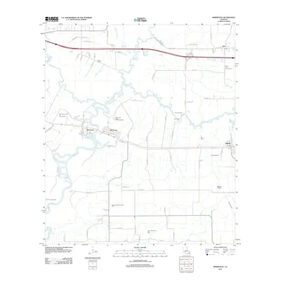
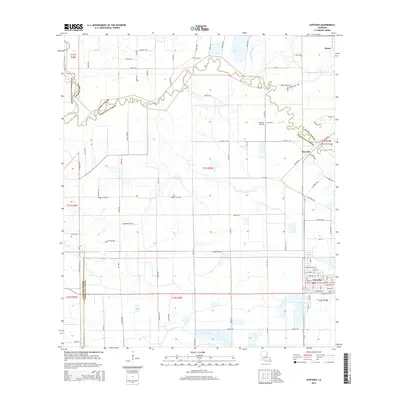
 1983 Wright1983 Print · USGSThe Louisiana prairie between Acadia and Vermilion Parishes comes alive in the early 1980s, showing a landscape shaped by rice irrigation and rail. Local historians can trace family roots at Hanks Cem, locate the Jesse Owens Sch, or follow the Southern Pacific through Morse and Wright.2 unique versions available
 - 1984 Map of Gueydan, 1985 Print
 1984 Gueydan1985 Print · USGSGueydan and the surrounding Louisiana wetlands were captured in the early eighties as a complex hub of irrigation and air strips. Genealogists and historians can trace the rice-farming infrastructure around Riceville, Morse, and the banks of Bayou Queue de Tortue.2 unique versions available
 - 1984 Map of Mermentau, 1985 Print
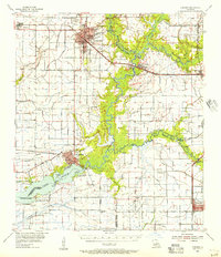
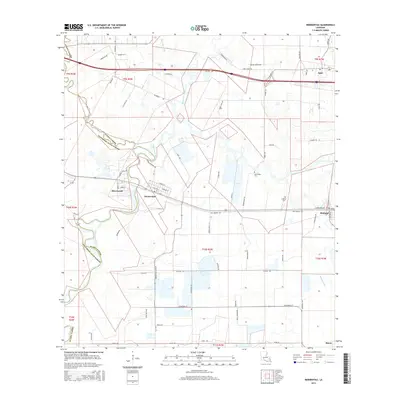
 1984 Mermentau1985 Print · USGSThe Mermentau River basin in the early eighties serves as a perfect record of the transition between historic bayou life and modern agriculture. Genealogists can locate specific burial sites at Indian Cem or Quebodaux Cem, while following the L I & M rail line through Egan and Midland.2 unique versions available
 - 1985 Map of Crowley, 1986 Print
 1985 Crowley1986 Print · USGSCoastal prairie and bayou country are captured in the mid-eighties as the rice-and-rail economy defined South Louisiana life. Genealogists and researchers can trace family lands and rural hubs from Crowley to Jennings, following the paths of the Southern Pacific Railroad and the winding Mermentau River.2 unique versions available
 - 1998 Map of Crowley West, 2000 Print
 1998 Crowley West2000 Print · USGSAcadia Parish at the end of the nineties shows a landscape deeply tied to water management and aviation. Genealogists and historians can trace the irrigation networks and find family landmarks like Leger Cem, Estherwood, and the Ross Sch.
 - 2012 Map of Wright, 2012 Print
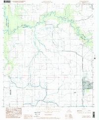
 2012 Wright2012 Print · USGSCovers Morse, including Gueydan, Mulvey, and other nearby areas
 - 2012 Map of Mermentau, 2012 Print
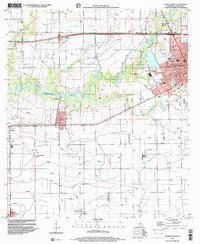
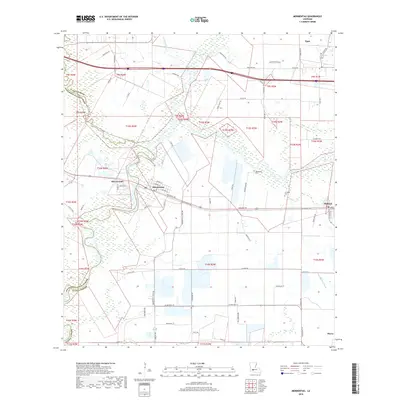
 2012 Mermentau2012 Print · USGSCovers Morse, including Jennings, Mermentau, and other nearby areas
 - 2012 Map of Crowley West, 2012 Print
 2012 Crowley West2012 Print · USGSCovers Morse, including Crowley, Estherwood, and other nearby areas
 - 2012 Map of Gueydan, 2012 Print
 2012 Gueydan2012 Print · USGSCovers Morse, including Gueydan, Riceville, and other nearby areas
 - 2015 Map of Wright, 2015 Print
 2015 Wright2015 Print · USGSCovers Morse, including Gueydan, Mulvey, and other nearby areas
 - 2015 Map of Crowley West, 2015 Print
 2015 Crowley West2015 Print · USGSCovers Morse, including Crowley, Estherwood, and other nearby areas
 - 2015 Map of Mermentau, 2015 Print
 2015 Mermentau2015 Print · USGSCovers Morse, including Jennings, Mermentau, and other nearby areas
 - 2015 Map of Gueydan, 2015 Print
 2015 Gueydan2015 Print · USGSCovers Morse, including Gueydan, Riceville, and other nearby areas
 - 2018 Map of Mermentau, 2018 Print
 2018 Mermentau2018 Print · USGSCovers Morse, including Jennings, Mermentau, and other nearby areas
Showing maps 1-25 of 36
Top cities near Morse
- Crowley historical maps
- Jennings historical maps
- Rayne historical maps
- Kaplan historical maps
- Lake Arthur historical maps
- Gueydan historical maps
See more
Frequently asked questions
- What are the different types of historical maps available for Morse?
- What is the oldest map of Morse?
- Where can I purchase historical maps of Morse for my home or office?
- Where can I download high-res historical maps of Morse?
- Are there historical topographic maps available for Morse?
- Is there historical aerial imagery available for Morse?
- Where are historical maps of Morse sourced from?