Old Maps of Cofield, Louisiana for Metal Detecting
Plan your next treasure hunt with 20 historic maps of Cofield. Find old homesites, ghost towns, trails, and gathering spots that may be lost to time — perfect for identifying promising metal detecting locations.
- Locate forgotten sites: Uncover places like long-lost settlements, abandoned rail lines, or gathering spots.
- Plan better hunts: Use map overlays combined with LiDAR or satellite views to narrow in on historically rich areas.
- Made for detectorists: Thousands of hobbyists use these maps to discover relics, coins, and hidden history.
Use these historic maps to boost your research and find new opportunities beneath the surface of Cofield.
Cofield, LA maps
(20)- 1892 Map of Donaldsonville
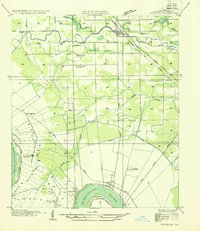
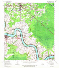
 1892 Donaldsonville1892 Print · USGSLouisiana river life in the early 1890s centered on the great meanders and landings of the river parishes. Genealogists and historians can trace the early footprints of Donaldsonville, locate the Indian Mounds, and see the impact of the Nita Crevasse on the shoreline.12 unique versions available
 - 1935 Map of Gonzales
 1935 Gonzales1935 Print · USGSThe river parishes of Louisiana come alive in the mid-1930s, showing the vital connection between the winding Mississippi River and the growing interior. Genealogists can locate family landmarks like Conway Plantation or the industrial Belle Helene Refinery and St Paul Church.
 - 1939 Map of Donaldsonville, 1953 Print
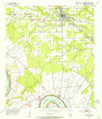
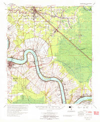
 1939 Donaldsonville1953 Print · USGSLouisiana's river parishes are captured here in the late 1930s, showing a landscape defined by the winding Mississippi River and its rich agricultural traditions. Genealogists and historians can trace family roots through numerous combined school and church sites like Little Zion Sch Ch & Cem or the sprawling riverside Monroe Plantation.5 unique versions available
 - 1953 Map of Gonzales, 1955 Print
 1953 Gonzales1955 Print · USGSAscension Parish at mid-century reveals a landscape defined by the winding Mississippi River and a dense network of bayous. Researchers can trace historic river landings like Point Houmas Landing and rural community hubs such as Burnside and Belle Helene.
 - 1954 Map of Gonzales
 1954 Gonzales1954 Print · USGSAscension Parish during the mid-fifties shows a landscape shaped by the Mississippi meanders and the arrival of modern highways. Local historians can trace the riverfront rail networks and family landmarks like Conway Plantation, Marchland, and the Belle Helene Refinery.
 - 1954 Map of Baton Rouge, 1974 Print
 1954 Baton Rouge1974 Print · USGSSoutheast Louisiana in the mid-fifties is captured here during a period of transition for its river and rail economies. Researchers can trace the path of the Mississippi River and find landmarks like the Bonnet Carre Spillway and Bayou Plaquemine.2 unique versions available
 - 1956 Map of Baton Rouge
 1956 Baton Rouge1956 Print · USGSSouth Louisiana at the height of the mid-century oil boom shows a landscape of river oxbows and rising industry. Researchers can trace family roots through river towns like Scotlandville or locate early industrial sites and Oil wells near Lake Maurepas.
 - 1961 Map of Gonzales, 1963 Print
 1961 Gonzales1963 Print · USGSThe Ascension Parish landscape in the early sixties shows the shift from river-based plantation culture to a modern rail and industrial corridor. Genealogists and local historians can trace family landmarks like Belle Helene Plantation, St Landry Ch, and Lusk Cem.3 unique versions available
 - 1961 Map of Baton Rouge, 1966 Print
 1961 Baton Rouge1966 Print · USGSSoutheastern Louisiana in the early sixties remains a landscape of deep river bends and sprawling coastal lakes. Genealogists and historians can trace the rail-and-river economy through landmarks like Free-Nigger Point, Donaldsonville, and the Illinois Central Railroad.
 - 1962 Map of Baton Rouge
 1962 Baton Rouge1962 Print · USGSSouth Louisiana in the early sixties reveals a landscape of river-bend parishes and emerging interstate corridors. Genealogists and historians can trace family roots through historic river towns like Donaldsonville and Plaquemine, or follow the path of the Illinois Central Railroad through the swamp basins.
 - 1962 Map of Donaldsonville, 1963 Print
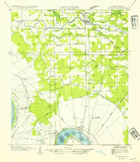
 1962 Donaldsonville1963 Print · USGSThe Mississippi River parishes of Ascension and St. James are shown here in the early sixties as industrial oil fields began to emerge alongside historic riverfront settlements. Researchers can trace family roots through numerous sites like St Michael Cem, Burnside Cem, and the small community of Brulie Maurin.
 - 1965 Map of Donaldsonville
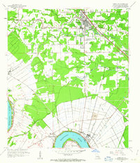
 1965 Donaldsonville1965 Print · USGSThe Mississippi River corridor south of Baton Rouge comes into focus in the 1960s, showing a transition between plantation heritage and the petroleum age. Genealogists can trace family names and local landmarks through sites like Belle Helene Plantation, Brulie Maurin, and St Landry Ch Cem.
 - 1983 Map of Ponchatoula, 1984 Print
 1983 Ponchatoula1984 Print · USGSThe Lake Pontchartrain Basin and the River Parishes come into focus during the early 1980s, showcasing the region's complex water-dependent geography. Researchers can trace the rail routes of the Illinois Central Gulf Railroad and explore landmarks from Pass Manchac to Donaldsonville.2 unique versions available
 - 1991 Map of Gonzales
 1991 Gonzales1991 Print · USGSAscension Parish is captured here in the early nineties as residential growth expanded outward from the river. Genealogists and local historians can trace family sites near Hope Haven Cem, the community at Hillaryville, and landmarks like Sacred Heart of Mary Ch.2 unique versions available
 - 1998 Map of Gonzales, 2001 Print
 1998 Gonzales2001 Print · USGSAscension Parish at the close of the twentieth century shows a unique blend of riverfront industry and suburban growth near the Mississippi. Genealogists can locate family landmarks like Sacred Heart of Mary Ch, Burnside Cem, and the river-bend settlement of Hillaryville.
 - 2012 Map of Gonzales, 2012 Print
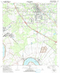
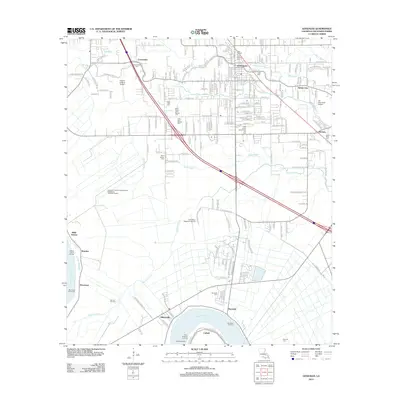 2012 Gonzales2012 Print · USGSCovers Cofield, including Gonzales, Sorrento, and other nearby areas
 - 2015 Map of Gonzales, 2015 Print
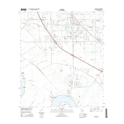 2015 Gonzales2015 Print · USGSCovers Cofield, including Gonzales, Sorrento, and other nearby areas
 - 2018 Map of Gonzales, 2018 Print
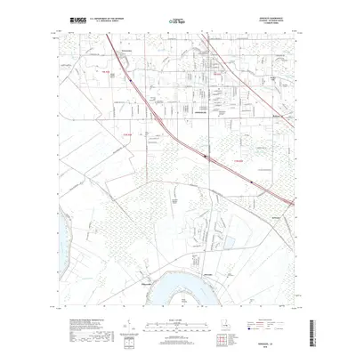 2018 Gonzales2018 Print · USGSCovers Cofield, including Gonzales, Sorrento, and other nearby areas
 - 2020 Map of Gonzales, 2020 Print
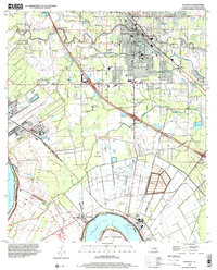
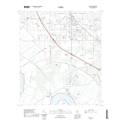 2020 Gonzales2020 Print · USGSCovers Cofield, including Gonzales, Sorrento, and other nearby areas
 - 2024 Map of Gonzales, 2024 Print
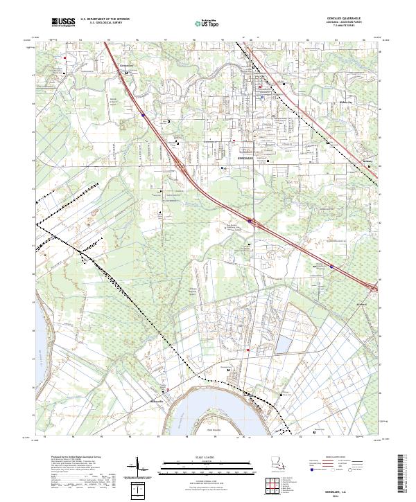 2024 Gonzales2024 Print · USGSThe Louisiana bayou country around Gonzales is captured here as it balances its historic riverfront roots with modern growth. Researchers can trace numerous family and parish burial grounds like Lusk Cem and Burnside Cem along the Mississippi River and Bayou Conway.
End of results
Showing maps 1-20 of 20
Top cities near Cofield
- Baton Rouge historical maps
- St. George historical maps
- Prairieville historical maps
- Gonzales historical maps
- Donaldsonville historical maps
- Lutcher historical maps
See more
Frequently asked questions
- What are the different types of historical maps available for Cofield?
- What is the oldest map of Cofield?
- Where can I purchase historical maps of Cofield for my home or office?
- Where can I download high-res historical maps of Cofield?
- Are there historical topographic maps available for Cofield?
- Is there historical aerial imagery available for Cofield?
- Where are historical maps of Cofield sourced from?