2020s Maps of Cottonport, Louisiana
Explore 4 historic maps of Cottonport from the 2020s. These maps offer a rare glimpse into what life looked like during the 2020s — showing old roads, neighborhoods, homes, and landmarks that have changed or disappeared over time.
Whether you're researching your family's past, planning a metal detecting trip, or studying how Cottonport's landscape evolved across the 2020s, these high-resolution maps are a powerful tool for exploring the history of this region.
- Focus on a specific era: All maps on this page are from the 2020s, giving you a focused view of this time period.
- See what’s changed: Compare century-old streets, trails, and buildings to today's modern landscape using overlays and satellite layers.
- Research with precision: Use these maps for genealogy, historical research, land use analysis, or educational projects.
- View, download, or print: Maps are fully viewable online in high resolution, and can be downloaded or printed for your own records.
Start exploring Cottonport's history through authentic maps from the 2020s. This is your window into the past.
Cottonport, LA maps
(4)- 2020 Map of Cottonport, 2020 Print
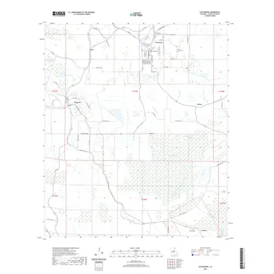 2020 Cottonport2020 Print · USGSCovers Cottonport, including Evergreen, Hickory, and other nearby areas
 - 2020 Map of Marksville South, 2020 Print
 2020 Marksville South2020 Print · USGSCovers Cottonport, including Marksville, Mansura, and other nearby areas
 - 2024 Map of Cottonport, 2024 Print
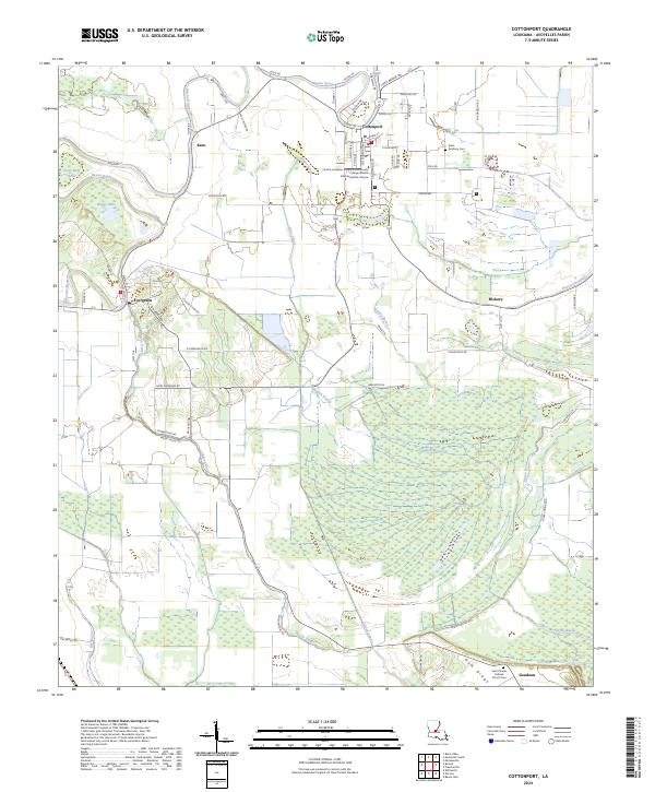 2024 Cottonport2024 Print · USGSAvoyelles Parish life in the current era centers on Cottonport and the surrounding wetland systems of Spring Bayou. Researchers can trace local genealogy at Saint Anthony Cem or explore the landscape around Evergreen and Karo.
 - 2024 Map of Marksville South, 2024 Print
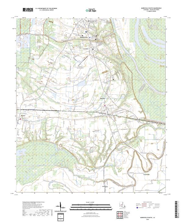 2024 Marksville South2024 Print · USGSAvoyelles Parish enters the mid-2020s with its deep French heritage and bayou-driven geography clearly visible across the Marksville area. Researchers can trace family history through sites like Tunica-Biloxi Cem or explore the wetlands of Lac aux Perles.
End of results
Showing maps 1-4 of 4
Top cities near Cottonport
- Marksville historical maps
- Bunkie historical maps
- Simmesport historical maps
- Mansura historical maps
- Moreauville historical maps
- Hessmer historical maps
See more
Frequently asked questions
- What are the different types of historical maps available for Cottonport?
- What is the oldest map of Cottonport?
- Where can I purchase historical maps of Cottonport for my home or office?
- Where can I download high-res historical maps of Cottonport?
- Are there historical topographic maps available for Cottonport?
- Is there historical aerial imagery available for Cottonport?
- Where are historical maps of Cottonport sourced from?