Old Maps of Lucky, Louisiana for Academic Research
Study the evolution of Lucky with 39 high-resolution historic maps. Whether you're teaching, researching, or modeling changes in land use, these maps provide essential visual documentation of urban, environmental, and geographic change.
- Analyze long-term change: Track patterns in development, transportation, and natural features.
- Ideal for environmental or urban studies: Support academic projects with primary historical map data.
- Use in the classroom or lab: Educators and researchers rely on these maps to bring historical context to life.
These maps are a powerful tool for teaching, research, and visualizing how Lucky has changed over the decades.
Lucky, LA maps
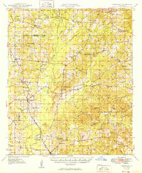
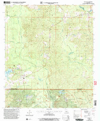
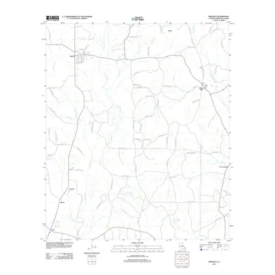
(39)- 1947 Map of Goldonna
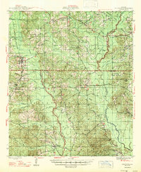 1947 Goldonna1947 Print · USGSNorth Louisiana's timber and rail country is captured here just after the war, showing the rural communities of Natchitoches and Bienville Parishes. Researchers can locate local landmarks like Blooms Mill, trace the Louisiana and Arkansas Railroad, or find old school sites like Readhimer Sch.
 - 1947 Map of Ashland
 1947 Ashland1947 Print · USGSNorth Louisiana's parish boundaries converge in this mid-century landscape where timber and rail lines defined daily life. Genealogists can locate numerous rural landmarks like St Mathews Ch, Old Saline Cem, and the old rail stop at Ashland.
 - 1947 Map of Bienville, 1963 Print
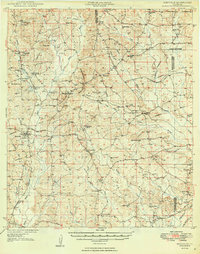
 1947 Bienville1963 Print · USGSNorth central Louisiana is shown here in the mid-forties, characterized by a mix of timber, rail, and early gas exploration. Researchers can find numerous rural landmarks like Raspberry School, the Louisiana and Arkansas Railroad, and Driskill Mountain.2 unique versions available
 - 1948 Map of Jamestown, 1960 Print
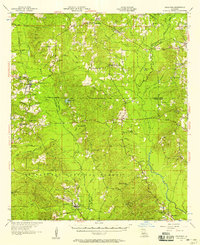
 1948 Jamestown1960 Print · USGSNorthwest Louisiana's timber and oil lands appear here in the late 1940s, just as modern infrastructure began to weave through the piney woods. Genealogists can locate family sites near S Gamel Cemetery, Galilee School, and Rosenwald School.3 unique versions available
 - 1949 Map of Jamestown
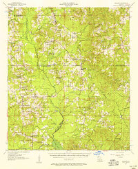
 1949 Jamestown1949 Print · USGSNorthwestern Louisiana at mid-century reveals a landscape of rural communities and timbered bottoms along the parish lines. Genealogists can trace family roots at Little Hope Cem or Gamel Cem, while locating vanished schools like Baltimore Sch and Madden Sch.
 - 1949 Map of Bienville
 1949 Bienville1949 Print · USGSNorthern Louisiana hill country is documented here in the late 1940s, showing the rural communities of Bienville Parish and its neighbors. Researchers can locate dozens of country churches and schools, including Raspberry School and Mt Villa Ch Cem, or trace the Louisiana and North West Railroad.2 unique versions available
 - 1955 Map of Shreveport
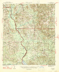
 1955 Shreveport1955 Print · USGSNorthern Louisiana in the mid-fifties is captured here as a landscape of military bases, vast oil fields, and burgeoning college towns. Genealogists and historians can trace the rail-and-river economy through the Monroe Gas Field, Grambling College, and Barksdale Air Force Base.3 unique versions available
 - 1956 Map of Shreveport
 1956 Shreveport1956 Print · USGSNorthern Louisiana during the mid-fifties presents a complex landscape of booming oil fields and strategic military installations. Genealogists and historians can trace the infrastructure of the Monroe Gas Field and family-named locales from Cotton Valley to Jonesboro.
 - 1957 Map of Goldonna
 1957 Goldonna1957 Print · USGSThe rural pine woods of Natchitoches and Bienville Parishes are captured here in the late fifties, just as local landmarks were beginning to change. Genealogists can locate family sites such as Morning Star Ch, Goldonna Cem, and the Pleasant Ridge Sch.3 unique versions available
 - 1957 Map of Ashland, 1958 Print
 1957 Ashland1958 Print · USGSNorth Louisiana's hill country comes alive in the late fifties, showing the rural communities of Ashland and Chestnut at a crossroads. Genealogists can trace family roots through sites like Old Saline Ch, the Luke Cem, and several early schools.3 unique versions available
 - 1984 Map of Shreveport
 1984 Shreveport1984 Print · USGSNorthern Louisiana at the peak of the 1980s reveals a landscape of massive water management projects and Cold War military hubs. Trace the rail lines of the Kansas City Southern Ry past Barksdale Air Force Base and the high ground of Driskill Mountain.2 unique versions available
 - 1985 Map of Monroe South
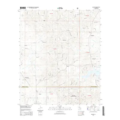
 1985 Monroe South1985 Print · USGSNorth Central Louisiana in the mid-1980s was a hub of timber production and rail transport spanning from the Dugdemona River to the Ouachita valley. Family researchers and historians can trace the rail lines of the Midsouth Railroad through Jonesboro or find local landmarks like Mineral Springs and Punkin Center.2 unique versions available
 - 1985 Map of Shreveport South
 1985 Shreveport South1985 Print · USGSNorthwest Louisiana in the mid-eighties shows a landscape defined by the Red River and a transition from urban centers to deep timberland. Researchers can trace the rail-and-river economy through landmarks like Barksdale Air Force Base, the Sligo Oil and Gas Field, and Lake Bistineau.2 unique versions available
 - 1986 Map of Saline
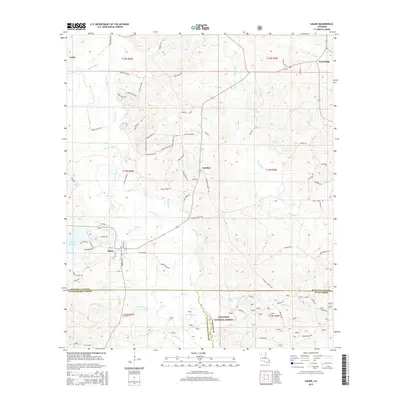
 1986 Saline1986 Print · USGSIn the mid-1980s, the village of Saline and the nearby community of Friendship served as the hubs of this three-parish border region. Local historians can trace family land near the Kisatchie National Forest or locate landmarks like Mill Creek Reservoir and Blewer Pond.
 - 1986 Map of Ashland
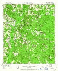
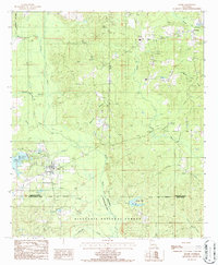
 1986 Ashland1986 Print · USGSIn the 1980s, this area of north-central Louisiana remained a landscape of timber and small settlements. Researchers can trace family-named watercourses like Ouzts Br and Corbitt Br near the village of Ashland and the community of Lucky.
 - 1986 Map of Bienville
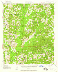
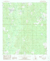 1986 Bienville1986 Print · USGSBienville Parish in the mid-1980s reveals a landscape of creek-side settlements and rural junctions centered on Bienville. Researchers can trace local heritage through landmarks like Lucky, New Friendship, and the vanished paths of an Old RR Grade.
 - 1986 Map of Sparta
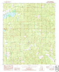 1986 Sparta1986 Print · USGSNorth central Louisiana is shown in the mid-1980s as a quiet patchwork of timberland and winding creeks. Genealogists and local historians can trace the rural roads around Sparta, the village of Lucky, and the shores of Kepler Creek Lake.
 - 2003 Map of Ashland, 2005 Print
 2003 Ashland2005 Print · USGSThe border of Bienville and Natchitoches Parishes was a landscape of managed timber and rural homesteads at the turn of the millennium. Researchers can locate local landmarks like the Ashland corporate limits, family-named waterways such as Prothro Mill Creek, and several Cem sites.
 - 2003 Map of Saline, 2005 Print
 2003 Saline2005 Print · USGSLouisiana's hill country is captured here at the turn of the millennium where Bienville, Natchitoches, and Winn Parishes meet. Genealogists can trace the rural communities of Saline and Friendship, or locate landmarks like Brickyard Branch and Burnt Cabin Creek.
 - 2012 Map of Sparta, 2012 Print
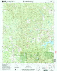
 2012 Sparta2012 Print · USGSCovers Lucky, including Sparta, Bienville Parish, and other nearby areas
 - 2012 Map of Saline, 2012 Print
 2012 Saline2012 Print · USGSCovers Lucky, including Saline, Carolina, and other nearby areas
 - 2012 Map of Ashland, 2012 Print
 2012 Ashland2012 Print · USGSCovers Lucky, including Ashland, New Ramah, and other nearby areas
 - 2012 Map of Bienville, 2012 Print
 2012 Bienville2012 Print · USGSCovers Lucky, including Bienville, Crowson, and other nearby areas
 - 2015 Map of Saline, 2015 Print
 2015 Saline2015 Print · USGSCovers Lucky, including Saline, Carolina, and other nearby areas
 - 2015 Map of Ashland, 2015 Print
 2015 Ashland2015 Print · USGSCovers Lucky, including Ashland, New Ramah, and other nearby areas
Showing maps 1-25 of 39
Top cities near Lucky
- Martin historical maps
- Goldonna historical maps
- Ashland historical maps
- Saline historical maps
- Bienville historical maps
- Castor historical maps
See more
Frequently asked questions
- What are the different types of historical maps available for Lucky?
- What is the oldest map of Lucky?
- Where can I purchase historical maps of Lucky for my home or office?
- Where can I download high-res historical maps of Lucky?
- Are there historical topographic maps available for Lucky?
- Is there historical aerial imagery available for Lucky?
- Where are historical maps of Lucky sourced from?