Old Maps of Sulphur, Louisiana
Explore 41 old maps of Sulphur, spanning from 1935 to today. These high-resolution historic maps reveal how streets, neighborhoods, landmarks, and natural features evolved over time — perfect for genealogy, metal detecting, research, and local history exploration.
What you can do with these maps:
- See how Sulphur changed over time: Compare historical maps to modern-day views to trace roads, homesites, rail lines & more.
- View detailed metadata: Each map includes creators, publishers, year, scale, and archive source.
- Overlay maps with satellite & LiDAR: Visualize the past alongside modern tools to explore terrain & human change.
- Trusted historical sources: Maps sourced from the USGS, Library of Congress, and other archives.
- Access maps your way: View online, download high-res files, or order prints for personal or research use.
Start exploring old maps of Sulphur to uncover forgotten places, hidden landmarks, and the deep history beneath your feet.
Sulphur, LA maps
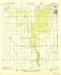
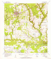
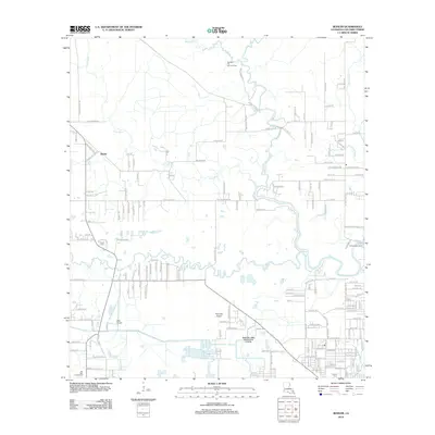
(41)- 1935 Map of Buhler
 1935 Buhler1935 Print · USGSCalcasieu Parish was undergoing a significant transition in the mid-1930s as logging infrastructure gave way to modern highways and canals. Genealogists and researchers can trace early river crossings like Anthony Ferry and the remnants of the Old Logging Railroad Grade near Buhler.
 - 1947 Map of Sulphur
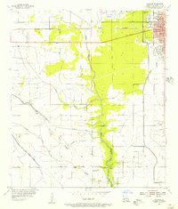
 1947 Sulphur1947 Print · USGSIn Calcasieu Parish during the mid-1940s, the rail and road networks around Sulphur supported a growing industrial landscape. Genealogists and researchers can trace local landmarks like Choupique Sch and the vanished stop at Brimstone.
 - 1947 Map of Sulphur Mines
 1947 Sulphur Mines1947 Print · USGSCalcasieu Parish was a hub of resource extraction and water engineering in the years surrounding the Second World War. Researchers can trace the industrial footprint of the Edgerly Oil Field and the complex waterway network of the Union Sulphur Canal and Houston River.
 - 1947 Map of West Lake
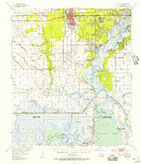
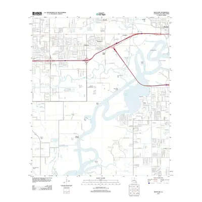
 1947 West Lake1947 Print · USGSCalcasieu Parish was undergoing significant maritime expansion just after the war, centered on the vital ship canal and river system. Genealogists and historians can trace family roots at Farquhar Cemetery, find the old Vincent Sch, or locate the historic Vincent Landing.
 - 1952 Map of Lake Charles
 1952 Lake Charles1952 Print · USGSSouthwest Louisiana is captured here in the mid-fifties, showing a landscape defined by the rise of the petrochemical industry and deep-water navigation. Researchers can trace family roots through numerous small-town settlements and oil developments like Nibletts Bluff, the Lockport Oil Field, and Starks.
 - 1954 Map of Sulphur
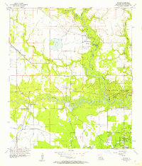
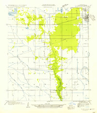 1954 Sulphur1954 Print · USGSCalcasieu Parish reveals its industrial and rural character in the mid-1950s as settlements like Sulphur and Brimstone expand along the rail lines. Researchers can trace historic water routes and local landmarks including the Choupique Sch, Carlyss, and Spring Gully.
 - 1954 Map of West Lake
 1954 West Lake1954 Print · USGSCoastal Calcasieu Parish is captured here in the mid-1950s as the shipping and rail industries reshaped the marshland. Researchers can trace family sites at Farquhar Cemetery, visit the old Vincent Sch, or locate the historic Vincent Landing along the Calcasieu River.
 - 1954 Map of Lake Charles, 1964 Print
 1954 Lake Charles1964 Print · USGSSouthwest Louisiana in the mid-fifties is defined by its massive petroleum industry and its complex network of bayous and rail lines. Researchers can trace the development of the Sulphur Mines Oil Field or locate historic settlements like Longville and De Quincy.3 unique versions available
 - 1955 Map of Westlake, 1956 Print
 1955 Westlake1956 Print · USGSCalcasieu Parish in the mid-1950s shows a region defined by the petroleum industry and expanding rail networks. Researchers can trace the development of Sulphur and Mossville, or locate family sites like Burleson Cem and St Johns Sch.4 unique versions available
 - 1955 Map of Sulphur, 1956 Print
 1955 Sulphur1956 Print · USGSCalcasieu Parish in the mid-fifties shows a landscape of rising industry and expanding neighborhoods around the rail lines. Genealogists and local historians can trace the early layout of Sulphur and locate sites like the Roseland Cem and the settlement of Brimstone.3 unique versions available
 - 1955 Map of Sulphur, 1956 Print
 1955 Sulphur1956 Print · USGSCalcasieu Parish in the mid-fifties is a landscape of rapid industrial growth centered on the sulfur and oil fields. Researchers can trace the roots of local communities through the Mimosa-Pines Cem, the Salem Sch, and the Black Bayou Ferry crossing.3 unique versions available
 - 1956 Map of Buhler, 1957 Print
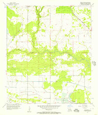
 1956 Buhler1957 Print · USGSCalcasieu Parish in the mid-fifties remains a world of river crossings and rail lines as the region transitions toward industrial growth. Genealogists and local historians can trace family sites like Lyle Cem and Royer Cem or locate the historic Dunn Ferry crossing.4 unique versions available
 - 1956 Map of Brimstone, 1957 Print
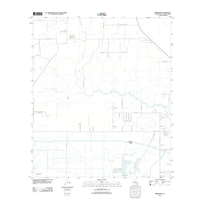
 1956 Brimstone1957 Print · USGSCalcasieu Parish at the height of the 1950s oil boom shows a landscape defined by industrial extraction and water engineering. Trace the footprints of the Edgerly Oil Field, the Sulphur Oil Field, and the rail lines of the Kansas City Southern.3 unique versions available
 - 1956 Map of De Quincy, 1957 Print
 1956 De Quincy1957 Print · USGSCalcasieu Parish comes alive in the mid-1950s as a bustling crossroads of rail, river commerce, and oil extraction. Researchers can trace the heritage of local families at Rigmaiden Cemetery, explore the rail junction at De Quincy, and locate rural landmarks like New Hope Church.3 unique versions available
 - 1986 Map of Lake Charles
 1986 Lake Charles1986 Print · USGSThe Louisiana-Texas borderlands are captured here in the mid-1980s, showcasing the industrial growth of the Lake Charles region and its rail-linked satellite towns. Trace the evolution of coastal settlements and family landmarks from Sulphur to the Highland Cem.2 unique versions available
 - 1994 Map of Sulphur, 1996 Print
 1994 Sulphur1996 Print · USGSCalcasieu Parish comes into focus during the mid-nineties as the industrial and residential centers of Sulphur and Carlyss expand. Researchers can trace local landmarks like Roseland Cem, the historic site of Brimstone, and the regional Southland Field.
 - 1994 Map of Westlake, 1996 Print
 1994 Westlake1996 Print · USGSThe industrial and maritime heart of Calcasieu Parish is revealed here during the mid-nineties, showing the intersection of heavy industry and residential growth. Genealogists and historians can locate family plots at Farquerar Cem and Burleson Cem or trace the early waterfront at Vincent Landing.
 - 1996 Map of Westlake, 1999 Print
 1996 Westlake1999 Print · USGSThe Calcasieu River waterfront was a hub of petrochemical industry and maritime commerce in the mid-nineties. Genealogists and historians can trace family locations through Farquarer Cem or the settlements of Mossville and Vincent Landing.
 - 1998 Map of Sulphur, 2000 Print
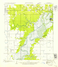
 1998 Sulphur2000 Print · USGSCalcasieu Parish at the close of the twentieth century shows a landscape defined by industry and water management. Researchers can trace the development of Sulphur and Carlyss, locating landmarks like Roseland Cem and the historic area of Brimstone.
 - 1998 Map of Brimstone, 2000 Print
 1998 Brimstone2000 Print · USGSThe industrial wetlands of Calcasieu Parish are documented here at the end of the millennium, showing a landscape defined by oil extraction. Researchers can trace the extensive pipelines and the operations at Edgerly Oil Field or locate the De Quincy Lookout Tower.
 - 1998 Map of Buhler, 2002 Print
 1998 Buhler2002 Print · USGSCalcasieu Parish comes to life in this late twentieth-century survey, showcasing the river-bound communities north of Lake Charles. Researchers can trace rural landmarks like the Indian Bayou Ferry and the Willow Spring School alongside family sites like Lyle Cem.
 - 2012 Map of Sulphur, 2012 Print
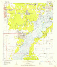
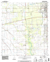
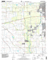
 2012 Sulphur2012 Print · USGSCovers Sulphur, including Carlyss, Choupique, and other nearby areas
 - 2012 Map of Buhler, 2012 Print
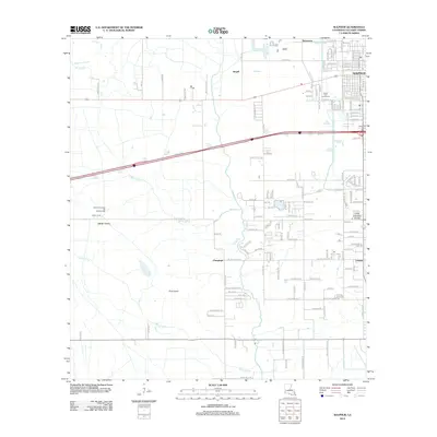
 2012 Buhler2012 Print · USGSCovers Sulphur, including Westlake, Buhler, and other nearby areas
 - 2012 Map of Brimstone, 2012 Print
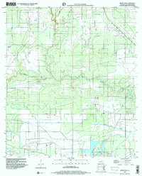
 2012 Brimstone2012 Print · USGSCovers Sulphur, including Calcasieu Parish, United States, and other nearby areas
 - 2012 Map of Westlake, 2012 Print
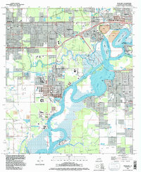
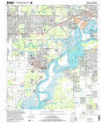
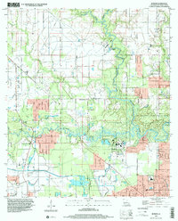
 2012 Westlake2012 Print · USGSCovers Sulphur, including Lake Charles, Westlake, and other nearby areas
Showing maps 1-25 of 41
Top cities near Sulphur
Top neighborhoods of Sulphur
Frequently asked questions
- What are the different types of historical maps available for Sulphur?
- What is the oldest map of Sulphur?
- Where can I purchase historical maps of Sulphur for my home or office?
- Where can I download high-res historical maps of Sulphur?
- Are there historical topographic maps available for Sulphur?
- Is there historical aerial imagery available for Sulphur?
- Where are historical maps of Sulphur sourced from?