Old Maps of Lone Pine, Louisiana
Explore 15 old maps of Lone Pine, spanning from 1934 to today. These high-resolution historic maps reveal how streets, neighborhoods, landmarks, and natural features evolved over time — perfect for genealogy, metal detecting, research, and local history exploration.
What you can do with these maps:
- See how Lone Pine changed over time: Compare historical maps to modern-day views to trace roads, homesites, rail lines & more.
- View detailed metadata: Each map includes creators, publishers, year, scale, and archive source.
- Overlay maps with satellite & LiDAR: Visualize the past alongside modern tools to explore terrain & human change.
- Trusted historical sources: Maps sourced from the USGS, Library of Congress, and other archives.
- Access maps your way: View online, download high-res files, or order prints for personal or research use.
Start exploring old maps of Lone Pine to uncover forgotten places, hidden landmarks, and the deep history beneath your feet.
Lone Pine, LA maps
(15)- 1934 Map of Greens Bayou, 1960 Print
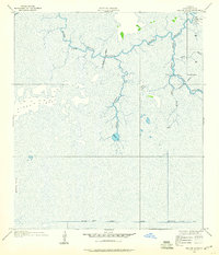 1934 Greens Bayou1960 Print · USGSCameron Parish in the mid-1930s is revealed here as an intricate world of bayous and marsh outposts. Researchers can trace the early drainage network and locate seasonal settlements like Lone Pine, Grays Camp, and Gate Camp along the banks of Black Bayou.2 unique versions available
 - 1935 Map of Greens Bayou
 1935 Greens Bayou1935 Print · USGSCameron Parish marshlands are meticulously charted in the mid-1930s, showing a remote landscape of winding bayous and isolated camps. Genealogists and historians can trace old coastal sites like Lone Pine, Grays Camp, and the ridges of Pines Ridge.
 - 1954 Map of Port Arthur
 1954 Port Arthur1954 Print · USGSThe Texas and Louisiana coastlines meet here in the mid-fifties, showing the industrial rise of Port Arthur alongside vast wildlife preserves. Researchers can trace remote coastal settlements and infrastructure like Pecan Island, the Sabine Pass Lighthouse, and the North Island School.
 - 1955 Map of Johnsons Bayou, 1956 Print
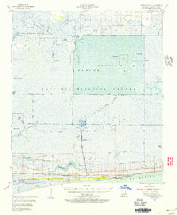 1955 Johnsons Bayou1956 Print · USGSCoastal Cameron Parish in the mid-fifties reveals a landscape of Chenier ridges and marshland industry between the wildlife refuge and the Gulf. Researchers can locate family sites like Smith Ridge Cem and follow the early footprints of the Burton Oil Field.3 unique versions available
 - 1956 Map of Port Arthur, 1965 Print
 1956 Port Arthur1965 Print · USGSThe Texas and Louisiana coastlines meet here in the mid-fifties, showing a landscape of sprawling marshes and growing refinery towns. Genealogists and historians can trace ridge settlements like Grand Cheniere or find the Sabine Pass Lighthouse and Pecan Island.3 unique versions available
 - 1958 Map of Port Arthur
 1958 Port Arthur1958 Print · USGSThe Texas and Louisiana coastlines meet in the late fifties at the busy industrial port of Port Arthur. Historians and genealogists can trace the early rail networks of the Southern Pacific and locate coastal settlements like Cameron, Pecan Island, and Abbeville.
 - 1959 Map of Port Arthur
 1959 Port Arthur1959 Print · USGSThe Texas and Louisiana coastlines meet in this late-fifties study of a landscape defined by industry and wildlife preserves. Trace the Intracoastal Waterway past Pecan Island and Abbeville, or locate the shipping channels at Sabine Pass.
 - 1973 Map of Port Arthur, 1974 Print
 1973 Port Arthur1974 Print · USGSThe Texas-Louisiana borderlands in the early seventies reveal an intricate landscape of coastal marshes and heavy industry. Trace the growth of Port Arthur, the extent of the oil and gas fields, and old ridge settlements like Pecan Island.
 - 1982 Map of Greens Bayou
 1982 Greens Bayou1982 Print · USGSCameron Parish wetlands were an intricate mix of natural bayous and industrial canals in the early eighties. Researchers can trace the water-management infrastructure of the Sabine National Wildlife Refuge, from the Lookout Tower to Grays Camp.
 - 1983 Map of Port Arthur
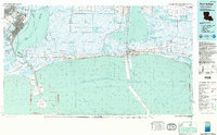 1983 Port Arthur1983 Print · USGSThe Texas and Louisiana coastline comes into sharp focus during the early 1980s, showcasing the industrial hubs of the Gulf. Trace the development of Port Arthur and Port Neches or locate specific facilities like St Gabriel Hospital and the West Hackberry Oil Field.
 - 2012 Map of Greens Bayou, 2012 Print
 2012 Greens Bayou2012 Print · USGSCovers Lone Pine, including Cameron Parish, United States, and other nearby areas
 - 2015 Map of Greens Bayou, 2015 Print
 2015 Greens Bayou2015 Print · USGSCovers Lone Pine, including Cameron Parish, United States, and other nearby areas
 - 2018 Map of Greens Bayou, 2018 Print
 2018 Greens Bayou2018 Print · USGSCovers Lone Pine, including Cameron Parish, United States, and other nearby areas
 - 2020 Map of Greens Bayou, 2020 Print
 2020 Greens Bayou2020 Print · USGSCovers Lone Pine, including Cameron Parish, United States, and other nearby areas
 - 2024 Map of Greens Bayou, 2024 Print
 2024 Greens Bayou2024 Print · USGSCameron Parish's coastal marshes are meticulously charted in 2024, showing the vital intersection of natural waterways and civil engineering. Genealogists and historians can trace family-named landmarks like Marceaux Island and Pines Ridge or follow the paths of Starks North Canal and Greens Bayou.
End of results
Showing maps 1-15 of 15
Top cities near Lone Pine
- Port Arthur historical maps
- Orange historical maps
- Bridge City historical maps
- West Orange historical maps
- Vinton historical maps
- Pinehurst historical maps
Frequently asked questions
- What are the different types of historical maps available for Lone Pine?
- What is the oldest map of Lone Pine?
- Where can I purchase historical maps of Lone Pine for my home or office?
- Where can I download high-res historical maps of Lone Pine?
- Are there historical topographic maps available for Lone Pine?
- Is there historical aerial imagery available for Lone Pine?
- Where are historical maps of Lone Pine sourced from?