Old Maps of Blackburn, Louisiana
Explore 12 old maps of Blackburn, spanning from 1952 to today. These high-resolution historic maps reveal how streets, neighborhoods, landmarks, and natural features evolved over time — perfect for genealogy, metal detecting, research, and local history exploration.
What you can do with these maps:
- See how Blackburn changed over time: Compare historical maps to modern-day views to trace roads, homesites, rail lines & more.
- View detailed metadata: Each map includes creators, publishers, year, scale, and archive source.
- Overlay maps with satellite & LiDAR: Visualize the past alongside modern tools to explore terrain & human change.
- Trusted historical sources: Maps sourced from the USGS, Library of Congress, and other archives.
- Access maps your way: View online, download high-res files, or order prints for personal or research use.
Start exploring old maps of Blackburn to uncover forgotten places, hidden landmarks, and the deep history beneath your feet.
Blackburn, LA maps
(12)- 1952 Map of Homer, 1953 Print
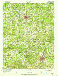 1952 Homer1953 Print · USGSClaiborne Parish in the early fifties shows a landscape transitioning between timber agriculture and a booming petroleum economy. Genealogists can trace family footprints across dozens of rural landmarks like Ward Chapel Sch, Shady Grove Cem, and the extensive Homer Oil Field.4 unique versions available
 - 1955 Map of Shreveport
 1955 Shreveport1955 Print · USGSNorthern Louisiana in the mid-fifties is captured here as a landscape of military bases, vast oil fields, and burgeoning college towns. Genealogists and historians can trace the rail-and-river economy through the Monroe Gas Field, Grambling College, and Barksdale Air Force Base.3 unique versions available
 - 1956 Map of Shreveport
 1956 Shreveport1956 Print · USGSNorthern Louisiana during the mid-fifties presents a complex landscape of booming oil fields and strategic military installations. Genealogists and historians can trace the infrastructure of the Monroe Gas Field and family-named locales from Cotton Valley to Jonesboro.
 - 1984 Map of Shreveport
 1984 Shreveport1984 Print · USGSNorthern Louisiana at the peak of the 1980s reveals a landscape of massive water management projects and Cold War military hubs. Trace the rail lines of the Kansas City Southern Ry past Barksdale Air Force Base and the high ground of Driskill Mountain.2 unique versions available
 - 1986 Map of Blackburn
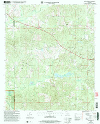
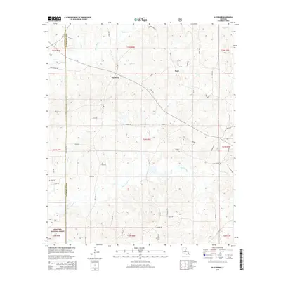
 1986 Blackburn1986 Print · USGSNorthern Louisiana parish life is captured here in the mid-1980s, centered on the communities of Blackburn and Ruple. Local historians can trace family locations near several Cem sites and explore the wooded reaches of the Kisatchie National Forest.
 - 1986 Map of Shreveport North
 1986 Shreveport North1986 Print · USGSNorthern Louisiana in the mid-eighties shows a landscape of expansive river bottoms and growing suburban centers. Genealogists and historians can trace the development of Shreveport, the infrastructure of Barksdale Air Force Base, and rural life in Rocky Mount.2 unique versions available
 - 2003 Map of Blackburn, 2005 Print
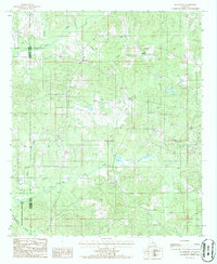
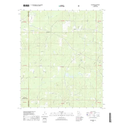
 2003 Blackburn2005 Print · USGSThe borderlands of Claiborne and Webster Parish are captured here at the turn of the millennium, showing a landscape of pine forests and quiet rural crossroads. Researchers can locate family Cem sites and trace old industry markers like the Lookout Tower and Oil Field.
 - 2012 Map of Blackburn, 2012 Print
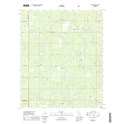
 2012 Blackburn2012 Print · USGSCovers Blackburn, including Ruple, Webster Parish, and other nearby areas
 - 2015 Map of Blackburn, 2015 Print
 2015 Blackburn2015 Print · USGSCovers Blackburn, including Ruple, Webster Parish, and other nearby areas
 - 2018 Map of Blackburn, 2018 Print
 2018 Blackburn2018 Print · USGSCovers Blackburn, including Ruple, Webster Parish, and other nearby areas
 - 2020 Map of Blackburn, 2020 Print
 2020 Blackburn2020 Print · USGSCovers Blackburn, including Ruple, Webster Parish, and other nearby areas
 - 2024 Map of Blackburn, 2024 Print
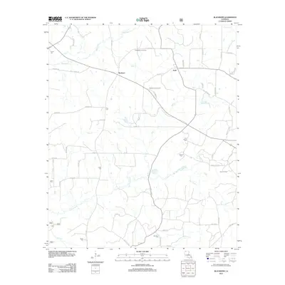
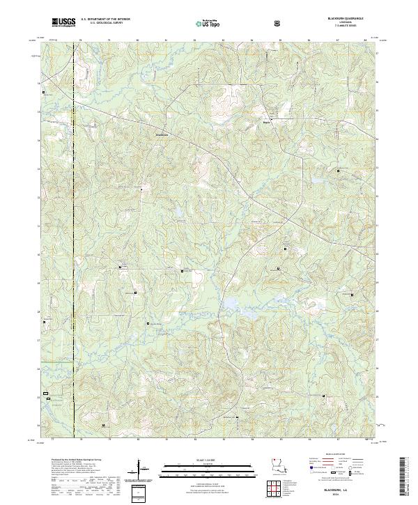 2024 Blackburn2024 Print · USGSNorth Louisiana's timber and oil country is captured here at the parish line between Webster and Claiborne in the 2020s. Genealogists and historians can trace family locations through over a dozen rural burial sites including Grisby - Lewis Cem, Ruple Cem, and Webb Cem.
End of results
Showing maps 1-12 of 12
Top cities near Blackburn
- Minden historical maps
- Homer historical maps
- Haynesville historical maps
- Cotton Valley historical maps
- Athens historical maps
- Shongaloo historical maps
Frequently asked questions
- What are the different types of historical maps available for Blackburn?
- What is the oldest map of Blackburn?
- Where can I purchase historical maps of Blackburn for my home or office?
- Where can I download high-res historical maps of Blackburn?
- Are there historical topographic maps available for Blackburn?
- Is there historical aerial imagery available for Blackburn?
- Where are historical maps of Blackburn sourced from?