Old Maps of Claiborne Parish, Louisiana
Explore 170 old maps of Claiborne Parish, spanning from 1927 to today. These high-resolution historic maps reveal how streets, neighborhoods, landmarks, and natural features evolved over time — perfect for genealogy, metal detecting, research, and local history exploration.
What you can do with these maps:
- See how Claiborne Parish changed over time: Compare historical maps to modern-day views to trace roads, homesites, rail lines & more.
- View detailed metadata: Each map includes creators, publishers, year, scale, and archive source.
- Overlay maps with satellite & LiDAR: Visualize the past alongside modern tools to explore terrain & human change.
- Trusted historical sources: Maps sourced from the USGS, Library of Congress, and other archives.
- Access maps your way: View online, download high-res files, or order prints for personal or research use.
Start exploring old maps of Claiborne Parish to uncover forgotten places, hidden landmarks, and the deep history beneath your feet.
Claiborne Parish, LA maps
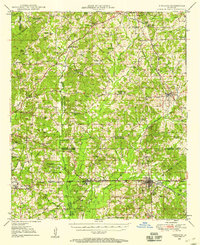
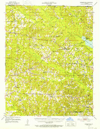
(170)- 1927 Map of El Dorado
 1927 El Dorado1927 Print · USGSUnion County, Arkansas, is captured here in the late twenties as the oil boom transformed the landscape around El Dorado. Researchers can trace the early footprints of settlements like Caledonia and find rural landmarks such as Old Parker Chapel and Jennys Store.2 unique versions available
 - 1930 Map of El Dorado, 1949 Print
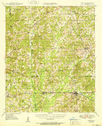
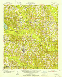
 1930 El Dorado1949 Print · USGSUnion County enters its oil boom era during the late twenties, with this survey capturing the burgeoning industry surrounding El Dorado. Genealogists and local historians can trace rural school districts like Shady Grove Sch and Fairview Sch, or locate family sites near Parnell Cemetery.
 - 1949 Map of Gibsland, 1958 Print
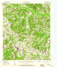
 1949 Gibsland1958 Print · USGSGibsland and the surrounding hill country are captured here at the height of the mid-century energy boom. Researchers can trace historic family connections at Germantown Church, locate the Athens Lookout Tower, and see the rail junction of the Illinois Central.2 unique versions available
 - 1950 Map of Gibsland
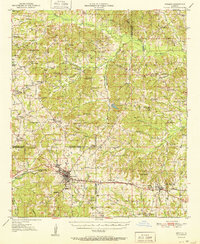
 1950 Gibsland1950 Print · USGSMid-century Bienville Parish is revealed here as a landscape of crossroads communities and emerging energy fields just after the war. Researchers can trace family roots through numerous rural landmarks like Mt Lebanon, Germantown Ch, and the Mayflower Sch.
 - 1950 Map of Arcadia, 1960 Print
 1950 Arcadia1960 Print · USGSNorthern Louisiana during the mid-century was a landscape of dense rail corridors and rural schoolhouses. Genealogists can trace the ILLINOIS CENTRAL line through ARCADIA and find remote landmarks like Macedonia Ch and Point Pleasant Cem.4 unique versions available
 - 1951 Map of Arcadia
 1951 Arcadia1951 Print · USGSNorth Louisiana at mid-century reveals a landscape of tight-knit rural communities and emerging energy fields. Genealogists can trace family roots through numerous country landmarks like Alabama Ch, Givens McGuire Cem, and the Hurricane Sch along the Illinois Central line.
 - 1951 Map of Summerfield, 1952 Print
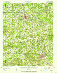
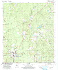
 1951 Summerfield1952 Print · USGSClaiborne Parish in the early fifties is a landscape of rural crossroads and growing industry. Genealogists can locate family landmarks like Aycock Cem or Sharon Sch, and trace the development of settlements from Lisbon to the Gas Refinery near the parish line.5 unique versions available
 - 1951 Map of Bernice, 1952 Print
 1951 Bernice1952 Print · USGSNorthern Louisiana life centered on the rail lines and creek bottoms in the early fifties. Genealogists can trace family roots through numerous rural landmarks like Hard Shell Cem, Harmony Chapel, and the community of Spearsville.4 unique versions available
 - 1951 Map of El Dorado, 1953 Print
 1951 El Dorado1953 Print · USGSSouthern Arkansas in the early fifties shows a landscape shaped by the Missouri Pacific railroad and rural growth around El Dorado. Genealogists can locate numerous landmarks like Parkers Chapel Sch, Wesley Chapel, and Caledonia.3 unique versions available
 - 1952 Map of Homer, 1953 Print
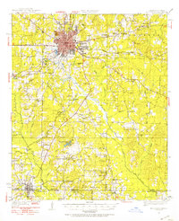
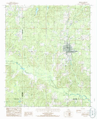
 1952 Homer1953 Print · USGSClaiborne Parish in the early fifties shows a landscape transitioning between timber agriculture and a booming petroleum economy. Genealogists can trace family footprints across dozens of rural landmarks like Ward Chapel Sch, Shady Grove Cem, and the extensive Homer Oil Field.4 unique versions available
 - 1953 Map of El Dorado, 1967 Print
 1953 El Dorado1967 Print · USGSSouth Arkansas in the mid-1960s was a landscape of industrial growth and river-fed commerce. Researchers can trace the extensive Oil and Gas Fields around Magnolia, the expansive U S Naval Ammunition Depot, and the busy rail lines of the Missouri Pacific.3 unique versions available
 - 1955 Map of Shreveport
 1955 Shreveport1955 Print · USGSNorthern Louisiana in the mid-fifties is captured here as a landscape of military bases, vast oil fields, and burgeoning college towns. Genealogists and historians can trace the rail-and-river economy through the Monroe Gas Field, Grambling College, and Barksdale Air Force Base.3 unique versions available
 - 1956 Map of Shreveport
 1956 Shreveport1956 Print · USGSNorthern Louisiana during the mid-fifties presents a complex landscape of booming oil fields and strategic military installations. Genealogists and historians can trace the infrastructure of the Monroe Gas Field and family-named locales from Cotton Valley to Jonesboro.
 - 1957 Map of El Dorado
 1957 El Dorado1957 Print · USGSSouth Arkansas in the mid-1950s was a critical hub of military logistics and rail-river commerce. Genealogists and historians can trace family land across the Arkansas Louisiana border and locate sites like the U.S. Naval Ammunition Depot or the rail junctions at Magnolia and Camden.
 - 1958 Map of El Dorado
 1958 El Dorado1958 Print · USGSSouthern Arkansas and the Louisiana borderlands are shown during a period of heavy rail traffic and defense industry activity. Researchers can trace the legacy of the U. S. Naval Ammunition Depot or locate family roots in Smackover, Huttig, and Nashville.3 unique versions available
 - 1960 Map of El Dorado
 1960 El Dorado1960 Print · USGSSouth Central Arkansas in the late fifties was a hub of energy production and defense industry. Researchers can trace the extensive Oil and Gas Fields around El Dorado or locate family landmarks like Old Park Cem and New Hope Church.
 - 1971 Map of Wesson, 1973 Print
 1971 Wesson1973 Print · USGSThe Arkansas-Louisiana state line south of Wesson comes to life in the early 1970s, showing a landscape of timber and creek-side communities. Researchers can trace family history at Three Creeks Cem or follow the path of an Old Railroad Grade.2 unique versions available
 - 1971 Map of Emerson SE, 1973 Print
 1971 Emerson SE1973 Print · USGSThe borderlands of Arkansas and Louisiana appear here in the early seventies as a landscape shaped by petroleum and parish history. Genealogists and historians can trace local landmarks like Chalybeate Springs Cem, the East Haynesville Oil and Gas Field, and Mt Israel Ch.2 unique versions available
 - 1971 Map of Wesson SW, 1973 Print
 1971 Wesson SW1973 Print · USGSThe Arkansas-Louisiana state line comes alive in the early seventies, showing a landscape of bayous and rising energy production. Trace family roots and rural life at Dodge City, Salem Ch, and the winding banks of Cornie Bayou.
 - 1971 Map of Emerson, 1973 Print
 1971 Emerson1973 Print · USGSThe Arkansas-Louisiana border in the early seventies shows a landscape shaped by petroleum and rail. Genealogists and historians can trace family landmarks like Sweet Home Ch and Elliott Cem alongside the Louisiana and North West line.2 unique versions available
 - 1981 Map of Junction City
 1981 Junction City1981 Print · USGSJunction City sits squarely on the Arkansas-Louisiana border in the early eighties, surrounded by oil fields and bayou country. Trace family roots at Graceland Cem and Caledonia Ch, or locate old homesites near Upland and Lamberton.
 - 1984 Map of Shreveport
 1984 Shreveport1984 Print · USGSNorthern Louisiana at the peak of the 1980s reveals a landscape of massive water management projects and Cold War military hubs. Trace the rail lines of the Kansas City Southern Ry past Barksdale Air Force Base and the high ground of Driskill Mountain.2 unique versions available
 - 1985 Map of Monroe North, 1986 Print
 1985 Monroe North1986 Print · USGSNorth-central Louisiana in the mid-eighties was a landscape defined by the growth of university towns and the expansion of the natural gas industry. Researchers can trace rural family roots through landmarks like Lisbon Cem, New Hope Ch, and the many schools in Farmerville or Bernice.2 unique versions available
 - 1985 Map of El Dorado, 1986 Print
 1985 El Dorado1986 Print · USGSSouth-central Arkansas and the Louisiana borderlands appear here in the mid-1980s, defined by the energy industry and river bottomlands. Genealogists and historians can locate rural landmarks like Old Parkers Chapel Cem, the Smackover Gas Field, and the El Dorado & Wesson RR.2 unique versions available
 - 1985 Map of Bernice, 1986 Print
 1985 Bernice1986 Print · USGSNorth Louisiana in the early eighties is captured here, centering on the grid of Bernice and the rural reaches of the surrounding parishes. Researchers can trace land ties along Middle Fork Bayou D'Arbonne or locate rural landmarks like Weldon and several old Cem sites.
Showing maps 1-25 of 170
Top cities of Claiborne Parish
Frequently asked questions
- What are the different types of historical maps available for Claiborne Parish?
- What is the oldest map of Claiborne Parish?
- Where can I purchase historical maps of Claiborne Parish for my home or office?
- Where can I download high-res historical maps of Claiborne Parish?
- Are there historical topographic maps available for Claiborne Parish?
- Is there historical aerial imagery available for Claiborne Parish?
- Where are historical maps of Claiborne Parish sourced from?