Old Maps of Mason, Louisiana for Academic Research
Study the evolution of Mason with 12 high-resolution historic maps. Whether you're teaching, researching, or modeling changes in land use, these maps provide essential visual documentation of urban, environmental, and geographic change.
- Analyze long-term change: Track patterns in development, transportation, and natural features.
- Ideal for environmental or urban studies: Support academic projects with primary historical map data.
- Use in the classroom or lab: Educators and researchers rely on these maps to bring historical context to life.
These maps are a powerful tool for teaching, research, and visualizing how Mason has changed over the decades.
Mason, LA maps
(12)- 1939 Map of Fort Necessity, 1941 Print
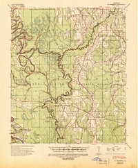 1939 Fort Necessity1941 Print · USGSThe Louisiana backcountry near the junction of Richland, Caldwell, and Franklin Parishes comes alive in the years leading up to the war. Researchers can trace rural lineages through local landmarks like Rosenwald Sch, the community at Fort Necessity, and active river crossings like Duchene Ferry.
 - 1955 Map of Jackson
 1955 Jackson1955 Print · USGSThe Lower Mississippi Valley at the middle of the century reveals a landscape of deep river meanders and growing rail hubs. Genealogists and historians can trace the mid-century footprints of Vicksburg National Military Park, old river landings at Port Gibson, and the rail corridors of the Illinois Central Railroad.3 unique versions available
 - 1958 Map of Fort Necessity, 1959 Print
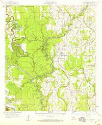 1958 Fort Necessity1959 Print · USGSThe Louisiana bottomlands of Franklin Parish are captured here in the late fifties, defined by the winding Boeuf River and dense bayou networks. Researchers can locate vanished landmarks and family cemeteries like Long Lake Cem, the Ft Necessity Sch, and Liddieville.3 unique versions available
 - 1961 Map of Jackson
 1961 Jackson1961 Print · USGSThe Lower Mississippi Delta and the state capital area are captured here during the post-war era of infrastructure expansion. Researchers can trace the complex river oxbows and rail lines connecting Vicksburg, Yazoo City, and the Illinois Central Railroad network.
 - 1962 Map of Jackson
 1962 Jackson1962 Print · USGSThe Mississippi Delta and the state capital region are mapped here in the early sixties, showing a landscape defined by the great river and the growing city of JACKSON. Genealogists can trace family roots through numerous landmarks like Cedar Hill Cem, rural stops on the Illinois Central RR, and historic sites like Champion Hill.2 unique versions available
 - 1982 Map of Tallulah, 1983 Print
 1982 Tallulah1983 Print · USGSNortheast Louisiana in the early eighties was a landscape of intricate oxbow lakes and railroad towns. Researchers can trace the heritage of parish centers like Tallulah and Winnsboro, or locate rural landmarks near Yucatan Lake and the Illinois Central Gulf tracks.
 - 1983 Map of Mason, 1984 Print
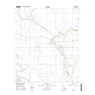
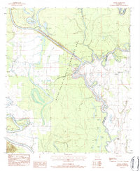 1983 Mason1984 Print · USGSCaldwell and Franklin Parishes in the early eighties are defined here by the winding Boeuf River and its surrounding wetlands. Genealogists and local historians can trace family sites at Mason, Mason Ridge Ch, and the Burrough Ch Cem.
 - 2012 Map of Mason, 2012 Print
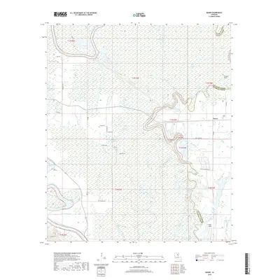
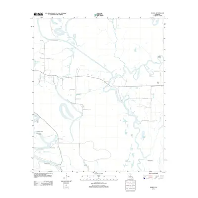 2012 Mason2012 Print · USGSCovers Mason, including Franklin Parish, Caldwell Parish, and other nearby areas
 - 2015 Map of Mason, 2015 Print
 2015 Mason2015 Print · USGSCovers Mason, including Franklin Parish, Caldwell Parish, and other nearby areas
 - 2018 Map of Mason, 2018 Print
 2018 Mason2018 Print · USGSCovers Mason, including Franklin Parish, Caldwell Parish, and other nearby areas
 - 2020 Map of Mason, 2020 Print
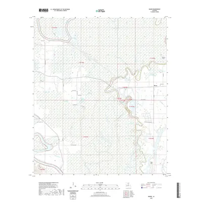 2020 Mason2020 Print · USGSCovers Mason, including Franklin Parish, Caldwell Parish, and other nearby areas
 - 2024 Map of Mason, 2024 Print
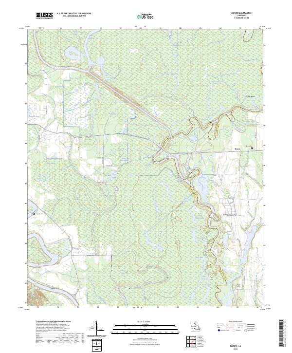 2024 Mason2024 Print · USGSThe alluvial bottoms of Caldwell Parish are captured here in a period of modern mapping that still preserves traditional landmarks. Genealogists can trace family sites near Mason, Block Cem, and the historic crossing at Hudson Ferry.
End of results
Showing maps 1-12 of 12
Top cities near Mason
- Winnsboro historical maps
- Wisner historical maps
- Gilbert historical maps
- Grayson historical maps
- Columbia historical maps
- Sicily Island historical maps
See more
Frequently asked questions
- What are the different types of historical maps available for Mason?
- What is the oldest map of Mason?
- Where can I purchase historical maps of Mason for my home or office?
- Where can I download high-res historical maps of Mason?
- Are there historical topographic maps available for Mason?
- Is there historical aerial imagery available for Mason?
- Where are historical maps of Mason sourced from?