Old Maps of River Ranch, Lafayette for Academic Research
Study the evolution of River Ranch with 14 high-resolution historic maps. Whether you're teaching, researching, or modeling changes in land use, these maps provide essential visual documentation of urban, environmental, and geographic change.
- Analyze long-term change: Track patterns in development, transportation, and natural features.
- Ideal for environmental or urban studies: Support academic projects with primary historical map data.
- Use in the classroom or lab: Educators and researchers rely on these maps to bring historical context to life.
These maps are a powerful tool for teaching, research, and visualizing how River Ranch has changed over the decades.
River Ranch, Lafayette maps
(14)- 1946 Map of Lafayette
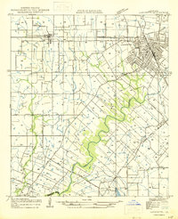 1946 Lafayette1946 Print · USGSLafayette and the surrounding Acadiana countryside are captured here in the mid-1940s as the city expanded around its educational and rail hubs. Genealogists and local historians can pinpoint the Louisiana Southwestern Institute, rural schoolhouses like Verot Sch, and the rail sidings at Tolson and Ely Junction.
 - 1952 Map of Lake Charles
 1952 Lake Charles1952 Print · USGSSouthwest Louisiana is captured here in the mid-fifties, showing a landscape defined by the rise of the petrochemical industry and deep-water navigation. Researchers can trace family roots through numerous small-town settlements and oil developments like Nibletts Bluff, the Lockport Oil Field, and Starks.
 - 1954 Map of Lafayette
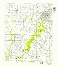 1954 Lafayette1954 Print · USGSMid-century Lafayette is captured here as the city grid expands toward the Louisiana Southwestern Institute and the Vermilion River. Genealogists can trace family tracts and small rail stops like Tolson, Scott, and Ely Junction.
 - 1954 Map of Lake Charles, 1964 Print
 1954 Lake Charles1964 Print · USGSSouthwest Louisiana in the mid-fifties is defined by its massive petroleum industry and its complex network of bayous and rail lines. Researchers can trace the development of the Sulphur Mines Oil Field or locate historic settlements like Longville and De Quincy.3 unique versions available
 - 1955 Map of Lafayette, 1956 Print
 1955 Lafayette1956 Print · USGSLafayette and the surrounding Acadiana prairies are captured in the mid-fifties, showing a bustling regional center defined by the Southern Pacific and SW Louisiana Institute. Genealogists can trace family names through numerous burial sites like Whittington Cem and Broussard Cem.3 unique versions available
 - 1955 Map of Lafayette, 1956 Print
 1955 Lafayette1956 Print · USGSMid-century Acadiana is captured here as LAFAYETTE expands near traditional settlements like Youngsville and Maurice. Genealogists and historians can locate numerous family-named landmarks, such as Abshire Cem, Judice High Sch, and the Duson Gas Field.5 unique versions available
 - 1983 Map of Lafayette
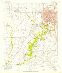
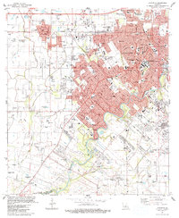 1983 Lafayette1983 Print · USGSLafayette and the surrounding Acadiana prairies underwent significant expansion in the early eighties as the energy industry and university campus grew. Researchers can locate numerous local burial grounds like Simon Cem and historic school sites including James Sch and Judice Sch.
 - 1985 Map of Crowley, 1986 Print
 1985 Crowley1986 Print · USGSCoastal prairie and bayou country are captured in the mid-eighties as the rice-and-rail economy defined South Louisiana life. Genealogists and researchers can trace family lands and rural hubs from Crowley to Jennings, following the paths of the Southern Pacific Railroad and the winding Mermentau River.2 unique versions available
 - 1994 Map of Lafayette, 1998 Print
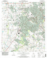 1994 Lafayette1998 Print · USGSLafayette and the surrounding Acadiana region are captured in the mid-1990s as suburban growth began to reshape the old parish lines. Genealogists can trace local history through several family-named landmarks including Cobb Cem, Broussard Cem, and the settlement of Scott.
 - 2012 Map of Lafayette, 2012 Print
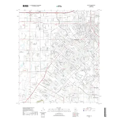
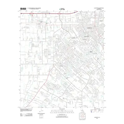 2012 Lafayette2012 Print · USGSCovers River Ranch, including Lafayette, Scott, and other nearby areas
 - 2015 Map of Lafayette, 2015 Print
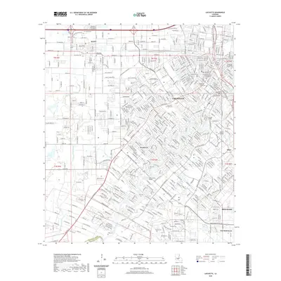
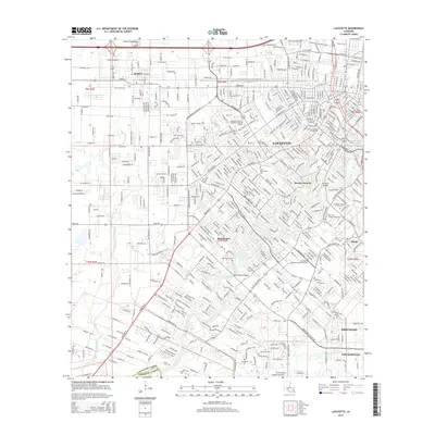 2015 Lafayette2015 Print · USGSCovers River Ranch, including Lafayette, Scott, and other nearby areas
 - 2018 Map of Lafayette, 2018 Print
 2018 Lafayette2018 Print · USGSCovers River Ranch, including Lafayette, Scott, and other nearby areas
 - 2020 Map of Lafayette, 2020 Print
 2020 Lafayette2020 Print · USGSCovers River Ranch, including Lafayette, Scott, and other nearby areas
 - 2024 Map of Lafayette, 2024 Print
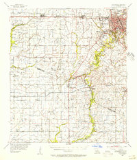
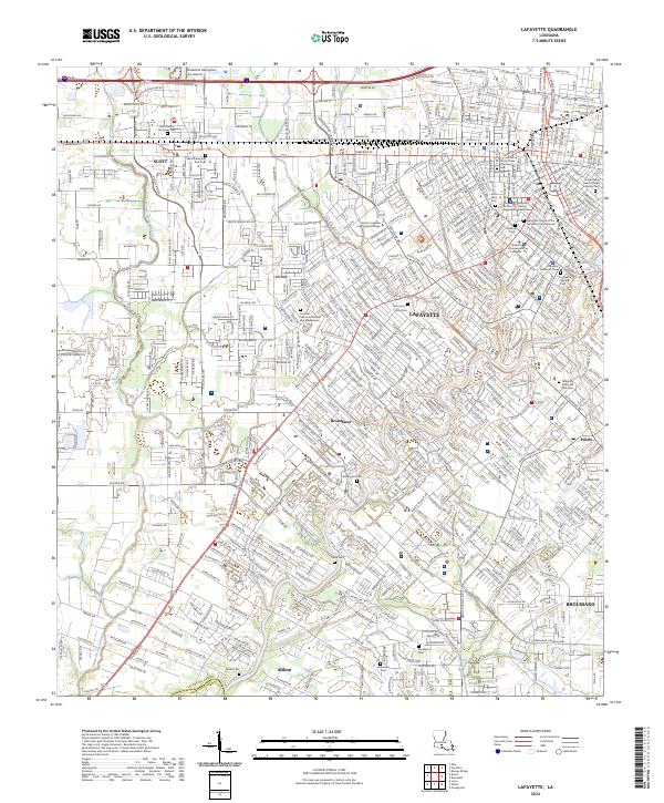 2024 Lafayette2024 Print · USGSLafayette and its neighboring Cajun Country settlements are shown in meticulous detail during this era of modern growth. Genealogists and local historians can trace family roots through numerous burial sites like Saints Peter and Paul Cem, Broussard Cem, and Saint John Cem.
End of results
Showing maps 1-14 of 14
Frequently asked questions
- What are the different types of historical maps available for River Ranch?
- What is the oldest map of River Ranch?
- Where can I purchase historical maps of River Ranch for my home or office?
- Where can I download high-res historical maps of River Ranch?
- Are there historical topographic maps available for River Ranch?
- Is there historical aerial imagery available for River Ranch?
- Where are historical maps of River Ranch sourced from?