Old Maps of Livingston Parish, Louisiana
Explore 177 old maps of Livingston Parish, spanning from 1892 to today. These high-resolution historic maps reveal how streets, neighborhoods, landmarks, and natural features evolved over time — perfect for genealogy, metal detecting, research, and local history exploration.
What you can do with these maps:
- See how Livingston Parish changed over time: Compare historical maps to modern-day views to trace roads, homesites, rail lines & more.
- View detailed metadata: Each map includes creators, publishers, year, scale, and archive source.
- Overlay maps with satellite & LiDAR: Visualize the past alongside modern tools to explore terrain & human change.
- Trusted historical sources: Maps sourced from the USGS, Library of Congress, and other archives.
- Access maps your way: View online, download high-res files, or order prints for personal or research use.
Start exploring old maps of Livingston Parish to uncover forgotten places, hidden landmarks, and the deep history beneath your feet.
Livingston Parish, LA maps
(177)- 1892 Map of Mount Airy
 1892 Mount Airy1892 Print · USGSThe lower Mississippi River corridor is captured here in the early 1890s, showcasing the traditional long-lot plantations and burgeoning rail towns. Researchers can trace the early footprints of Edgard and Mt Airy or locate family-named landmarks like Pauline and Johnson along the river's edge.4 unique versions available
 - 1892 Map of Donaldsonville
 1892 Donaldsonville1892 Print · USGSLouisiana river life in the early 1890s centered on the great meanders and landings of the river parishes. Genealogists and historians can trace the early footprints of Donaldsonville, locate the Indian Mounds, and see the impact of the Nita Crevasse on the shoreline.12 unique versions available
 - 1934 Map of Denham Springs
 1934 Denham Springs1934 Print · USGSLouisiana's river parishes come to life in the early 1930s as settlement spreads from the railroads into the bayous. Genealogists can trace family names at Broussard Grove Ch, locate the Rosenwald Sch, or find the old French Settlement Ferry crossing.2 unique versions available
 - 1934 Map of Springfield
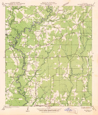
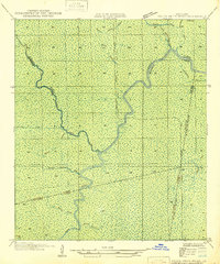
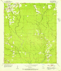
 1934 Springfield1934 Print · USGSLivingston Parish in the early 1930s is a landscape of complex waterways and small riverfront settlements. Genealogists can trace family roots through sites like Davidson Cem, the Hungarian Sch, and many historic landings including Magnolia Ldg.2 unique versions available
 - 1935 Map of Ponchatoula
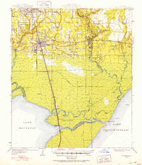
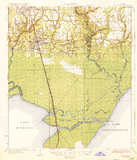 1935 Ponchatoula1935 Print · USGSCoastal Tangipahoa Parish is seen here in the mid-1930s, where the railroad and early highways began to bridge the gap between the piney woods and the great lakes. Researchers can locate family landmarks like Mitchell Cemetery or trace the old routes to the Manchac Akers Post Office and Jones Island.2 unique versions available
 - 1939 Map of Ponchatoula
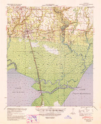 1939 Ponchatoula1939 Print · USGSLouisiana's Florida Parishes are captured here in the late thirties, where the rail lines of the Illinois Central meet the cypress swamps. Researchers can trace family roots at Wetmore Cem or locate the remote Pass Manchac LH and the lumber camps of the Louisiana Cypress Lumber Co.
 - 1939 Map of Springfield
 1939 Springfield1939 Print · USGSCoastal Louisiana at the end of the Depression era reveals a world of river landings and remote parish settlements. Genealogists and researchers can locate family sites like Davidson Cem, local schools such as Hungarian Sch, and numerous river points including Warsaw Log.2 unique versions available
 - 1939 Map of Denham Springs, 1942 Print
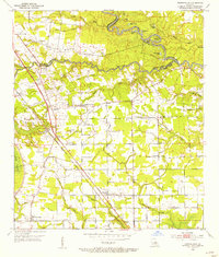
 1939 Denham Springs1942 Print · USGSLouisiana's river country comes alive in this pre-war survey of the Amite River basin during its transition to the modern highway era. Researchers can locate family roots at St Josephs Ch & Cem, track the old French Settlement Ferry, or find the Hoo Shoo Too Club.2 unique versions available
 - 1939 Map of Donaldsonville, 1953 Print
 1939 Donaldsonville1953 Print · USGSLouisiana's river parishes are captured here in the late 1930s, showing a landscape defined by the winding Mississippi River and its rich agricultural traditions. Genealogists and historians can trace family roots through numerous combined school and church sites like Little Zion Sch Ch & Cem or the sprawling riverside Monroe Plantation.5 unique versions available
 - 1942 Map of Montpelier
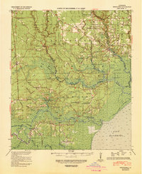
 1942 Montpelier1942 Print · USGSThe village of Montpelier and the winding Tickfaw River are captured here during the early 1940s. Genealogists and local historians can trace parish lines and locate community landmarks like Shiloh Ch, Morgan Sch, and Hillsdale Cem.
 - 1942 Map of Pine Grove
 1942 Pine Grove1942 Print · USGSSt. Helena Parish and the surrounding borderlands are captured here in the early 1940s as the regional logging rail era gives way to a modern highway network. Researchers can trace family sites at Sand Hill Cem and Salem Ch, or locate vanished local landmarks like Story Sch and the Old Grade.
 - 1942 Map of Pride
 1942 Pride1942 Print · USGSEast Baton Rouge and surrounding parishes are shown here in the early 1940s, a landscape defined by the Amite River and rural crossroads. You can trace community roots through many local landmarks, including Dennis Mills, Harrell Sch, and Stony Point Cem.
 - 1942 Map of Watson
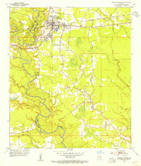
 1942 Watson1942 Print · USGSLivingston and East Baton Rouge parishes are documented here during the early war years, centered on the community of Watson. Genealogists can locate family landmarks like Womack Cem and Odom Cem, or trace the grounds of the Greenwell Springs Sanatorium.
 - 1942 Map of Satsuma
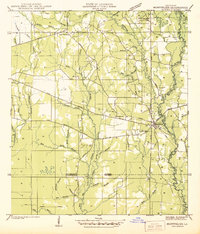
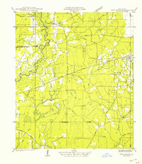
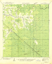
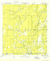
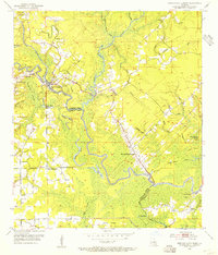
 1942 Satsuma1942 Print · USGSLivingston Parish at the start of the 1940s reveals a rural landscape defined by logging, rail, and small-town life. Genealogists can locate family landmarks like Vickers Cem and Mangum Chapel or trace the early paths of Friendship and Satsuma.
 - 1946 Map of North of Garyville
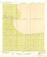 1946 North of Garyville1946 Print · USGSCoastal wetlands near the southern edge of the Maurepas basin are shown here in the mid-1940s. Researchers can trace the era's timber and water-borne commerce at Lutcher-Moore Camp and along the winding Blind River.
 - 1946 Map of Petite Amite River
 1946 Petite Amite River1946 Print · USGSCoastal Louisiana at the end of the depression era is revealed here as a wild corridor of bayous and shifting parish lines. Trace the path of the Garville Northern (Abandoned) railroad as it cuts through the swamps near Blind River and Black Lake.
 - 1947 Map of Sorrento
 1947 Sorrento1947 Print · USGSLouisiana's Ascension Parish is captured here in the mid-1940s as a landscape of vital rail corridors and complex drainage systems. Genealogists and historians can trace old homesteads and routes through Sorrento, Saint Amant, and McElroy along the Airline Highway.
 - 1949 Map of Amite
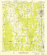 1949 Amite1949 Print · USGSTangipahoa Parish enters the post-war era as a busy corridor of rail commerce and rural community life. Researchers can trace family roots through numerous local landmarks, including Baham Cemetery, McMichael Church, and the Illinois Central line through Amite.
 - 1949 Map of Albany
 1949 Albany1949 Print · USGSLivingston Parish and Tangipahoa Parish settlements are mapped here just after the war, showing the rural landscape before modern development. Researchers can trace family history through sites like Hoover Cem, Woodhaven, and the Seventh Ward Sch near the Natalbany River.
 - 1950 Map of Doyle
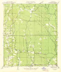
 1950 Doyle1950 Print · USGSLivingston Parish at the start of the 1940s is shown here as a landscape of rail-side towns and rural creek-bottom settlements. Genealogists can locate family burial sites like Stafford Cem and Lard Cem or trace the early path of the Illinois Central Railroad through Holden.
 - 1951 Map of Ponchatoula, 1953 Print
 1951 Ponchatoula1953 Print · USGSThe swampy interface of Tangipahoa Parish is captured in the early fifties as the railroad reached across the wetlands toward New Orleans. Trace historical footprints at Manchac Akers P.O., find family sites like Edwards Cem, or locate the Pass Manchac L H.3 unique versions available
 - 1953 Map of Walker, 1954 Print
 1953 Walker1954 Print · USGSLivingston Parish in the early fifties is defined by the Illinois Central rail line and the sprawling Colyell Creek drainage system. Genealogists and local historians can locate the Petes Rest Cem, the Walker Lookout Tower, and the Frost Sch.2 unique versions available
 - 1953 Map of Prairieville, 1954 Print
 1953 Prairieville1954 Print · USGSAscension Parish during the early fifties shows a landscape of riverine bayous and burgeoning settlements along the newly modernized Airline Highway. Researchers can trace family roots through numerous landmarks like Oak Grove, Galvez, and local congregations at St Paul Ch and Zion Ch.
 - 1953 Map of French Settlement, 1954 Print
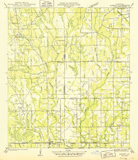
 1953 French Settlement1954 Print · USGSThe riverfront communities of Livingston and Ascension Parishes are shown in the early fifties, a time when the Amite River remained the primary geographic anchor. Genealogists can locate family burial sites at Felder Cem and Watson Cem or trace rural schools and churches like Port Vincent Sch and Shiloh Ch.2 unique versions available
 - 1953 Map of Denham Springs, 1954 Print
 1953 Denham Springs1954 Print · USGSDenham Springs and the surrounding parishes are captured here in the early fifties, showing a landscape defined by river bends and rail lines. Researchers can trace family history through sites like Palmetto Cem, Eden Ch, and the 7th Ward Sch.2 unique versions available
Showing maps 1-25 of 177
Top cities of Livingston Parish
- Denham Springs historical maps
- Walker historical maps
- Maurepas historical maps
- Livingston historical maps
- Killian historical maps
- Albany historical maps
See more
Frequently asked questions
- What are the different types of historical maps available for Livingston Parish?
- What is the oldest map of Livingston Parish?
- Where can I purchase historical maps of Livingston Parish for my home or office?
- Where can I download high-res historical maps of Livingston Parish?
- Are there historical topographic maps available for Livingston Parish?
- Is there historical aerial imagery available for Livingston Parish?
- Where are historical maps of Livingston Parish sourced from?