Old Maps of Nero, Louisiana for Metal Detecting
Plan your next treasure hunt with 16 historic maps of Nero. Find old homesites, ghost towns, trails, and gathering spots that may be lost to time — perfect for identifying promising metal detecting locations.
- Locate forgotten sites: Uncover places like long-lost settlements, abandoned rail lines, or gathering spots.
- Plan better hunts: Use map overlays combined with LiDAR or satellite views to narrow in on historically rich areas.
- Made for detectorists: Thousands of hobbyists use these maps to discover relics, coins, and hidden history.
Use these historic maps to boost your research and find new opportunities beneath the surface of Nero.
Nero, LA maps
(16)- 1891 Map of Pointe a La Hache
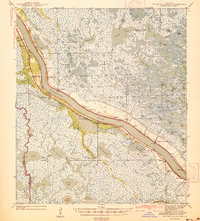
 1891 Pointe a La Hache1891 Print · USGSCoastal Plaquemines Parish and the Mississippi River delta appear here in the early 1890s, revealing a landscape of narrow riverfront plantations and rail-connected settlements. Researchers can trace the path of the New Orleans Ft Jackson and Grand Isl Railroad through historic sites like Pt A La Hache, Myrtle Grove, and Empire Mills.
 - 1892 Map of Pointe a La Hache, 1898 Print
 1892 Pointe a La Hache1898 Print · USGSThe lower Mississippi delta in the 1890s reveals a ribbon of riverfront settlements and competing rail lines. Genealogists and historians can trace family-named sites like Savoie and Nero or locate the Empire Mills (Martin) near Pt. A La Hache.
 - 1939 Map of Pointe a La Hache, 1941 Print
 1939 Pointe a La Hache1941 Print · USGSCoastal Plaquemines Parish centers on the riverbank communities of the late thirties, when the local economy was tied to the water and the rail. Researchers can trace the legacy of family settlements and rural institutions like the Deer Range Cem, St Jude Sch, and the rail lines at Pte Celeste.2 unique versions available
 - 1944 Map of Pointe a La Hache
 1944 Pointe a La Hache1944 Print · USGSThe Mississippi River delta in the early 1940s shows a landscape of rail-connected river towns and vast marshlands. Trace family roots and local history through Deer Range Cem, St Jude Sch, and settlements like Pointe a la Hache.
 - 1948 Map of Pointe a La Hache, 1951 Print
 1948 Pointe a La Hache1951 Print · USGSIn the late 1940s, the Mississippi River delta was a landscape of levee-side settlements and growing oil fields. Trace family history through riverfront outposts like Pointe a la Hache, the St Jude Sch (Colored) & Cem, and Beanbury Plantation.
 - 1957 Map of Breton Sound, 1967 Print
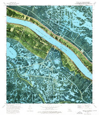
 1957 Breton Sound1967 Print · USGSThe Mississippi River delta is captured here in the mid-fifties, showing the fragile marshlands and river-dependent towns of the Louisiana coast. Genealogists and historians can trace riverside settlements like Pointe a la Hache, Pilottown, and Port Sulphur.3 unique versions available
 - 1961 Map of Breton Sound
 1961 Breton Sound1961 Print · USGSThe Louisiana delta and the outer marshes of Plaquemines Parish are captured here at the start of the 1960s. Researchers can trace the river settlements from Davant to Venice, locate isolated stations like Port Eads, and find old sites such as Fort Jackson.
 - 1962 Map of Pointe a La Hache, 1966 Print
 1962 Pointe a La Hache1966 Print · USGSCoastal Plaquemines Parish reveals a landscape of river-dependent towns and delta marshes in the early sixties. Genealogists can trace family roots through riverside sites like Carlisle P O, Besumar Plantation, and the Seichsnaydre Cem.
 - 1964 Map of Pointe a La Hache, 1965 Print
 1964 Pointe a La Hache1965 Print · USGSCoastal Louisiana at the height of the mid-century oil boom centers on the communities flanking the Mississippi River. Genealogists and historians can trace family roots through riverfront landmarks like Beaumar Plantation, Pointe a la Hache, and the St Jude Sch & Ch.
 - 1973 Map of Pointe a La Hache, 1976 Print
 1973 Pointe a La Hache1976 Print · USGSCoastal Plaquemines Parish in the early seventies shows a landscape where river transport and energy extraction meet. Researchers can trace the New Orleans and Coast RR through Woodland or locate local landmarks like St Thomas Ch and Hope Chapel.2 unique versions available
 - 1983 Map of Black Bay
 1983 Black Bay1983 Print · USGSCoastal St. Bernard Parish is shown in the early eighties as the Mississippi Delta's fishing villages and industrial infrastructure meet the expanding Gulf sounds. Genealogists and historians can trace family-named sites from Chalmette to Delacroix, including the Southern Railway System and St Bernard State Park.2 unique versions available
 - 2012 Map of Pointe a la Hache, 2012 Print
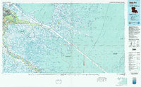
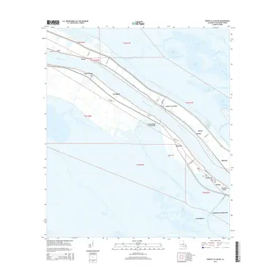
 2012 Pointe a la Hache2012 Print · USGSCovers Nero, including Martin, Beshel, and other nearby areas
 - 2015 Map of Pointe a la Hache, 2015 Print
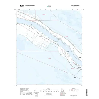
 2015 Pointe a la Hache2015 Print · USGSCovers Nero, including Martin, Beshel, and other nearby areas
 - 2018 Map of Pointe a la Hache, 2018 Print
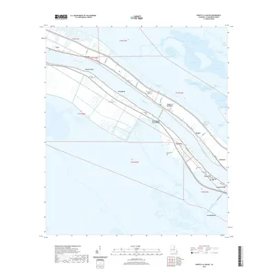
 2018 Pointe a la Hache2018 Print · USGSCovers Nero, including Martin, Beshel, and other nearby areas
 - 2020 Map of Pointe a la Hache, 2020 Print
 2020 Pointe a la Hache2020 Print · USGSCovers Nero, including Martin, Beshel, and other nearby areas
 - 2024 Map of Pointe a la Hache, 2024 Print
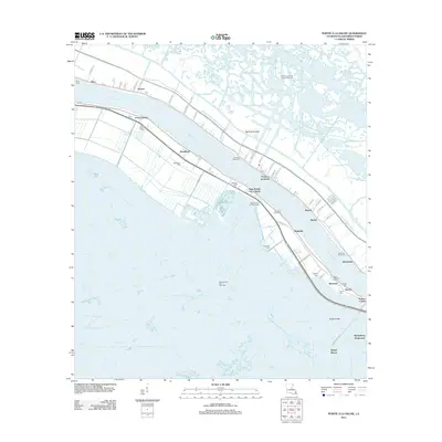
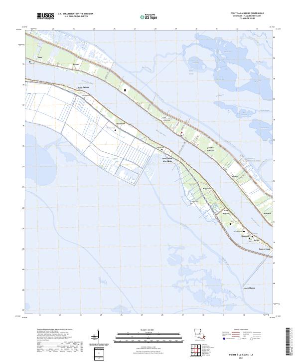 2024 Pointe a la Hache2024 Print · USGSCoastal Plaquemines Parish in the twenty-first century is a landscape of resilient riverfront towns and deep family ties. Genealogists and historians can trace lineage through numerous local sites like Woodland Cem, Ballowe Cem, and the Pointe a la Hache Ferry.
End of results
Showing maps 1-16 of 16
Top cities near Nero
Frequently asked questions
- What are the different types of historical maps available for Nero?
- What is the oldest map of Nero?
- Where can I purchase historical maps of Nero for my home or office?
- Where can I download high-res historical maps of Nero?
- Are there historical topographic maps available for Nero?
- Is there historical aerial imagery available for Nero?
- Where are historical maps of Nero sourced from?