Old Maps of Alexandria, Louisiana
Explore 33 old maps of Alexandria, spanning from 1935 to today. These high-resolution historic maps reveal how streets, neighborhoods, landmarks, and natural features evolved over time — perfect for genealogy, metal detecting, research, and local history exploration.
What you can do with these maps:
- See how Alexandria changed over time: Compare historical maps to modern-day views to trace roads, homesites, rail lines & more.
- View detailed metadata: Each map includes creators, publishers, year, scale, and archive source.
- Overlay maps with satellite & LiDAR: Visualize the past alongside modern tools to explore terrain & human change.
- Trusted historical sources: Maps sourced from the USGS, Library of Congress, and other archives.
- Access maps your way: View online, download high-res files, or order prints for personal or research use.
Start exploring old maps of Alexandria to uncover forgotten places, hidden landmarks, and the deep history beneath your feet.
Alexandria, LA maps
(33)- 1935 Map of Lecompte, 1949 Print
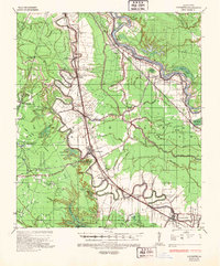 1935 Lecompte1949 Print · USGSThe Red River valley south of Alexandria comes into focus in the mid-1930s, showing a landscape defined by meandering bayous and critical rail lines. Genealogists can locate family landmarks like Spring Hill Cem, St Johns Ch, and the town of Cheneyville.
 - 1941 Map of Alexandria, 1944 Print
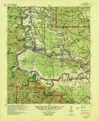
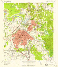
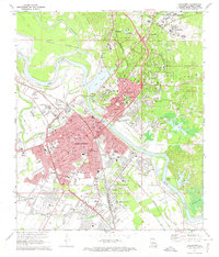
 1941 Alexandria1944 Print · USGSRapides and Grant Parishes are captured here in the early 1940s as massive military training grounds expanded alongside established rail towns. Trace the footprints of Camp Livingston and Camp Beauregard or locate local landmarks like the Philadelphia Ch and Kolin.
 - 1941 Map of Boyce, 1945 Print
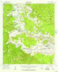
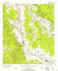
 1941 Boyce1945 Print · USGSRapides Parish was a landscape of river plantations and pine forests in the early 1940s. Genealogists and historians can locate numerous rural landmarks like Hotwells, Fairmount Plantation, and the Israelite Ch Sch & Cem along the Red River.2 unique versions available
 - 1945 Map of Boyce SE
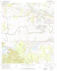
 1945 Boyce SE1945 Print · USGSRapides Parish during the mid-forties reveals a landscape defined by its complex waterways and early transportation routes. Researchers can locate vanished landmarks and family sites near Evening Star Ch, Rapides Sch, and along the Texas and Pacific Railroad Grade.
 - 1949 Map of Boyce SE
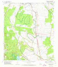
 1949 Boyce SE1949 Print · USGSRapides Parish at the end of the 1940s is a landscape of winding bayous and rural schools. Researchers can trace the legacy of local communities through landmarks like Evening Star Ch, Rapides Sch, and the Red River floodplain.
 - 1953 Map of Alexandria, 1963 Print
 1953 Alexandria1963 Print · USGSCentral Louisiana during the early fifties is mapped here at the intersection of the piney woods and the Red River valley. Genealogists and historians can trace the rail-and-river network connecting towns like Alexandria, Natchitoches, and the grounds of Camp Beauregard.3 unique versions available
 - 1955 Map of Alexandria
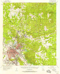
 1955 Alexandria1955 Print · USGSCentral Louisiana in the mid-fifties is a landscape of river-port cities, sprawling timberlands, and massive military reservations. Genealogists and historians can trace the rail networks of the Texas & Pacific RR and locate sites like Camp Polk Military Reservation and Natchitoches.
 - 1956 Map of Boyce, 1957 Print
 1956 Boyce1957 Print · USGSLouisiana's Red River valley in the mid-fifties reveals a landscape transitioning from traditional rail-and-river commerce to a burgeoning military presence. Trace family roots through dozens of rural sites like Hotwells, the Second Evening Star Ch, and Lacour Cem.3 unique versions available
 - 1957 Map of Alexandria, 1958 Print
 1957 Alexandria1958 Print · USGSThe Red River valley in the late fifties shows the post-war growth of Alexandria and Pineville amidst a landscape of military and state institutions. Genealogists and historians can locate dozens of neighborhood schools, cemeteries like Sardis Cem, and the early layout of Camp Beauregard.2 unique versions available
 - 1957 Map of Alexandria, 1958 Print
 1957 Alexandria1958 Print · USGSAlexandria and Pineville sit at a major rail and river crossroads during the late fifties, serving as a hub for military and state institutions. Genealogists can trace family roots at the Alexandria National Cem or locate historic campuses like Louisiana College and Bolton High Sch.2 unique versions available
 - 1957 Map of Lecompte, 1958 Print
 1957 Lecompte1958 Print · USGSCentral Louisiana in the mid-fifties reveals a landscape defined by the intricate winding of Bayou Boeuf and the fertile grounds of Bench Slough Plantation. Researchers can trace the heritage of local communities through landmarks like Lecompte Sch, Wise Cem, and the tracks of the Rock Island and Pacific RR.3 unique versions available
 - 1972 Map of Rapides, 1973 Print
 1972 Rapides1973 Print · USGSThe Red River valley in the early seventies shows a landscape of military expansion and hydraulic engineering. Trace the growth of England Air Force Base alongside historic sites like the Central Louisiana State Hospital and St Matthews Cem.3 unique versions available
 - 1972 Map of Woodworth East, 1974 Print
 1972 Woodworth East1974 Print · USGSRapides Parish in the early seventies shows the expansion of southern Alexandria alongside the managed timber of the Alexander State Forest. Researchers can trace rural lineages at Oakland Ch Cem, find old rail stops at Moreland, or locate the Gravel Pit near Woodworth.3 unique versions available
 - 1972 Map of Alexandria, 1974 Print
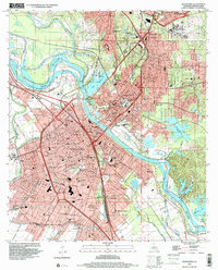
 1972 Alexandria1974 Print · USGSAlexandria and Pineville sit at a major rail and river crossroads in the early seventies, just as the urban landscape was maturing. Local historians can trace the footprints of Camp Beauregard, the VA Hospital, and family-named landmarks like Pierson Lake and Lee Heights.4 unique versions available
 - 1986 Map of Alexandria
 1986 Alexandria1986 Print · USGSCentral Louisiana in the mid-eighties shows a landscape of strategic military installations and deep river-valley agriculture. Researchers can trace the footprints of England Air Force Base, Camp Beauregard, and the extensive Kisatchie National Forest.2 unique versions available
 - 1998 Map of Alexandria, 2001 Print
 1998 Alexandria2001 Print · USGSAlexandria and Pineville sit at a vital crossing of the Red River during the late twentieth century. Genealogists and historians can trace neighborhood development through numerous local schools and landmarks like the Alexandria National Cem and Camp Beauregard.
 - 2003 Map of Woodworth East, 2005 Print
 2003 Woodworth East2005 Print · USGSThe alluvial plains south of Alexandria were defined by bayou-side farming and managed timberlands in the early 2000s. Researchers can locate local landmarks like Wise Cem, Oakland Ch, and the sprawling Alexander State Forest.
 - 2003 Map of Rapides, 2005 Print
 2003 Rapides2005 Print · USGSThe Red River valley and the eastern edge of the Kisatchie National Forest meet in this early 2000s survey of central Louisiana. Researchers can locate community anchors like First Evening Star Ch, trace the expansion of England Air Park, and explore the recreational shoreline of Kincaid Reservoir.
 - 2012 Map of Alexandria, 2012 Print
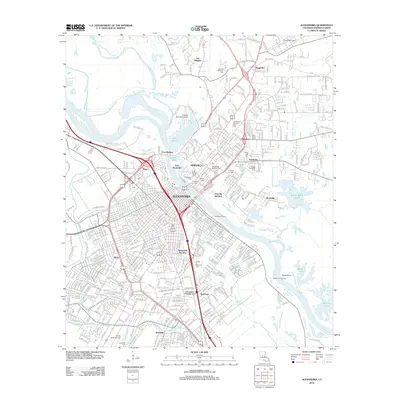 2012 Alexandria2012 Print · USGSCovers Alexandria, including Pineville, Ball, and other nearby areas
 - 2012 Map of Woodworth East, 2012 Print
 2012 Woodworth East2012 Print · USGSCovers Alexandria, including Woodworth, Chambers, and other nearby areas
 - 2012 Map of Rapides, 2012 Print
 2012 Rapides2012 Print · USGSCovers Alexandria, including Alfalfa, Barrett, and other nearby areas
 - 2015 Map of Rapides, 2015 Print
 2015 Rapides2015 Print · USGSCovers Alexandria, including Alfalfa, Barrett, and other nearby areas
 - 2015 Map of Woodworth East, 2015 Print
 2015 Woodworth East2015 Print · USGSCovers Alexandria, including Woodworth, Chambers, and other nearby areas
 - 2015 Map of Alexandria, 2015 Print
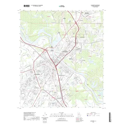
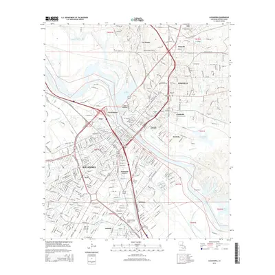 2015 Alexandria2015 Print · USGSCovers Alexandria, including Pineville, Ball, and other nearby areas
 - 2018 Map of Alexandria, 2018 Print
 2018 Alexandria2018 Print · USGSCovers Alexandria, including Pineville, Ball, and other nearby areas
Showing maps 1-25 of 33
Top cities near Alexandria
- Pineville historical maps
- Ball historical maps
- Colfax historical maps
- Lecompte historical maps
- Boyce historical maps
- Woodworth historical maps
See more
Top neighborhoods of Alexandria
- Samtown historical maps
- Alexandria Junction historical maps
- Kent historical maps
- Anandale historical maps
- Sieps historical maps
Frequently asked questions
- What are the different types of historical maps available for Alexandria?
- What is the oldest map of Alexandria?
- Where can I purchase historical maps of Alexandria for my home or office?
- Where can I download high-res historical maps of Alexandria?
- Are there historical topographic maps available for Alexandria?
- Is there historical aerial imagery available for Alexandria?
- Where are historical maps of Alexandria sourced from?