Old Maps of Hanna, Louisiana
Explore 13 old maps of Hanna, spanning from 1938 to today. These high-resolution historic maps reveal how streets, neighborhoods, landmarks, and natural features evolved over time — perfect for genealogy, metal detecting, research, and local history exploration.
What you can do with these maps:
- See how Hanna changed over time: Compare historical maps to modern-day views to trace roads, homesites, rail lines & more.
- View detailed metadata: Each map includes creators, publishers, year, scale, and archive source.
- Overlay maps with satellite & LiDAR: Visualize the past alongside modern tools to explore terrain & human change.
- Trusted historical sources: Maps sourced from the USGS, Library of Congress, and other archives.
- Access maps your way: View online, download high-res files, or order prints for personal or research use.
Start exploring old maps of Hanna to uncover forgotten places, hidden landmarks, and the deep history beneath your feet.
Hanna, LA maps
(13)- 1938 Map of Lake End
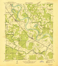 1938 Lake End1938 Print · USGSThe Red River valley comes alive in the late 1930s, showing the intersection of three Louisiana parishes and their vital rail corridors. Genealogists and historians can trace community life through old landmarks like Logan Chapel, Ajax Church, and the riverfront settlement of Lake End.
 - 1947 Map of Hanna
 1947 Hanna1947 Print · USGSRed River Parish and Natchitoches Parish are shown in the late 1940s, a period when the river valley remained a landscape of ferries, rural schools, and bayous. Genealogists can trace family landmarks like the Rambin Store, Jordon Ferry, and St James Cem.
 - 1953 Map of Alexandria, 1963 Print
 1953 Alexandria1963 Print · USGSCentral Louisiana during the early fifties is mapped here at the intersection of the piney woods and the Red River valley. Genealogists and historians can trace the rail-and-river network connecting towns like Alexandria, Natchitoches, and the grounds of Camp Beauregard.3 unique versions available
 - 1955 Map of Alexandria
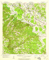
 1955 Alexandria1955 Print · USGSCentral Louisiana in the mid-fifties is a landscape of river-port cities, sprawling timberlands, and massive military reservations. Genealogists and historians can trace the rail networks of the Texas & Pacific RR and locate sites like Camp Polk Military Reservation and Natchitoches.
 - 1957 Map of Hanna, 1958 Print
 1957 Hanna1958 Print · USGSThe Red River valley in the late fifties was a maze of shifting waterways and emerging oil interests. Researchers can trace rural lineages through the Rambin Store, Jordan Ferry, and dozens of country churches like Zion Rest Church.3 unique versions available
 - 1986 Map of Natchitoches
 1986 Natchitoches1986 Print · USGSNorthwestern Louisiana during the mid-eighties shows a landscape shaped by major water projects and timberlands. Researchers can trace historic routes like the Old Spanish Trail or locate rural communities such as Fort Jesup, Fairview Alpha, and Grappes Bluff.2 unique versions available
 - 1989 Map of Hanna
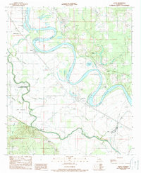 1989 Hanna1989 Print · USGSThe Red River valley at the edge of the Natchitoches and Red River parish lines shows a landscape shaped by water and work in the 1980s. Researchers can locate river crossings like Jordon Ferry, the local Oil Field, and settlements at Hanna and Lake End.2 unique versions available
 - 1992 Map of Hanna
 1992 Hanna1992 Print · USGSCoastal Plaquemines Parish reveals its intricate water network and riverfront settlements in the early nineties. Genealogists and historians can trace family locations in Happy Jack, Encalade, and Port Sulphur or locate the McBride School and Cem along the river road.
 - 2012 Map of Hanna, 2012 Print
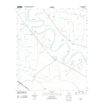 2012 Hanna2012 Print · USGSCovers Hanna, including King Hill, Lake End, and other nearby areas
 - 2015 Map of Hanna, 2015 Print
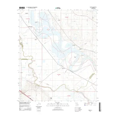 2015 Hanna2015 Print · USGSCovers Hanna, including King Hill, Lake End, and other nearby areas
 - 2018 Map of Hanna, 2018 Print
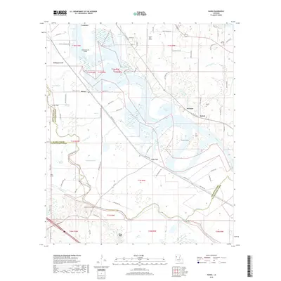 2018 Hanna2018 Print · USGSCovers Hanna, including King Hill, Lake End, and other nearby areas
 - 2020 Map of Hanna, 2020 Print
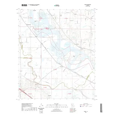 2020 Hanna2020 Print · USGSCovers Hanna, including King Hill, Lake End, and other nearby areas
 - 2024 Map of Hanna, 2024 Print
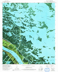
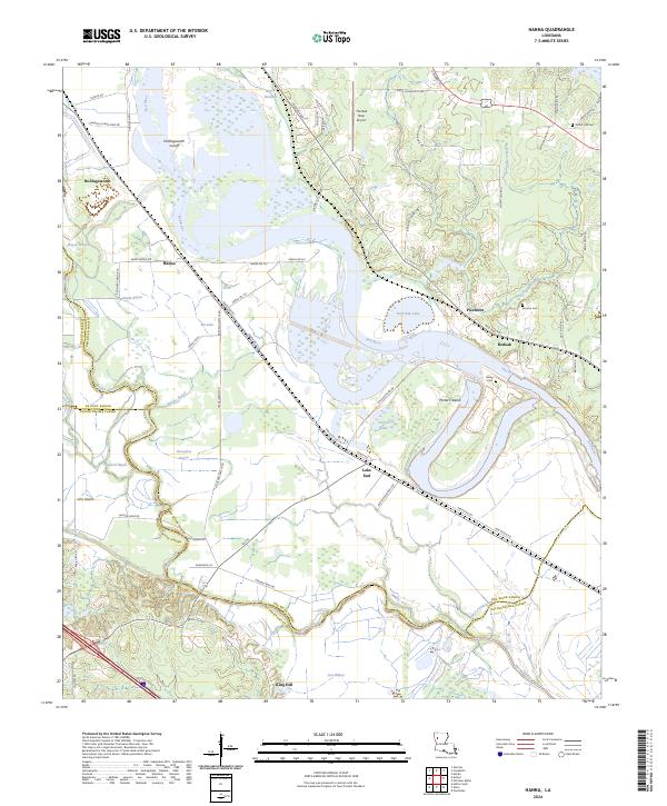 2024 Hanna2024 Print · USGSThe Red River bottomlands of North Louisiana are documented here at the crossroads of three parishes. Genealogists and local historians can locate early burial sites like Union Hall Cem and trace the development of settlements at Hanna, Redoak, and Lake End.
End of results
Showing maps 1-13 of 13
Top cities near Hanna
- Natchitoches historical maps
- Coushatta historical maps
- Campti historical maps
- Pleasant Hill historical maps
- Martin historical maps
- Ashland historical maps
See more
Frequently asked questions
- What are the different types of historical maps available for Hanna?
- What is the oldest map of Hanna?
- Where can I purchase historical maps of Hanna for my home or office?
- Where can I download high-res historical maps of Hanna?
- Are there historical topographic maps available for Hanna?
- Is there historical aerial imagery available for Hanna?
- Where are historical maps of Hanna sourced from?