Old Maps of Red River Parish, Louisiana
Explore 98 old maps of Red River Parish, spanning from 1937 to today. These high-resolution historic maps reveal how streets, neighborhoods, landmarks, and natural features evolved over time — perfect for genealogy, metal detecting, research, and local history exploration.
What you can do with these maps:
- See how Red River Parish changed over time: Compare historical maps to modern-day views to trace roads, homesites, rail lines & more.
- View detailed metadata: Each map includes creators, publishers, year, scale, and archive source.
- Overlay maps with satellite & LiDAR: Visualize the past alongside modern tools to explore terrain & human change.
- Trusted historical sources: Maps sourced from the USGS, Library of Congress, and other archives.
- Access maps your way: View online, download high-res files, or order prints for personal or research use.
Start exploring old maps of Red River Parish to uncover forgotten places, hidden landmarks, and the deep history beneath your feet.
Red River Parish, LA maps
(98)- 1937 Map of Campti NE
 1937 Campti NE1937 Print · USGSNatchitoches Parish at the end of the 1930s was a landscape of intricate bayous and timber tracts. Researchers can trace the path of the Logging Railroad or find family landmarks like Mt Zion Ch and the Clear Lake Sch near Campti.
 - 1937 Map of Campti NW
 1937 Campti NW1937 Print · USGSNatchitoches and Red River Parishes in the late thirties show a river-driven landscape of small farmsteads and rural schools. Genealogists and local historians can locate family sites like Sims Cem and old schoolhouses including Zion Hill Sch or New Manuel Sch.
 - 1938 Map of Chemard Lake
 1938 Chemard Lake1938 Print · USGSIn the late 1930s, the De Soto Parish riverlands were a complex world of winding bayous and small rural schoolhouses. Genealogists and historians can trace the foundations of local life at Rambin Store, Ajax, and country schools like Egypt Sch and Summer Hill Sch.
 - 1938 Map of Lake End
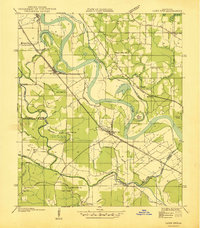 1938 Lake End1938 Print · USGSThe Red River valley comes alive in the late 1930s, showing the intersection of three Louisiana parishes and their vital rail corridors. Genealogists and historians can trace community life through old landmarks like Logan Chapel, Ajax Church, and the riverfront settlement of Lake End.
 - 1941 Map of East Point
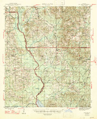
 1941 East Point1941 Print · USGSThe Red River Valley bottomlands are captured here in the late 1930s, showing a network of riverfront settlements and rural parish life. Researchers can trace family history through numerous landmarks like Elizabeth Church, Crichton School, and the St Marks Cemetery near the Bayou Toulon.
 - 1944 Map of Campti, 1955 Print
 1944 Campti1955 Print · USGSNatchitoches and the Red River valley are shown here during the mid-1940s, highlighting a landscape of river bends and rail-dependent settlements. Researchers can trace family roots through numerous country landmarks like Bethlehem Sch, St Lukes Cem, and the river port at Grand Ecore.
 - 1945 Map of Mansfield, 1956 Print
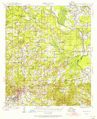 1945 Mansfield1956 Print · USGSDe Soto Parish in the mid-1940s centers on the rail junction at Mansfield just as the local landscape transitioned toward the post-war era. Genealogists can locate family sites at Evergreen Cem, Rock Chapel, and the historic Mansfield Battle Memorial Park.
 - 1947 Map of Ashland
 1947 Ashland1947 Print · USGSNorth Louisiana's parish boundaries converge in this mid-century landscape where timber and rail lines defined daily life. Genealogists can locate numerous rural landmarks like St Mathews Ch, Old Saline Cem, and the old rail stop at Ashland.
 - 1947 Map of Mansfield
 1947 Mansfield1947 Print · USGSIn the late 1940s, the De Soto Parish landscape centered on the rail hub of Mansfield and its surrounding plantation lands. Genealogists can trace family roots through numerous rural landmarks like the Lands End Plantation, Rock Chapel, and the Evergreen Cem.
 - 1947 Map of Hanna
 1947 Hanna1947 Print · USGSRed River Parish and Natchitoches Parish are shown in the late 1940s, a period when the river valley remained a landscape of ferries, rural schools, and bayous. Genealogists can trace family landmarks like the Rambin Store, Jordon Ferry, and St James Cem.
 - 1948 Map of Coushatta
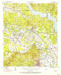
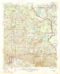
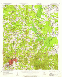
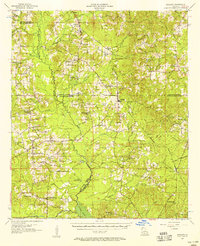
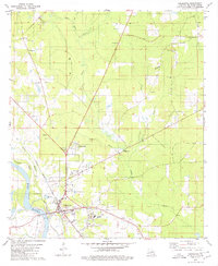
 1948 Coushatta1948 Print · USGSRed River Parish and the surrounding hill country are captured here just after the war, showing the intricate river-and-rail network. Genealogists can trace family names through dozens of landmarks like Elizabeth Sch, St Pauls Cem, and Hall Summit.
 - 1948 Map of Campti
 1948 Campti1948 Print · USGSNatchitoches Parish and the Red River valley are captured in the late 1940s, showing a landscape defined by oxbows and rural life. Researchers can trace historic schools and churches from Campti to Powhatan, including Bethel Cem and Grappes Bluff.2 unique versions available
 - 1953 Map of Alexandria, 1963 Print
 1953 Alexandria1963 Print · USGSCentral Louisiana during the early fifties is mapped here at the intersection of the piney woods and the Red River valley. Genealogists and historians can trace the rail-and-river network connecting towns like Alexandria, Natchitoches, and the grounds of Camp Beauregard.3 unique versions available
 - 1955 Map of Shreveport
 1955 Shreveport1955 Print · USGSNorthern Louisiana in the mid-fifties is captured here as a landscape of military bases, vast oil fields, and burgeoning college towns. Genealogists and historians can trace the rail-and-river economy through the Monroe Gas Field, Grambling College, and Barksdale Air Force Base.3 unique versions available
 - 1955 Map of Alexandria
 1955 Alexandria1955 Print · USGSCentral Louisiana in the mid-fifties is a landscape of river-port cities, sprawling timberlands, and massive military reservations. Genealogists and historians can trace the rail networks of the Texas & Pacific RR and locate sites like Camp Polk Military Reservation and Natchitoches.
 - 1956 Map of Shreveport
 1956 Shreveport1956 Print · USGSNorthern Louisiana during the mid-fifties presents a complex landscape of booming oil fields and strategic military installations. Genealogists and historians can trace the infrastructure of the Monroe Gas Field and family-named locales from Cotton Valley to Jonesboro.
 - 1957 Map of Hanna, 1958 Print
 1957 Hanna1958 Print · USGSThe Red River valley in the late fifties was a maze of shifting waterways and emerging oil interests. Researchers can trace rural lineages through the Rambin Store, Jordan Ferry, and dozens of country churches like Zion Rest Church.3 unique versions available
 - 1957 Map of Campti, 1958 Print
 1957 Campti1958 Print · USGSThe Red River Valley in the late fifties was a maze of shifting river bends, bayous, and rail towns like Campti and Powhatan. Researchers can trace the era's local geography through landmarks like N W State College and numerous rural sites like Black Lake Sch.5 unique versions available
 - 1957 Map of Mansfield, 1958 Print
 1957 Mansfield1958 Print · USGSDe Soto Parish in the late fifties shows a landscape shaped by rail lines and river bayous before modern development. Genealogists can trace family roots through sites like Slone Cem, the settlement at Naborton, and the grounds of Mansfield Battle Memorial Park.2 unique versions available
 - 1957 Map of Coushatta, 1958 Print
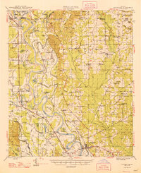
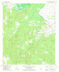
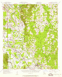 1957 Coushatta1958 Print · USGSMid-century Red River Parish is revealed here through its intricate river bends and small rural communities. Genealogists can trace family roots through numerous local landmarks like Hall Summit, Social Springs, and the Susie Island Sch (Abandoned).4 unique versions available
 - 1957 Map of Ashland, 1958 Print
 1957 Ashland1958 Print · USGSNorth Louisiana's hill country comes alive in the late fifties, showing the rural communities of Ashland and Chestnut at a crossroads. Genealogists can trace family roots through sites like Old Saline Ch, the Luke Cem, and several early schools.3 unique versions available
 - 1979 Map of East Point, 1980 Print
 1979 East Point1980 Print · USGSRed River Parish in the late seventies is defined by the winding Red River and the rural communities clustered along its fertile banks. Genealogists and local historians can locate several country churches and cemeteries, including St Marks Cem, True Vine Ch, and the community of East Point.
 - 1979 Map of Coushatta, 1980 Print
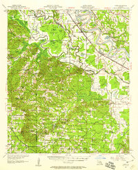
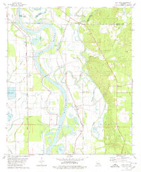
 1979 Coushatta1980 Print · USGSThe Red River valley in the late seventies reveals a landscape of petroleum exploration and riverside commerce. Trace family roots at Carroll Creek Ch Cem and follow the Kansas City Southern rail line through Coushatta.
 - 1980 Map of Bayou Pierre Lake
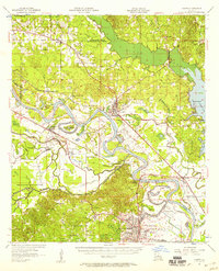
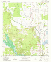
 1980 Bayou Pierre Lake1980 Print · USGSDe Soto and Red River Parishes are shown in the late 1970s, where an expansive oil and gas field meets the winding bayous. Researchers can locate family landmarks like Rock Chapel, Bethlehem Cemetery, and the settlement of Naborton.2 unique versions available
 - 1980 Map of Clear Lake
 1980 Clear Lake1980 Print · USGSLouisiana's bayou country is captured here in the 1970s, showing a transition between the Red River wetlands and local industry. Genealogists can locate family landmarks like Star Point, the New Friendship Cem, and Red Lake Ch.2 unique versions available
Showing maps 1-25 of 98
Top cities of Red River Parish
Frequently asked questions
- What are the different types of historical maps available for Red River Parish?
- What is the oldest map of Red River Parish?
- Where can I purchase historical maps of Red River Parish for my home or office?
- Where can I download high-res historical maps of Red River Parish?
- Are there historical topographic maps available for Red River Parish?
- Is there historical aerial imagery available for Red River Parish?
- Where are historical maps of Red River Parish sourced from?