1980s Maps of Red River Parish, Louisiana
Explore 13 historic maps of Red River Parish from the 1980s. These maps offer a rare glimpse into what life looked like during the 1980s — showing old roads, neighborhoods, homes, and landmarks that have changed or disappeared over time.
Whether you're researching your family's past, planning a metal detecting trip, or studying how Red River Parish's landscape evolved across the 1980s, these high-resolution maps are a powerful tool for exploring the history of this region.
- Focus on a specific era: All maps on this page are from the 1980s, giving you a focused view of this time period.
- See what’s changed: Compare century-old streets, trails, and buildings to today's modern landscape using overlays and satellite layers.
- Research with precision: Use these maps for genealogy, historical research, land use analysis, or educational projects.
- View, download, or print: Maps are fully viewable online in high resolution, and can be downloaded or printed for your own records.
Start exploring Red River Parish's history through authentic maps from the 1980s. This is your window into the past.
Red River Parish, LA maps
(13)- 1980 Map of Bayou Pierre Lake
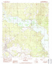
 1980 Bayou Pierre Lake1980 Print · USGSDe Soto and Red River Parishes are shown in the late 1970s, where an expansive oil and gas field meets the winding bayous. Researchers can locate family landmarks like Rock Chapel, Bethlehem Cemetery, and the settlement of Naborton.2 unique versions available
 - 1980 Map of Clear Lake
 1980 Clear Lake1980 Print · USGSLouisiana's bayou country is captured here in the 1970s, showing a transition between the Red River wetlands and local industry. Genealogists can locate family landmarks like Star Point, the New Friendship Cem, and Red Lake Ch.2 unique versions available
 - 1980 Map of Harmon
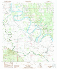
 1980 Harmon1980 Print · USGSThe Red River valley at the start of the 1980s reveals a landscape of industrial gas wells and traditional river settlements. Researchers can trace family history at Taylor Cem and Gahagan or locate old rail landmarks along the Kansas City Southern.
 - 1980 Map of Hall Summit
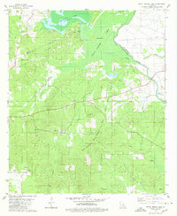
 1980 Hall Summit1980 Print · USGSThe rural landscape around Hall Summit and Martin is documented here as it appeared in the late 1970s. Genealogists and local historians can trace legacy sites like Mt Zion Cem, New Light Ch, and the workings of the Coushatta Oil Field.
 - 1983 Map of Fairview Alpha, 1984 Print
 1983 Fairview Alpha1984 Print · USGSThe Red River valley in the early eighties reveals a landscape of alluvial agriculture and rail-side settlements. Genealogists can locate family landmarks like Hawes Cem, Timon, and churches such as Bright Morning Star Ch and Davis Spring Ch.
 - 1983 Map of Campti, 1984 Print
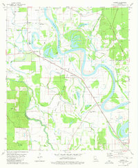
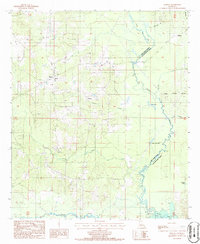
 1983 Campti1984 Print · USGSNatchitoches Parish life in the early 1980s centered on the waterways of Black Lake and the rail lines at Campti. Researchers can trace local heritage through sites like Campti Cem, Our Lady of the Rosary Ch, and the Kansas City Southern railroad.2 unique versions available
 - 1984 Map of Shreveport
 1984 Shreveport1984 Print · USGSNorthern Louisiana at the peak of the 1980s reveals a landscape of massive water management projects and Cold War military hubs. Trace the rail lines of the Kansas City Southern Ry past Barksdale Air Force Base and the high ground of Driskill Mountain.2 unique versions available
 - 1985 Map of Shreveport South
 1985 Shreveport South1985 Print · USGSNorthwest Louisiana in the mid-eighties shows a landscape defined by the Red River and a transition from urban centers to deep timberland. Researchers can trace the rail-and-river economy through landmarks like Barksdale Air Force Base, the Sligo Oil and Gas Field, and Lake Bistineau.2 unique versions available
 - 1986 Map of Martin
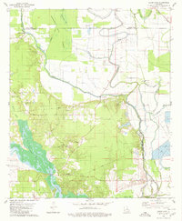
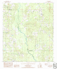
 1986 Martin1986 Print · USGSRed River Parish in the mid-1980s reveals a quiet landscape of bayous and small settlements before modern expansion. Genealogists and historians can trace local landmarks like Liberty Cem, the winding path of Black Lake, and the rural community of Martin.
 - 1986 Map of Natchitoches
 1986 Natchitoches1986 Print · USGSNorthwestern Louisiana during the mid-eighties shows a landscape shaped by major water projects and timberlands. Researchers can trace historic routes like the Old Spanish Trail or locate rural communities such as Fort Jesup, Fairview Alpha, and Grappes Bluff.2 unique versions available
 - 1986 Map of Roy
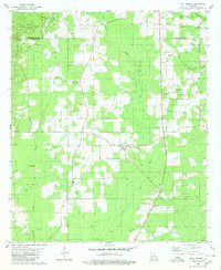
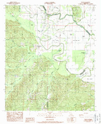
 1986 Roy1986 Print · USGSNorth Louisiana's parish lines intersect here in the 1980s, revealing a landscape of small timber and gravel settlements along the Black Lake Bayou. Researchers can trace old family footprints and rural sites like Holly Springs, Methvin, and the village of Roy.
 - 1989 Map of Evelyn
 1989 Evelyn1989 Print · USGSDe Soto Parish and the surrounding lowlands are captured here in the late twentieth century, showing a landscape defined by timber and energy. Genealogists can trace family roots through settlements like Evelyn and Harris or locate rural Cem sites near Rambin.2 unique versions available
 - 1989 Map of Hanna
 1989 Hanna1989 Print · USGSThe Red River valley at the edge of the Natchitoches and Red River parish lines shows a landscape shaped by water and work in the 1980s. Researchers can locate river crossings like Jordon Ferry, the local Oil Field, and settlements at Hanna and Lake End.2 unique versions available
End of results
Showing maps 1-13 of 13
Top cities of Red River Parish
Frequently asked questions
- What are the different types of historical maps available for Red River Parish?
- What is the oldest map of Red River Parish?
- Where can I purchase historical maps of Red River Parish for my home or office?
- Where can I download high-res historical maps of Red River Parish?
- Are there historical topographic maps available for Red River Parish?
- Is there historical aerial imagery available for Red River Parish?
- Where are historical maps of Red River Parish sourced from?