Old Maps of Contreras, Louisiana for Metal Detecting
Plan your next treasure hunt with 16 historic maps of Contreras. Find old homesites, ghost towns, trails, and gathering spots that may be lost to time — perfect for identifying promising metal detecting locations.
- Locate forgotten sites: Uncover places like long-lost settlements, abandoned rail lines, or gathering spots.
- Plan better hunts: Use map overlays combined with LiDAR or satellite views to narrow in on historically rich areas.
- Made for detectorists: Thousands of hobbyists use these maps to discover relics, coins, and hidden history.
Use these historic maps to boost your research and find new opportunities beneath the surface of Contreras.
Contreras, LA maps
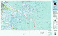
(16)- 1892 Map of St. Bernard
 1892 St. Bernard1892 Print · USGSCoastal Louisiana in the early 1890s is captured here as a landscape of river-bend settlements and expanding rail lines. Genealogists and historians can trace family land and depots at Poydras, St Bernard, and the New Orleans and Gulf Railroad stops.4 unique versions available
 - 1935 Map of Delacroix
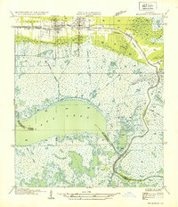 1935 Delacroix1935 Print · USGSCoastal St. Bernard Parish and its marshland communities appear in the mid-1930s as a complex network of bayous, canals, and rail. Researchers can trace the extension of the Louisiana Southern railroad to fishing outposts like Delacroix and Reggio.
 - 1941 Map of Delacroix
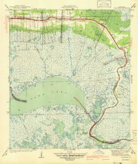 1941 Delacroix1941 Print · USGSCoastal St. Bernard Parish was a world of water and marsh during the late 1930s and early 1940s. Genealogists and local historians can trace the string of settlements along the bayou from St Bernard down to Delacroix, while mapping old waterways like the Magnolia Canal and Howards Ditch.
 - 1942 Map of St. Bernard, 1949 Print
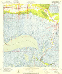
 1942 St. Bernard1949 Print · USGSCoastal St. Bernard and Plaquemines Parishes are shown during the early 1940s, capturing the delta’s transition from rural settlements to an industrial oil and rail corridor. Researchers can trace family roots at the Delacroix Island School or locate historic sites like Chalmette National Monument and the Martello Tower.
 - 1951 Map of Delacroix, 1952 Print
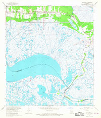
 1951 Delacroix1952 Print · USGSCoastal St. Bernard Parish in the early fifties shows a landscape of linear bayou settlements and expansive marshland. Genealogists and local historians can trace family locations along the Bayou in communities like Delacroix, Reggio, and Verret.
 - 1955 Map of St. Bernard
 1955 St. Bernard1955 Print · USGSCoastal Louisiana in the mid-fifties reveals a landscape defined by river commerce and expansive marshlands. Genealogists and historians can trace family-named sites and landmarks like True Love Cemetery, Pakenham Oaks, and the Martello Tower.
 - 1957 Map of Breton Sound, 1967 Print
 1957 Breton Sound1967 Print · USGSThe Mississippi River delta is captured here in the mid-fifties, showing the fragile marshlands and river-dependent towns of the Louisiana coast. Genealogists and historians can trace riverside settlements like Pointe a la Hache, Pilottown, and Port Sulphur.3 unique versions available
 - 1961 Map of Breton Sound
 1961 Breton Sound1961 Print · USGSThe Louisiana delta and the outer marshes of Plaquemines Parish are captured here at the start of the 1960s. Researchers can trace the river settlements from Davant to Venice, locate isolated stations like Port Eads, and find old sites such as Fort Jackson.
 - 1967 Map of Delacroix, 1968 Print
 1967 Delacroix1968 Print · USGSCoastal St. Bernard Parish was a landscape of marsh-side settlements and canal networks in the late sixties. Genealogists and researchers can trace local landmarks like True Love Cem, St Bernard High Sch, and the winding Bayou Terre aux Boeufs.4 unique versions available
 - 1969 Map of St. Bernard, 1970 Print
 1969 St. Bernard1970 Print · USGSCoastal St. Bernard Parish comes alive in this late-sixties survey of the riverfront and marshlands during a period of significant industrial and maritime growth. Researchers can trace the development of Chalmette, find family landmarks like St Bernard Memorial Gardens, and explore the winding Southern Railway through Violet and Verret.
 - 1983 Map of Black Bay
 1983 Black Bay1983 Print · USGSCoastal St. Bernard Parish is shown in the early eighties as the Mississippi Delta's fishing villages and industrial infrastructure meet the expanding Gulf sounds. Genealogists and historians can trace family-named sites from Chalmette to Delacroix, including the Southern Railway System and St Bernard State Park.2 unique versions available
 - 2012 Map of Delacroix, 2012 Print
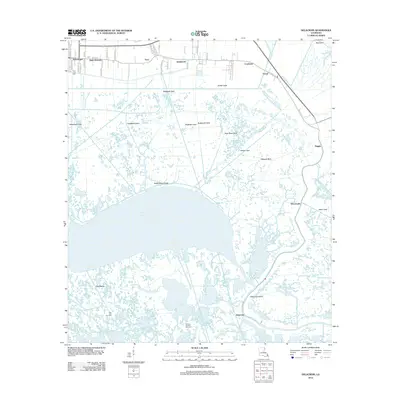 2012 Delacroix2012 Print · USGSCovers Contreras, including Reggio, Kenilworth, and other nearby areas
 - 2015 Map of Delacroix, 2015 Print
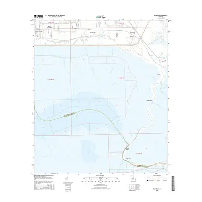 2015 Delacroix2015 Print · USGSCovers Contreras, including Reggio, Kenilworth, and other nearby areas
 - 2018 Map of Delacroix, 2018 Print
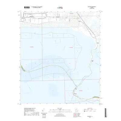 2018 Delacroix2018 Print · USGSCovers Contreras, including Reggio, Kenilworth, and other nearby areas
 - 2020 Map of Delacroix, 2020 Print
 2020 Delacroix2020 Print · USGSCovers Contreras, including Reggio, Kenilworth, and other nearby areas
 - 2024 Map of Delacroix, 2024 Print
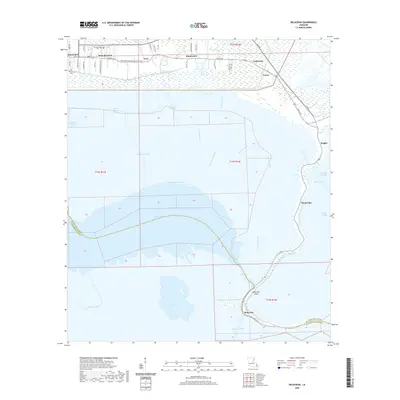
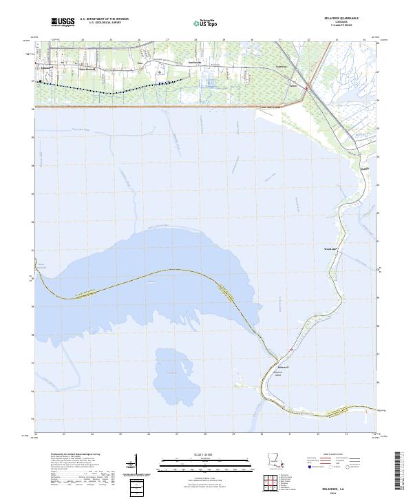 2024 Delacroix2024 Print · USGSSaint Bernard Parish at the edge of the Mississippi delta is mapped here in its modern configuration of marsh and waterway. Researchers can trace the linear communities along Bayou Rd and find local landmarks like True Love Cem, Delacroix, and Lake Lery.
End of results
Showing maps 1-16 of 16
Top cities near Contreras
Frequently asked questions
- What are the different types of historical maps available for Contreras?
- What is the oldest map of Contreras?
- Where can I purchase historical maps of Contreras for my home or office?
- Where can I download high-res historical maps of Contreras?
- Are there historical topographic maps available for Contreras?
- Is there historical aerial imagery available for Contreras?
- Where are historical maps of Contreras sourced from?