Old Maps of Poydras, Louisiana for Genealogy
Trace your family roots with 16 historic maps of Poydras. These high-res maps reveal old neighborhoods, homesites, landmarks, and streets — helping you uncover where your ancestors lived and how the area evolved over time.
- Explore historic neighborhoods: Identify where your relatives may have lived in the 1800s or 1900s.
- Compare maps over time: Trace the changes in streets, buildings, and landmarks for multi-generational research.
- Perfect for genealogy & ancestry research: Used by family historians and researchers to map out lineage and migration.
These maps are an incredible resource for exploring your personal connection to Poydras's past.
Poydras, LA maps
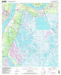
(16)- 1892 Map of St. Bernard
 1892 St. Bernard1892 Print · USGSCoastal Louisiana in the early 1890s is captured here as a landscape of river-bend settlements and expanding rail lines. Genealogists and historians can trace family land and depots at Poydras, St Bernard, and the New Orleans and Gulf Railroad stops.4 unique versions available
 - 1940 Map of Belle Chasse
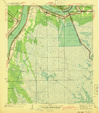 1940 Belle Chasse1940 Print · USGSCoastal Louisiana during the late 1930s is defined here by its intricate canal systems and riverside rail hubs. Trace the local economy through the Sea Train Terminal at Belle Chasse or the marshland paths near Tigers Ridge and Lake Lery.
 - 1942 Map of St. Bernard, 1949 Print
 1942 St. Bernard1949 Print · USGSCoastal St. Bernard and Plaquemines Parishes are shown during the early 1940s, capturing the delta’s transition from rural settlements to an industrial oil and rail corridor. Researchers can trace family roots at the Delacroix Island School or locate historic sites like Chalmette National Monument and the Martello Tower.
 - 1951 Map of Belle Chasse, 1952 Print
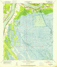 1951 Belle Chasse1952 Print · USGSLower Plaquemines Parish in the early fifties is captured here as a critical industrial and rail hub along the Mississippi. Researchers can trace riverfront life from Stella to Poydras, or locate mid-century landmarks like Callender Airport and the Sea Train Terminal.2 unique versions available
 - 1955 Map of St. Bernard
 1955 St. Bernard1955 Print · USGSCoastal Louisiana in the mid-fifties reveals a landscape defined by river commerce and expansive marshlands. Genealogists and historians can trace family-named sites and landmarks like True Love Cemetery, Pakenham Oaks, and the Martello Tower.
 - 1957 Map of Breton Sound, 1967 Print
 1957 Breton Sound1967 Print · USGSThe Mississippi River delta is captured here in the mid-fifties, showing the fragile marshlands and river-dependent towns of the Louisiana coast. Genealogists and historians can trace riverside settlements like Pointe a la Hache, Pilottown, and Port Sulphur.3 unique versions available
 - 1961 Map of Breton Sound
 1961 Breton Sound1961 Print · USGSThe Louisiana delta and the outer marshes of Plaquemines Parish are captured here at the start of the 1960s. Researchers can trace the river settlements from Davant to Venice, locate isolated stations like Port Eads, and find old sites such as Fort Jackson.
 - 1966 Map of Belle Chasse, 1968 Print
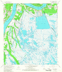 1966 Belle Chasse1968 Print · USGSThe Mississippi River's shifting path and industrial riverfront dominate the landscape of Plaquemines Parish in the mid-sixties. Genealogists and historians can locate legacy landmarks like Bethlehem Ch, the English Turn Cem, and the Sea Train Terminal near Belle Chasse.6 unique versions available
 - 1969 Map of St. Bernard, 1970 Print
 1969 St. Bernard1970 Print · USGSCoastal St. Bernard Parish comes alive in this late-sixties survey of the riverfront and marshlands during a period of significant industrial and maritime growth. Researchers can trace the development of Chalmette, find family landmarks like St Bernard Memorial Gardens, and explore the winding Southern Railway through Violet and Verret.
 - 1983 Map of Black Bay
 1983 Black Bay1983 Print · USGSCoastal St. Bernard Parish is shown in the early eighties as the Mississippi Delta's fishing villages and industrial infrastructure meet the expanding Gulf sounds. Genealogists and historians can trace family-named sites from Chalmette to Delacroix, including the Southern Railway System and St Bernard State Park.2 unique versions available
 - 1999 Map of Belle Chasse, 2000 Print
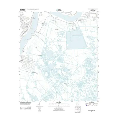
 1999 Belle Chasse2000 Print · USGSThe Mississippi River corridor south of New Orleans reveals a mix of military aviation and deep-delta marshland during the late twentieth century. Genealogists and historians can trace family-named sites like Bethlehem Ch, follow the Old Railroad Grade, or locate the Sea Train Terminal.
 - 2012 Map of Belle Chasse, 2012 Print
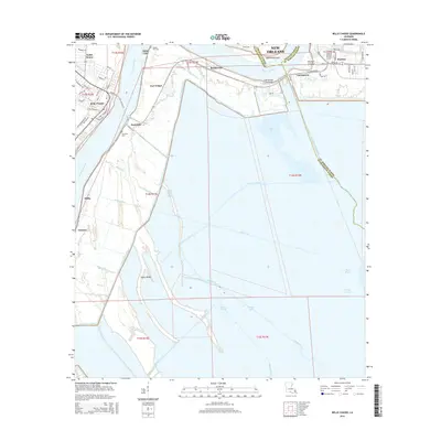
 2012 Belle Chasse2012 Print · USGSCovers Poydras, including New Orleans, Stella, and other nearby areas
 - 2015 Map of Belle Chasse, 2015 Print
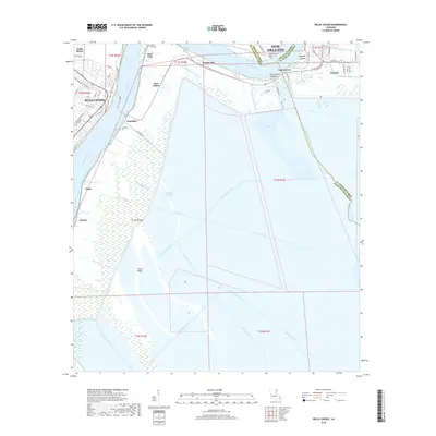
 2015 Belle Chasse2015 Print · USGSCovers Poydras, including New Orleans, Stella, and other nearby areas
 - 2018 Map of Belle Chasse, 2018 Print
 2018 Belle Chasse2018 Print · USGSCovers Poydras, including New Orleans, Stella, and other nearby areas
 - 2020 Map of Belle Chasse, 2020 Print
 2020 Belle Chasse2020 Print · USGSCovers Poydras, including New Orleans, Stella, and other nearby areas
 - 2024 Map of Belle Chasse, 2024 Print
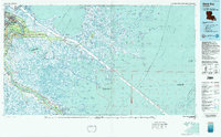
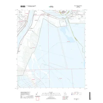
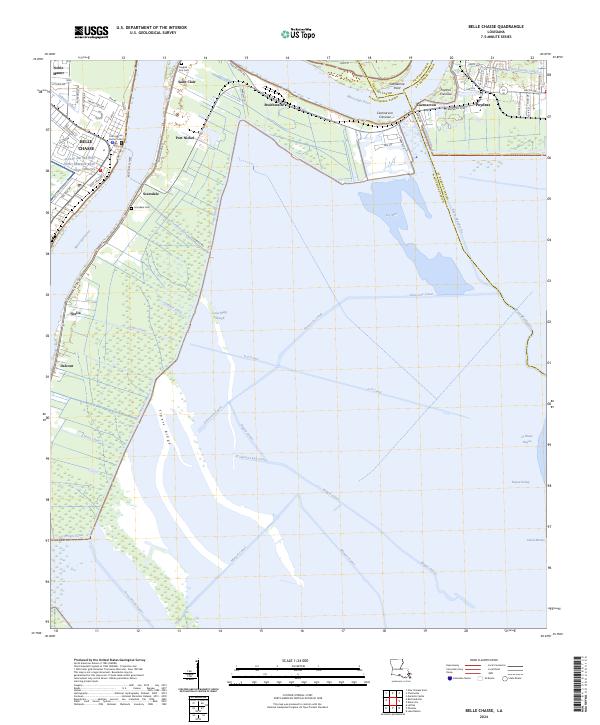 2024 Belle Chasse2024 Print · USGSThe Plaquemines Parish riverfront comes into focus in this recent survey of the Mississippi oxbow below New Orleans. Genealogists and historians can trace family sites near English Turn Cem, locate the Belle Chasse Ferry crossing, and study industrial sites like Port Nickel.
End of results
Showing maps 1-16 of 16
Top cities near Poydras
- New Orleans historical maps
- Algiers historical maps
- Chalmette historical maps
- Gretna historical maps
- Jean Lafitte historical maps
Frequently asked questions
- What are the different types of historical maps available for Poydras?
- What is the oldest map of Poydras?
- Where can I purchase historical maps of Poydras for my home or office?
- Where can I download high-res historical maps of Poydras?
- Are there historical topographic maps available for Poydras?
- Is there historical aerial imagery available for Poydras?
- Where are historical maps of Poydras sourced from?