Old Maps of Saint Helena Parish, Louisiana
Explore 85 old maps of Saint Helena Parish, spanning from 1940 to today. These high-resolution historic maps reveal how streets, neighborhoods, landmarks, and natural features evolved over time — perfect for genealogy, metal detecting, research, and local history exploration.
What you can do with these maps:
- See how Saint Helena Parish changed over time: Compare historical maps to modern-day views to trace roads, homesites, rail lines & more.
- View detailed metadata: Each map includes creators, publishers, year, scale, and archive source.
- Overlay maps with satellite & LiDAR: Visualize the past alongside modern tools to explore terrain & human change.
- Trusted historical sources: Maps sourced from the USGS, Library of Congress, and other archives.
- Access maps your way: View online, download high-res files, or order prints for personal or research use.
Start exploring old maps of Saint Helena Parish to uncover forgotten places, hidden landmarks, and the deep history beneath your feet.
Saint Helena Parish, LA maps
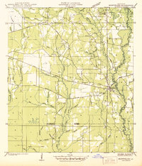
(85)- 1940 Map of Roseland, 1954 Print
 1940 Roseland1954 Print · USGSTangipahoa Parish in the 1940s is seen here as a series of rail-side towns and rural crossroads along the Illinois Central Railroad. Genealogists and historians can trace early community hubs like Fluker, Arcola, and the Kelly Cem.
 - 1941 Map of Gilead
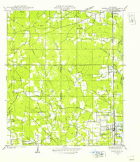
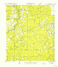
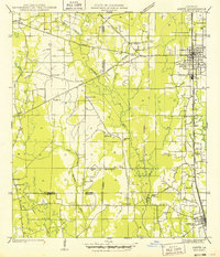
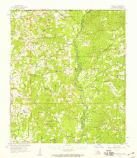
 1941 Gilead1941 Print · USGSSt. Helena and East Feliciana parishes are documented here in the early 1940s, split by the winding Amite River. Genealogists can trace family roots at Powers Cem and Youngblood Cem or locate local hubs like Wesley Chapel and Gilead.
 - 1941 Map of Chipola
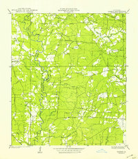
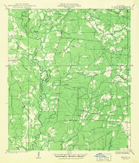
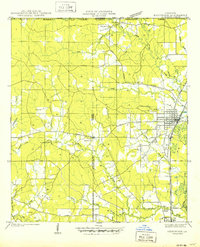
 1941 Chipola1941 Print · USGSSt. Helena and East Feliciana parishes are shown here in the early 1940s just as the modern highway system began to solidify. Family historians can trace local roots at Hurst Cem, Joiners, and rural school sites like St Helena Sch.
 - 1942 Map of Roseland
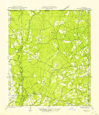
 1942 Roseland1942 Print · USGSTangipahoa Parish is seen here in the early 1940s, when the Illinois Central Railroad linked a corridor of small towns and timber lands. Genealogists can trace early residents through sites like Kelly Cem, Big Zion Sch, and Claiborne Chapel.
 - 1942 Map of Montpelier
 1942 Montpelier1942 Print · USGSThe village of Montpelier and the winding Tickfaw River are captured here during the early 1940s. Genealogists and local historians can trace parish lines and locate community landmarks like Shiloh Ch, Morgan Sch, and Hillsdale Cem.
 - 1942 Map of Liverpool
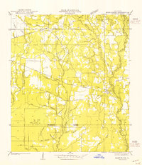
 1942 Liverpool1942 Print · USGSSt. Helena Parish at the start of the 1940s is a landscape of rural homesteads and river branches along the Mississippi border. Researchers can trace family sites like Anglin Cem and Bates Cem or locate the old Oakland Sch and the Liverpool Fire Tower.
 - 1942 Map of Pine Grove
 1942 Pine Grove1942 Print · USGSSt. Helena Parish and the surrounding borderlands are captured here in the early 1940s as the regional logging rail era gives way to a modern highway network. Researchers can trace family sites at Sand Hill Cem and Salem Ch, or locate vanished local landmarks like Story Sch and the Old Grade.
 - 1942 Map of Pride
 1942 Pride1942 Print · USGSEast Baton Rouge and surrounding parishes are shown here in the early 1940s, a landscape defined by the Amite River and rural crossroads. You can trace community roots through many local landmarks, including Dennis Mills, Harrell Sch, and Stony Point Cem.
 - 1942 Map of Gilead
 1942 Gilead1942 Print · USGSSt. Helena and East Feliciana Parishes are captured here in the early 1940s, split by the meandering Amite River. Researchers can trace the footprints of rural life through old landmarks like Sunflower Sch, Pipkin Chapel, and Powers Cem.
 - 1945 Map of Chipola
 1945 Chipola1945 Print · USGSSt. Helena Parish was a landscape of small crossroads and creek-side settlements in the years following the Great Depression. Genealogists and local historians can trace family locations near Chipola, Darlington, and rural landmarks like the Riverside Sch.
 - 1949 Map of Amite
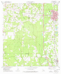
 1949 Amite1949 Print · USGSTangipahoa Parish enters the post-war era as a busy corridor of rail commerce and rural community life. Researchers can trace family roots through numerous local landmarks, including Baham Cemetery, McMichael Church, and the Illinois Central line through Amite.
 - 1950 Map of Kentwood
 1950 Kentwood1950 Print · USGSKentwood and Tangipahoa thrive along the Illinois Central rail corridor during the mid-century, marking a period of established rural settlement along the Mississippi state line. Researchers can locate numerous family burial sites and churches, including the Camp Moore Confederate Cem, Barnes Cem, and Bethel Ch.
 - 1950 Map of Greensburg
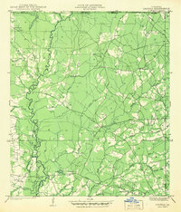
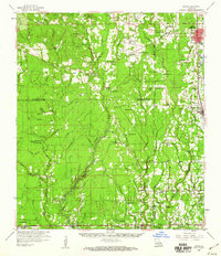
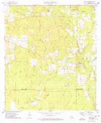
 1950 Greensburg1950 Print · USGSMid-century St. Helena Parish comes into focus in this detailed topographic record of the area surrounding the parish seat. Local historians can trace the precise locations of rural community centers like the St Helena Training Sch, Crossroads Ch, and Hutchinson Cem.
 - 1954 Map of Montpelier
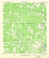
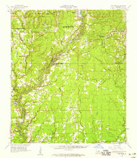
 1954 Montpelier1954 Print · USGSThe rural landscape of St. Helena Parish is captured here in the mid-1950s, centered on the community of Montpelier. Genealogists and historians can trace local landmarks like Hillsdale Cem, the Old Railroad Grade, and several country schools including Mt Zion Sch.
 - 1954 Map of Pride, 1955 Print
 1954 Pride1955 Print · USGSEast Baton Rouge and surrounding parishes are captured here in the mid-1950s, a landscape defined by the winding Amite River and numerous bayous. Researchers can trace rural lineages through sites like Oaknolia, South Union Ch, and the Stony Point Cem.2 unique versions available
 - 1954 Map of Baton Rouge, 1974 Print
 1954 Baton Rouge1974 Print · USGSSoutheast Louisiana in the mid-fifties is captured here during a period of transition for its river and rail economies. Researchers can trace the path of the Mississippi River and find landmarks like the Bonnet Carre Spillway and Bayou Plaquemine.2 unique versions available
 - 1956 Map of Baton Rouge
 1956 Baton Rouge1956 Print · USGSSouth Louisiana at the height of the mid-century oil boom shows a landscape of river oxbows and rising industry. Researchers can trace family roots through river towns like Scotlandville or locate early industrial sites and Oil wells near Lake Maurepas.
 - 1958 Map of Felixville, 1959 Print
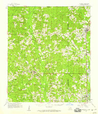
 1958 Felixville1959 Print · USGSEast Feliciana Parish and the Mississippi border country come alive in this late 1950s survey of rural life. Researchers can trace family sites at the Eighth Ward Sch, find legacy churches like Wesley Chapel, or locate old settlements including Hatchersville and Felixville (PO).4 unique versions available
 - 1958 Map of Kentwood, 1959 Print
 1958 Kentwood1959 Print · USGSThe Florida Parishes in the late fifties centered on the busy Illinois Central rail line and the growing timber towns of Kentwood and Roseland. Researchers can trace old family homesteads and landmarks like Camp Moore Cem, New Zion Sch, and Venable Ch.2 unique versions available
 - 1958 Map of Pine Grove, 1959 Print
 1958 Pine Grove1959 Print · USGSLouisiana's river-bottom parishes are shown here in the late fifties, when small timber and rail-stop communities still defined the rural landscape. Genealogists and researchers can trace lineage through dozens of local sites like Judson Ch Cem, Pride Chapel, and the vanished tracks of the Old Railroad Grade.3 unique versions available
 - 1959 Map of Amite, 1960 Print
 1959 Amite1960 Print · USGSSoutheastern Louisiana parishes in the late fifties show a landscape of river-fed bottomlands and rail-centered towns. Genealogists can trace family lines at Leonard Chapel Cems, Gatlin Cem, and the St John the Baptist Chapel.3 unique versions available
 - 1961 Map of Baton Rouge, 1966 Print
 1961 Baton Rouge1966 Print · USGSSoutheastern Louisiana in the early sixties remains a landscape of deep river bends and sprawling coastal lakes. Genealogists and historians can trace the rail-and-river economy through landmarks like Free-Nigger Point, Donaldsonville, and the Illinois Central Railroad.
 - 1962 Map of Baton Rouge
 1962 Baton Rouge1962 Print · USGSSouth Louisiana in the early sixties reveals a landscape of river-bend parishes and emerging interstate corridors. Genealogists and historians can trace family roots through historic river towns like Donaldsonville and Plaquemine, or follow the path of the Illinois Central Railroad through the swamp basins.
 - 1974 Map of Montpelier, 1978 Print
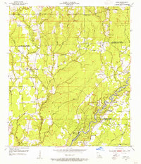
 1974 Montpelier1978 Print · USGSSt. Helena Parish during the mid-seventies is mapped here at a time when the rural landscape was defined by small timber-and-creek communities. Researchers can trace family roots at Hillsdale Cem or locate old community centers like Midway Ch and Jack.
 - 1974 Map of Amite, 1978 Print
 1974 Amite1978 Print · USGSThe Tangipahoa Parish landscape in the mid-seventies shows the steady growth of Amite and Independence along the vital Illinois Central Gulf rail corridor. Genealogists and historians can trace numerous family landmarks, from Baham Cem and Durbin Cem to local spiritual centers like Harris Chapel.
Showing maps 1-25 of 85
Top cities of Saint Helena Parish
Frequently asked questions
- What are the different types of historical maps available for Saint Helena Parish?
- What is the oldest map of Saint Helena Parish?
- Where can I purchase historical maps of Saint Helena Parish for my home or office?
- Where can I download high-res historical maps of Saint Helena Parish?
- Are there historical topographic maps available for Saint Helena Parish?
- Is there historical aerial imagery available for Saint Helena Parish?
- Where are historical maps of Saint Helena Parish sourced from?