Old Maps of Tigerville, Louisiana for Hiking & Exploration
Hike through history with 15 historic maps of Tigerville. Explore old trails, ghost towns, and forgotten backroads — perfect for outdoor adventurers and local explorers.
- Rediscover forgotten places: Map out old mining camps, roads, and footpaths that no longer exist on modern maps.
- Layer with modern tools: Combine with LiDAR or satellite views to plan hikes through historical terrain.
- Made for exploration: Popular among hikers, overlanders, and local history lovers.
Use these maps to find adventure and explore the hidden past of Tigerville.
Tigerville, LA maps
(15)- 1892 Map of Mount Airy
 1892 Mount Airy1892 Print · USGSThe lower Mississippi River corridor is captured here in the early 1890s, showcasing the traditional long-lot plantations and burgeoning rail towns. Researchers can trace the early footprints of Edgard and Mt Airy or locate family-named landmarks like Pauline and Johnson along the river's edge.4 unique versions available
 - 1949 Map of Garyville
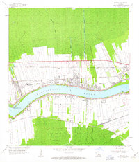
 1949 Garyville1949 Print · USGSThe Mississippi River corridor comes alive in the late 1940s, showing the intersection of rail-and-river commerce and deep-rooted sugar parishes. Trace ancestral roots and industrial history through the Columbia Sugar Mill, St Peters Ch, and the Illinois Central railroad line.
 - 1954 Map of Baton Rouge, 1974 Print
 1954 Baton Rouge1974 Print · USGSSoutheast Louisiana in the mid-fifties is captured here during a period of transition for its river and rail economies. Researchers can trace the path of the Mississippi River and find landmarks like the Bonnet Carre Spillway and Bayou Plaquemine.2 unique versions available
 - 1956 Map of Baton Rouge
 1956 Baton Rouge1956 Print · USGSSouth Louisiana at the height of the mid-century oil boom shows a landscape of river oxbows and rising industry. Researchers can trace family roots through river towns like Scotlandville or locate early industrial sites and Oil wells near Lake Maurepas.
 - 1961 Map of Baton Rouge, 1966 Print
 1961 Baton Rouge1966 Print · USGSSoutheastern Louisiana in the early sixties remains a landscape of deep river bends and sprawling coastal lakes. Genealogists and historians can trace the rail-and-river economy through landmarks like Free-Nigger Point, Donaldsonville, and the Illinois Central Railroad.
 - 1962 Map of Baton Rouge
 1962 Baton Rouge1962 Print · USGSSouth Louisiana in the early sixties reveals a landscape of river-bend parishes and emerging interstate corridors. Genealogists and historians can trace family roots through historic river towns like Donaldsonville and Plaquemine, or follow the path of the Illinois Central Railroad through the swamp basins.
 - 1962 Map of Reserve, 1963 Print
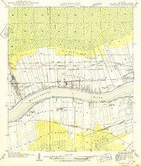
 1962 Reserve1963 Print · USGSThe Louisiana river parishes are caught in a moment of industrial transition in the early 1960s, framed by the winding Mississippi River. Genealogists and historians can trace the legacy of the sugar coast through local landmarks like San Francisco Plantation and the Wallace (PO).5 unique versions available
 - 1962 Map of Mount Airy, 1966 Print
 1962 Mount Airy1966 Print · USGSThe riverfront culture of St. John the Baptist and St. James Parishes is captured here in the early 1960s as industrial growth meets historic riverside estates. Genealogists and historians can trace family sites from Gramercy to Reserve, including landmarks like San Francisco Plantation and St Joseph Cath Ch.2 unique versions available
 - 1983 Map of Ponchatoula, 1984 Print
 1983 Ponchatoula1984 Print · USGSThe Lake Pontchartrain Basin and the River Parishes come into focus during the early 1980s, showcasing the region's complex water-dependent geography. Researchers can trace the rail routes of the Illinois Central Gulf Railroad and explore landmarks from Pass Manchac to Donaldsonville.2 unique versions available
 - 1999 Map of Reserve, 2000 Print
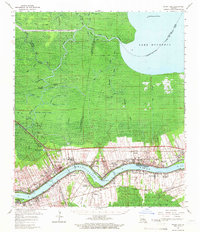
 1999 Reserve2000 Print · USGSThe Mississippi River parishes at the close of the century show a fascinating landscape of industrial growth and plantation history. Researchers can trace the riverfront developments from San Francisco Plantation to the rail infrastructure at Reserve Station and Edgard Station.
 - 2012 Map of Reserve, 2012 Print
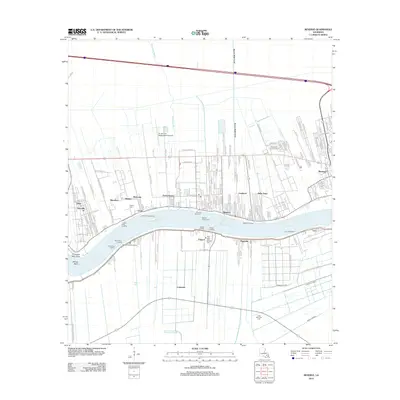 2012 Reserve2012 Print · USGSCovers Tigerville, including Dolsen, Hope, and other nearby areas
 - 2015 Map of Reserve, 2015 Print
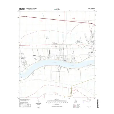 2015 Reserve2015 Print · USGSCovers Tigerville, including Dolsen, Hope, and other nearby areas
 - 2018 Map of Reserve, 2018 Print
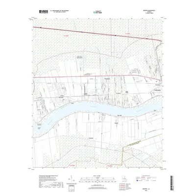 2018 Reserve2018 Print · USGSCovers Tigerville, including Dolsen, Hope, and other nearby areas
 - 2020 Map of Reserve, 2020 Print
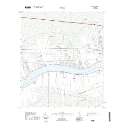 2020 Reserve2020 Print · USGSCovers Tigerville, including Dolsen, Hope, and other nearby areas
 - 2024 Map of Reserve, 2024 Print
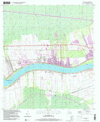
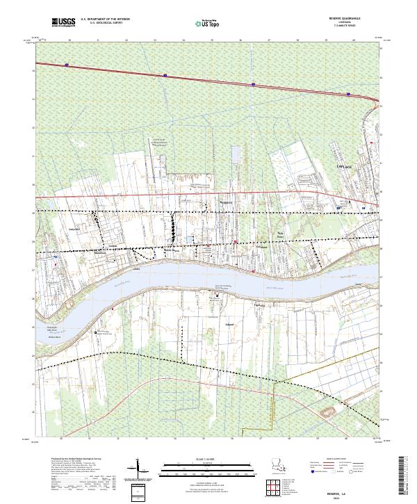 2024 Reserve2024 Print · USGSSettled along the Great River Road in the 2020s, this area shows the enduring river-oriented geography of St. John the Baptist Parish. Genealogists can trace family sites from Edgard to Reserve, including Saint John the Baptist Cem and Bishop Cem.
End of results
Showing maps 1-15 of 15
Top cities near Tigerville
Frequently asked questions
- What are the different types of historical maps available for Tigerville?
- What is the oldest map of Tigerville?
- Where can I purchase historical maps of Tigerville for my home or office?
- Where can I download high-res historical maps of Tigerville?
- Are there historical topographic maps available for Tigerville?
- Is there historical aerial imagery available for Tigerville?
- Where are historical maps of Tigerville sourced from?