Old Maps of Cypremort Point, Louisiana for Academic Research
Study the evolution of Cypremort Point with 9 high-resolution historic maps. Whether you're teaching, researching, or modeling changes in land use, these maps provide essential visual documentation of urban, environmental, and geographic change.
- Analyze long-term change: Track patterns in development, transportation, and natural features.
- Ideal for environmental or urban studies: Support academic projects with primary historical map data.
- Use in the classroom or lab: Educators and researchers rely on these maps to bring historical context to life.
These maps are a powerful tool for teaching, research, and visualizing how Cypremort Point has changed over the decades.
Cypremort Point, LA maps
(9)- 1945 Map of New Orleans
 1945 New Orleans1945 Print · USGSCoastal Louisiana and the Mississippi delta are captured here just after the war, showing the region's transition into a modern industrial and transit hub. Genealogists can trace family settlements along Bayou Teche or identify rail stops for the Illinois Central and Texas & Pacific lines.
 - 1949 Map of Cypremort Pt
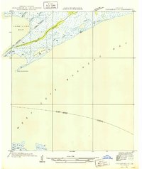 1949 Cypremort Pt1949 Print · USGSThe Louisiana coast at the edge of St. Mary Parish is captured here during the late 1940s, showing a world of winding bayous and expansive bays. Researchers can trace the shifting shoreline near Cypremort Point, Oyster Lake, and the remote Dead Cypress Point.3 unique versions available
 - 1963 Map of New Orleans
 1963 New Orleans1963 Print · USGSCoastal Louisiana in the mid-twentieth century reveals a complex world of bayou settlements, expanding oil fields, and vital rail networks. Genealogists and historians can trace family roots through river towns like Thibodaux or follow the Southern Pacific line through Franklin and Patterson.4 unique versions available
 - 1966 Map of New Orleans
 1966 New Orleans1966 Print · USGSCoastal Louisiana in the mid-1960s reveals a transition from traditional bayou life to an intensive offshore oil and gas economy. Researchers can trace the rail lines of the Southern Pacific RR through Morgan City or locate the Eugene Island Lighthouse among the delta's shifting marshes.
 - 1968 Map of Hammock Lake, 1969 Print
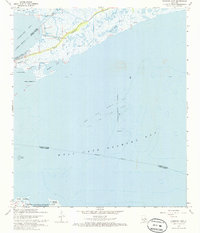 1968 Hammock Lake1969 Print · USGSCoastal St. Mary Parish in the late sixties shows a landscape of tidal marshes and emerging offshore industry. Genealogists and maritime researchers can trace the shoreline through Cypremort Point Beach, Quintana, and the Shark Bayou wetlands.2 unique versions available
 - 1968 Map of Marsh Island, 1970 Print
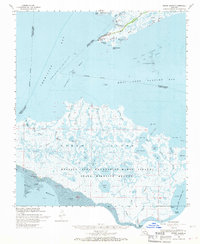 1968 Marsh Island1970 Print · USGSCoastal Louisiana marshes and offshore oil fields define this region in the late sixties. Naturalists and researchers can trace the intricate waterways of the Marsh Island State Wildlife Refuge and locate remote sites like the Conservation Camp or Cypremort Point.2 unique versions available
 - 1983 Map of Morgan City
 1983 Morgan City1983 Print · USGSThe Louisiana coast in the early eighties reveals a landscape shaped by water and industry, from the salt domes to the sugar parishes. Trace the historic corridor of the Bayou Teche, the rail lines through Morgan City, and the wetlands of Weeks Island.2 unique versions available
 - 1994 Map of Hammock Lake, 1998 Print
 1994 Hammock Lake1998 Print · USGSThe Louisiana coast and its offshore energy fields are captured in the 1990s as industry met conservation. Trace the development of the West Cote Blanche Oil and Gas Field and the boundaries of Cypremort Point State Park.
 - 2024 Map of Hammock Lake, 2024 Print
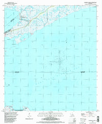
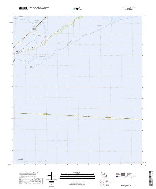 2024 Hammock Lake2024 Print · USGSCoastal Louisiana marshes and bayous are meticulously detailed in this recent survey of the Iberia and St. Mary parish lines. Researchers can trace the shifting shorelines of Vermilion Bay and locate landmarks like Cypremort Point Beach and Dead Cypress Point.
End of results
Showing maps 1-9 of 9
Top cities near Cypremort Point
Frequently asked questions
- What are the different types of historical maps available for Cypremort Point?
- What is the oldest map of Cypremort Point?
- Where can I purchase historical maps of Cypremort Point for my home or office?
- Where can I download high-res historical maps of Cypremort Point?
- Are there historical topographic maps available for Cypremort Point?
- Is there historical aerial imagery available for Cypremort Point?
- Where are historical maps of Cypremort Point sourced from?