Old Maps of Fivemile Oaks, Louisiana for Academic Research
Study the evolution of Fivemile Oaks with 16 high-resolution historic maps. Whether you're teaching, researching, or modeling changes in land use, these maps provide essential visual documentation of urban, environmental, and geographic change.
- Analyze long-term change: Track patterns in development, transportation, and natural features.
- Ideal for environmental or urban studies: Support academic projects with primary historical map data.
- Use in the classroom or lab: Educators and researchers rely on these maps to bring historical context to life.
These maps are a powerful tool for teaching, research, and visualizing how Fivemile Oaks has changed over the decades.
Fivemile Oaks, LA maps
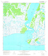
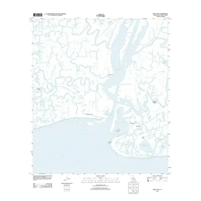
(16)- 1935 Map of Belle Isle
 1935 Belle Isle1935 Print · USGSThe Louisiana marshlands around Plaquemines Parish are captured in the mid-1930s, documenting a fragile coastal landscape of bayous and islands. Local historians can trace the early shoreline and navigation points like Telegraph Point, Stone Island, and Belle Isle.
 - 1941 Map of Belle Isle, 1943 Print
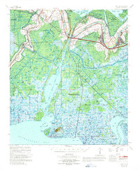
 1941 Belle Isle1943 Print · USGSCoastal St. Mary Parish is shown here in the early 1940s during a period of significant hydraulic engineering and industrial shifts. Researchers can trace family sites at Little Zion Ch & Cem, the location of Plantation Fairfax, or the early Bateman Lake Oil Field.
 - 1945 Map of New Orleans
 1945 New Orleans1945 Print · USGSCoastal Louisiana and the Mississippi delta are captured here just after the war, showing the region's transition into a modern industrial and transit hub. Genealogists can trace family settlements along Bayou Teche or identify rail stops for the Illinois Central and Texas & Pacific lines.
 - 1954 Map of Belle Isle
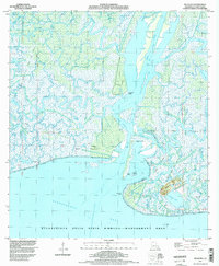
 1954 Belle Isle1954 Print · USGSThe Louisiana bayou country of St. Mary Parish is captured in the mid-1950s, showing a landscape defined by plantation history and new industrial growth. Genealogists can locate family landmarks like Waveland Plantation, Jerusalem Church, and the North Bend Cemetery.
 - 1963 Map of New Orleans
 1963 New Orleans1963 Print · USGSCoastal Louisiana in the mid-twentieth century reveals a complex world of bayou settlements, expanding oil fields, and vital rail networks. Genealogists and historians can trace family roots through river towns like Thibodaux or follow the Southern Pacific line through Franklin and Patterson.4 unique versions available
 - 1966 Map of New Orleans
 1966 New Orleans1966 Print · USGSCoastal Louisiana in the mid-1960s reveals a transition from traditional bayou life to an intensive offshore oil and gas economy. Researchers can trace the rail lines of the Southern Pacific RR through Morgan City or locate the Eugene Island Lighthouse among the delta's shifting marshes.
 - 1966 Map of Belle Isle, 1967 Print
 1966 Belle Isle1967 Print · USGSCoastal Louisiana in the mid-sixties reveals a landscape of industrial energy and complex marshland hydrology. Researchers can trace the layout of the Big Wax Gas and Oil Field and locate landmarks like Belle Isle Point and Negro Hammock.3 unique versions available
 - 1967 Map of Belle Isle, 1969 Print
 1967 Belle Isle1969 Print · USGSThe coastal marshlands and bayou communities of St. Mary Parish are captured in the late sixties as the region's oil and gas industry matured. Researchers can trace family sites and industrial landmarks from Patterson to the Belle Isle Gas and Oil Field or the Little Zion Church.
 - 1983 Map of Morgan City
 1983 Morgan City1983 Print · USGSThe Louisiana coast in the early eighties reveals a landscape shaped by water and industry, from the salt domes to the sugar parishes. Trace the historic corridor of the Bayou Teche, the rail lines through Morgan City, and the wetlands of Weeks Island.2 unique versions available
 - 1994 Map of Belle Isle, 1998 Print
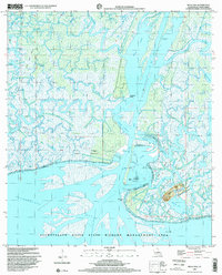
 1994 Belle Isle1998 Print · USGSThe coastal marshes of St. Mary Parish are captured in the mid-nineties, showing a landscape defined by the energy industry and delta hydrology. Researchers can trace dredging and development via the Belle Isle Oil and Gas Field and the Wax Lake Outlet.
 - 1998 Map of Belle Isle, 2000 Print
 1998 Belle Isle2000 Print · USGSThe Louisiana coast near the turn of the millennium was a maze of shifting delta marsh and industrial development. Researchers can trace the complex waterways around Belle Isle, locating remote landmarks like Negro Hammock and the Gas Field.
 - 2012 Map of Belle Isle, 2012 Print
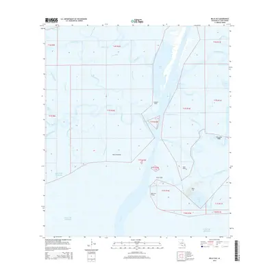
 2012 Belle Isle2012 Print · USGSCovers Fivemile Oaks, including St. Mary Parish, United States, and other nearby areas
 - 2015 Map of Belle Isle, 2015 Print
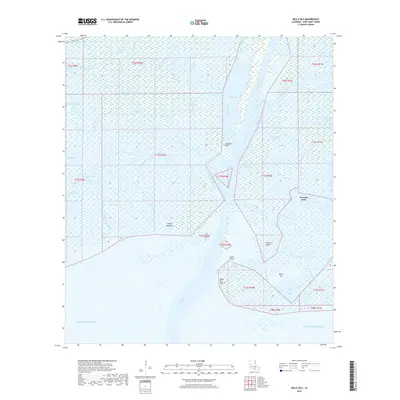
 2015 Belle Isle2015 Print · USGSCovers Fivemile Oaks, including St. Mary Parish, United States, and other nearby areas
 - 2018 Map of Belle Isle, 2018 Print
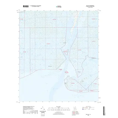
 2018 Belle Isle2018 Print · USGSCovers Fivemile Oaks, including St. Mary Parish, United States, and other nearby areas
 - 2020 Map of Belle Isle, 2020 Print
 2020 Belle Isle2020 Print · USGSCovers Fivemile Oaks, including St. Mary Parish, United States, and other nearby areas
 - 2024 Map of Belle Isle, 2024 Print
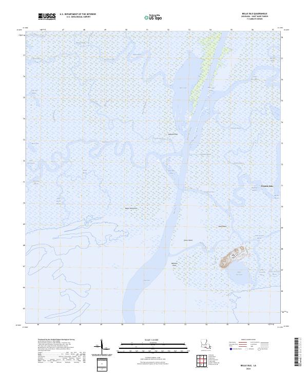 2024 Belle Isle2024 Print · USGSCoastal St. Mary Parish is captured in this modern survey, showing the complex deltaic environment where the Atchafalaya's waters meet the Gulf. Researchers can trace the shifting marshes and landforms like Belle Isle, Fivemile Oaks, and Negro Hammock.
End of results
Showing maps 1-16 of 16
Top cities near Fivemile Oaks
- Morgan City historical maps
- Franklin historical maps
- Patterson historical maps
- Berwick historical maps
- Bayou Vista historical maps
Frequently asked questions
- What are the different types of historical maps available for Fivemile Oaks?
- What is the oldest map of Fivemile Oaks?
- Where can I purchase historical maps of Fivemile Oaks for my home or office?
- Where can I download high-res historical maps of Fivemile Oaks?
- Are there historical topographic maps available for Fivemile Oaks?
- Is there historical aerial imagery available for Fivemile Oaks?
- Where are historical maps of Fivemile Oaks sourced from?