
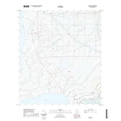
1935 Map of Belle Isle
USGS Topo · Published 1935About this map
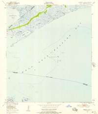
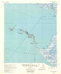
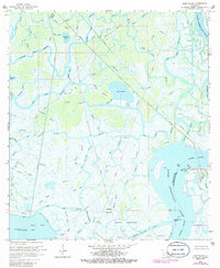
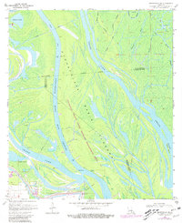
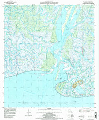
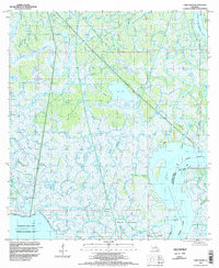
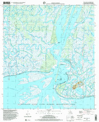
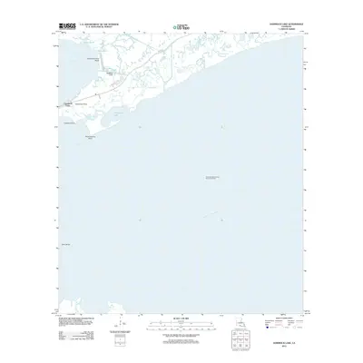
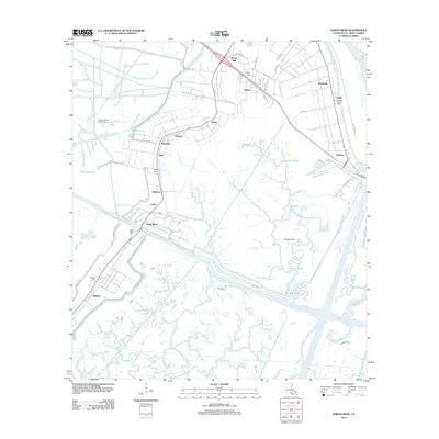
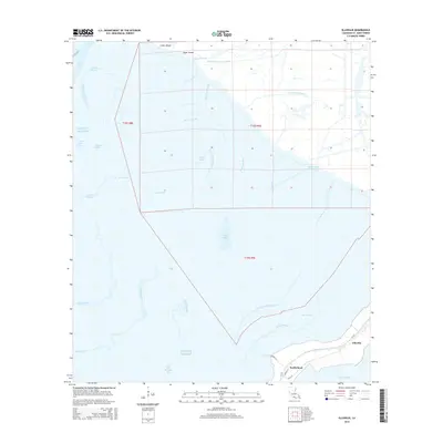
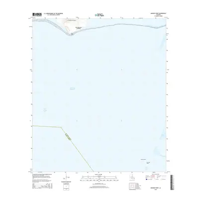
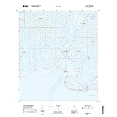
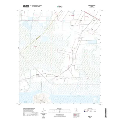
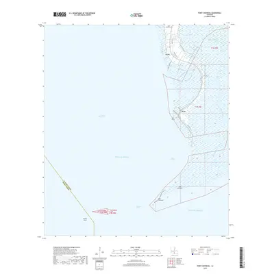
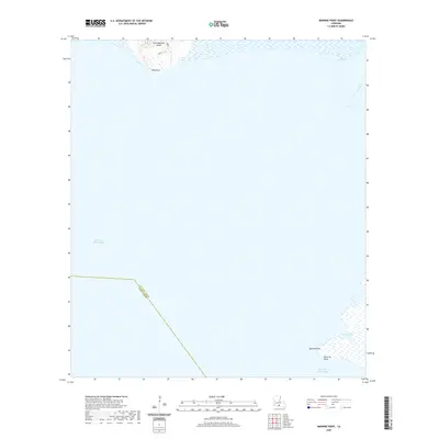
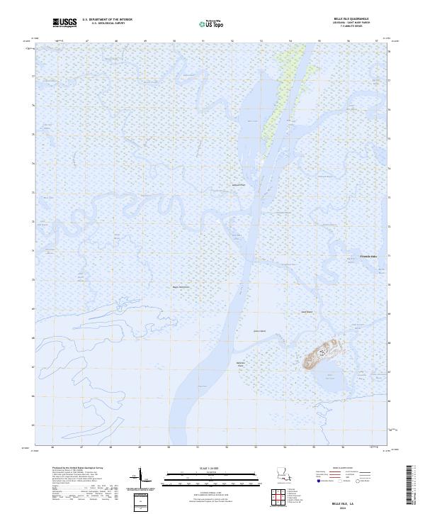
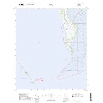
Belle Isle and the surrounding marshlands of Plaquemines Parish appear here during a 1935 field examination, a period when the Louisiana coastline was being documented via early aerial photography by the U.S. Army Air Corps. This coastal landscape is a complex network of wetlands and tidal channels, defined by major water bodies like Black Bay and California Bay. The map highlights the shifting nature of the delta, where landforms like Stone Island and landmarks such as Telegraph Point provided essential navigation markers for those working these waters. The presence of numerous passes and bayous, including Bel La Pass, Julius Bayou, and the aptly named Bayou Lost, illustrates the intricate hydrology of the region before significant modern coastal erosion and engineering altered the footprint of the marsh.
Find a feature on this map
15 named features on this map. Tap any name to fly to it.
Don’t see what you’re looking for? This feature index may not catch every label — zoom into the map to look around manually.
Map Details
Editions of this 1935 Belle Isle Map
This is the sole edition of this map. No revisions or reprints were ever made.
Historical Maps of Fivemile Oaks Through Time
77 maps found
1935 Belle Isle
St. Mary Parish, LA

1937 Bayou Sale
St. Mary Parish, LA

1941 Belle Isle
St. Mary Parish, LA
1949 Hammock Lake
St. Mary Parish, LA

1954 Belle Isle
St. Mary Parish, LA

1957 Bayou Sale
St. Mary Parish, LA
1957 Point Au Fer
St. Mary Parish, LA
1963 Kemper
St. Mary Parish, LA
1966 Belle Isle
St. Mary Parish, LA
1966 Lake Salve
St. Mary Parish, LA
1966 North Bend
St. Mary Parish, LA
1967 Belle Isle
St. Mary Parish, LA
1968 Hammock Lake
St. Mary Parish, LA
1970 Centerville NW
St. Mary Parish, LA
1970 Ellerslie
St. Mary Parish, LA
1970 Marone Point
St. Mary Parish, LA
1970 Point Chevreuil
St. Mary Parish, LA
1994 Belle Isle
St. Mary Parish, LA
1994 Ellerslie
St. Mary Parish, LA
1994 Hammock Lake
St. Mary Parish, LA
1994 Kemper
St. Mary Parish, LA
1994 Lake Salve
St. Mary Parish, LA
1994 Marone Point
St. Mary Parish, LA
1994 North Bend
St. Mary Parish, LA
1994 Point Chevreuil
St. Mary Parish, LA
1998 Belle Isle
St. Mary Parish, LA
2012 Belle Isle
St. Mary Parish, LA
2012 Centerville NW
St. Mary Parish, LA
2012 Ellerslie
St. Mary Parish, LA
2012 Hammock Lake
St. Mary Parish, LA
2012 Kemper
St. Mary Parish, LA
2012 Lake Salve
St. Mary Parish, LA
2012 Marone Point
St. Mary Parish, LA
2012 North Bend
St. Mary Parish, LA
2012 Point Chevreuil
St. Mary Parish, LA
2015 Belle Isle
St. Mary Parish, LA
2015 Centerville NW
St. Mary Parish, LA
2015 Ellerslie
St. Mary Parish, LA
2015 Hammock Lake
St. Mary Parish, LA
2015 Kemper
St. Mary Parish, LA
2015 Lake Salve
St. Mary Parish, LA
2015 Marone Point
St. Mary Parish, LA
2015 North Bend
St. Mary Parish, LA
2015 Point Chevreuil
St. Mary Parish, LA
2015 South of Belle Isle
St. Mary Parish, LA
2018 Belle Isle
St. Mary Parish, LA
2018 Centerville NW
St. Mary Parish, LA
2018 Ellerslie
St. Mary Parish, LA
2018 Hammock Lake
St. Mary Parish, LA
2018 Kemper
St. Mary Parish, LA
2018 Lake Salve
St. Mary Parish, LA
2018 Marone Point
St. Mary Parish, LA
2018 North Bend
St. Mary Parish, LA
2018 Point Chevreuil
St. Mary Parish, LA
2018 South of Belle Isle
St. Mary Parish, LA
2020 Belle Isle
St. Mary Parish, LA
2020 Centerville NW
St. Mary Parish, LA
2020 Ellerslie
St. Mary Parish, LA
2020 Hammock Lake
St. Mary Parish, LA
2020 Kemper
St. Mary Parish, LA
2020 Lake Salve
St. Mary Parish, LA
2020 Marone Point
St. Mary Parish, LA
2020 North Bend
St. Mary Parish, LA
2020 Point Chevreuil
St. Mary Parish, LA
2020 South of Belle Isle
St. Mary Parish, LA
2024 Belle Isle
St. Mary Parish, LA
2024 Centerville NW
St. Mary Parish, LA
2024 Ellerslie
St. Mary Parish, LA
2024 Hammock Lake
St. Mary Parish, LA
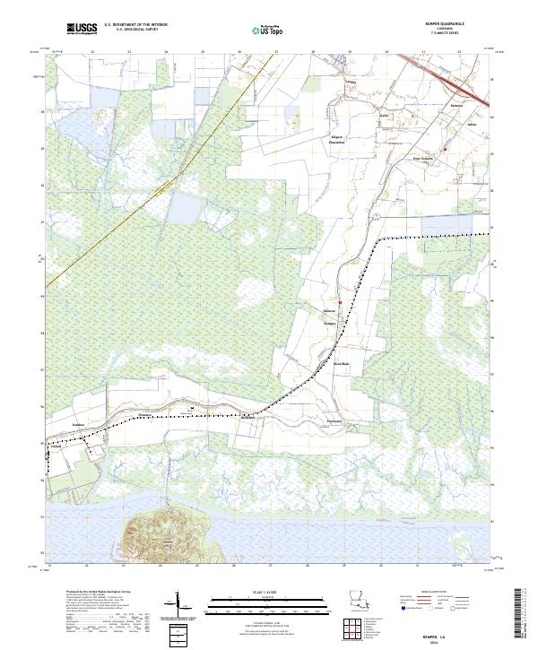
2024 Kemper
St. Mary Parish, LA
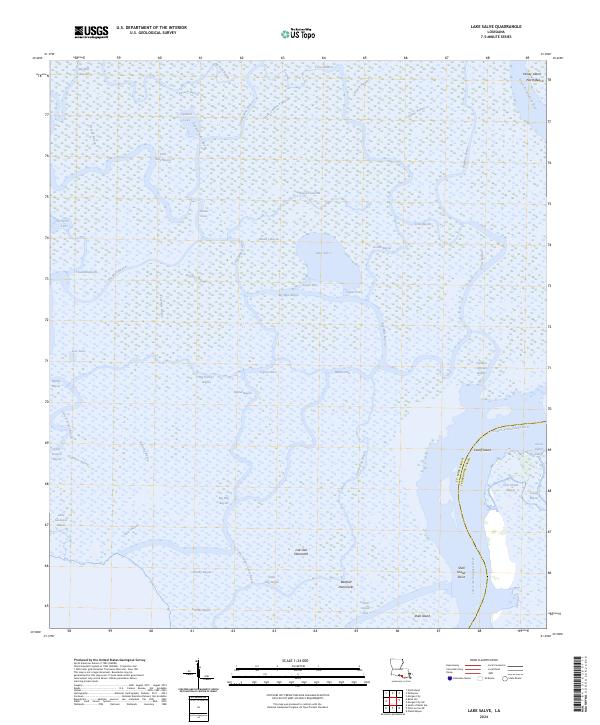
2024 Lake Salve
St. Mary Parish, LA
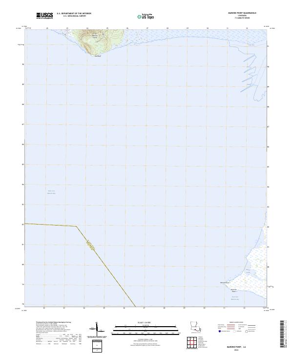
2024 Marone Point
St. Mary Parish, LA
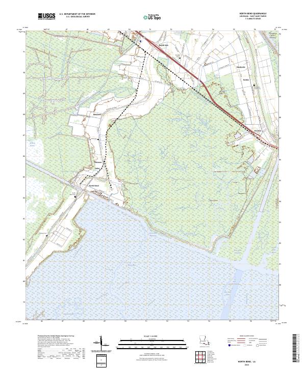
2024 North Bend
St. Mary Parish, LA
2024 Point Chevreuil
St. Mary Parish, LA
2024 South of Belle Isle
St. Mary Parish, LA
2025 Point Chevreuil
St. Mary Parish, LA
2025 South of Belle Isle
St. Mary Parish, LA