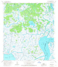
1966 Map of Lake Salve
USGS Topo · Published 1967About this map
Lake Salve lies at the center of this intricate wetland environment in St. Mary Parish and Terrebonne Parish, where a dense network of waterways defines the landscape before it opens into Atchafalaya Bay. The complex hydrology of the mid-1960s is evidenced by the convergence of major arteries like the Big Wax Bayou and Lower Atchafalaya River with smaller, winding channels such as Fishtrap Bayou and Myrtle Bayou. Named terrestrial high points like Beadles, Live Oak Hammock, and the Wetfoot Hammocks emerge from the surrounding marsh, providing critical footing in an otherwise fluid geography. The presence of several Oil Wells and a prominent Pipeline corridor near Chicken Island Bayou reflects the era's active industrial footprint within the Louisiana coastal marshes.
Find a feature on this map
44 named features on this map. Tap any name to fly to it.
Don’t see what you’re looking for? This feature index may not catch every label — zoom into the map to look around manually.
Map Details
Editions of this 1966 Lake Salve Map
3 editions found
Other maps of this area

1932 · Lake Decade
USGS Topo · 1:62,500

1935 · Belle Isle
USGS Topo · 1:31,680

1935 · Morgan City
USGS Topo · 1:62,500

1941 · Belle Isle
USGS Topo · 1:62,500

1945 · New Orleans
USGS Topo · 1:250,000

1954 · Morgan City
USGS Topo · 1:62,500

1954 · Belle Isle
USGS Topo · 1:62,500

1957 · Lake Decade
USGS Topo · 1:62,500

1957 · Point Au Fer
USGS Topo · 1:62,500

1963 · New Orleans
USGS Topo · 1:250,000