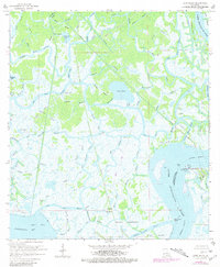
1966 Map of Lake Salve
USGS Topo · Published 1981About this map
Lake Salve lies at the heart of this intricate network of waterways in St. Mary and Terrebonne Parishes. The landscape is dominated by the Lower Atchafalaya River and a labyrinth of tidal passages including Big Wax Bayou, Little Wax Bayou, and Cross Canal. This mid-century survey captures the region's heavy industrial footprint, specifically the Belle Isle Gas and Oil Field and numerous pipelines that cut across the marshes. Small rises in elevation are marked by local landmarks like Live Oak Hammock and Wetfoot Hammocks, which stand in contrast to the surrounding wetlands and open waters of Spanish Lake and Bateman Lake. The map reveals a specialized coast economy dependent on dredging and mineral extraction, noted by several oil wells and the strategic Shell Island Point at the river's mouth.
Find a feature on this map
65 named features on this map. Tap any name to fly to it.
Don’t see what you’re looking for? This feature index may not catch every label — zoom into the map to look around manually.
Map Details
Editions of this 1966 Lake Salve Map
3 editions found
Other maps of this area

1932 · Lake Decade
USGS Topo · 1:62,500

1935 · Belle Isle
USGS Topo · 1:31,680

1935 · Morgan City
USGS Topo · 1:62,500

1941 · Belle Isle
USGS Topo · 1:62,500

1945 · New Orleans
USGS Topo · 1:250,000

1954 · Morgan City
USGS Topo · 1:62,500

1954 · Belle Isle
USGS Topo · 1:62,500

1957 · Lake Decade
USGS Topo · 1:62,500

1957 · Point Au Fer
USGS Topo · 1:62,500

1963 · New Orleans
USGS Topo · 1:250,000