
1963 Map of New Orleans
USGS Topo · Published 1963About this map
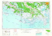
Bayou Teche and the Mississippi River anchor this expansive mapping of the Louisiana coast during the mid-twentieth century. The intricate transition from the sugar-cane-growing inland parishes to the marshy littoral is documented through an extensive network of waterways and early oil industry infrastructure. Significant settlements like Houma, New Iberia, and Morgan City serve as hubs for commerce, while the rail lines of the Southern Pacific and Texas and Pacific railroads illustrate the vital transport links connecting the Gulf to the interior.
Find a feature on this map
121 named features on this map. Tap any name to fly to it.
Don’t see what you’re looking for? This feature index may not catch every label — zoom into the map to look around manually.
Map Details
Editions of this 1963 New Orleans Map
4 editions found
Other maps of this area

1891 · Hahnville
USGS Topo · 1:62,500

1891 · Spanish Fort
USGS Topo · 1:62,500

1891 · Pointe a La Hache
USGS Topo · 1:62,500

1891 · New Orleans
USGS Topo · 1:62,500

1892 · Barataria
USGS Topo · 1:62,500

1892 · Cheniere Caminada
USGS Topo · 1:62,500

1892 · Lac Des Allemands
USGS Topo · 1:62,500

1892 · Chef Menteur
USGS Topo · 1:62,500

1892 · Mount Airy
USGS Topo · 1:62,500

1892 · Gibson
USGS Topo · 1:62,500