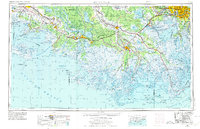
1963 Map of New Orleans
USGS Topo · Published 1974About this map
Houma and the surrounding coastal parishes are shown here in the early 1970s, at a time when the interplay between the petroleum industry and the complex bayou network was heavily defined by modern infrastructure. The Southern Pacific railroad and Highway 90 anchor a string of settlements from New Iberia through Morgan City to Thibodaux, reflecting the historical development along the natural levees. The vast Basin Floodway and the Atchafalaya River dominate the central landscape, highlighting the massive engineering required to manage the delta's water. Off the coast, the map documents the intricate geography of the barrier islands and marshes, including Marsh Island and the Isles Dernieres, while the US Naval Air Station near the Mississippi River illustrates the strategic importance of the region during the Cold War era.
Find a feature on this map
125 named features on this map. Tap any name to fly to it.
Don’t see what you’re looking for? This feature index may not catch every label — zoom into the map to look around manually.
Map Details
Editions of this 1963 New Orleans Map
4 editions found

Other maps of this area

1891 · Hahnville
USGS Topo · 1:62,500

1891 · Spanish Fort
USGS Topo · 1:62,500

1891 · Pointe a La Hache
USGS Topo · 1:62,500

1891 · New Orleans
USGS Topo · 1:62,500

1892 · Barataria
USGS Topo · 1:62,500

1892 · Cheniere Caminada
USGS Topo · 1:62,500

1892 · Lac Des Allemands
USGS Topo · 1:62,500

1892 · Chef Menteur
USGS Topo · 1:62,500

1892 · Mount Airy
USGS Topo · 1:62,500

1892 · Gibson
USGS Topo · 1:62,500