Old Maps of Houma, Louisiana
Explore 30 old maps of Houma, spanning from 1892 to today. These high-resolution historic maps reveal how streets, neighborhoods, landmarks, and natural features evolved over time — perfect for genealogy, metal detecting, research, and local history exploration.
What you can do with these maps:
- See how Houma changed over time: Compare historical maps to modern-day views to trace roads, homesites, rail lines & more.
- View detailed metadata: Each map includes creators, publishers, year, scale, and archive source.
- Overlay maps with satellite & LiDAR: Visualize the past alongside modern tools to explore terrain & human change.
- Trusted historical sources: Maps sourced from the USGS, Library of Congress, and other archives.
- Access maps your way: View online, download high-res files, or order prints for personal or research use.
Start exploring old maps of Houma to uncover forgotten places, hidden landmarks, and the deep history beneath your feet.
Houma, LA maps
(30)- 1892 Map of Gibson
 1892 Gibson1892 Print · USGSCoastal Louisiana in the early 1890s is captured here as a landscape of bayous and new rail lines. Genealogists and historians can trace family land along Bayou Black or locate old railway stops at Gibson, Chacahoula, and Schriever.4 unique versions available
 - 1892 Map of Houma
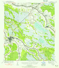
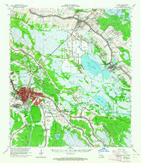
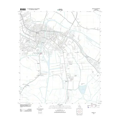
 1892 Houma1892 Print · USGSCoastal Louisiana in the 1890s shows a landscape of waterborne commerce and rising rail lines. Genealogists and historians can trace old homesteads along Bayou Lafourche or study the early street grid of Houma and the path of the Southern Pacific Railroad.4 unique versions available
 - 1897 Map of Gibson
 1897 Gibson1897 Print · USGSCoastal Louisiana in the late nineteenth century was a world defined by its waterways and the rising influence of the rail. Genealogists and researchers can trace the early layout of bayou settlements like Schriever, Ellendale, and Chacahoula along the Southern Pacific Railroad.
 - 1932 Map of Houma SW
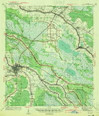
 1932 Houma SW1932 Print · USGSCoastal Louisiana at the height of the early thirties shows a region defined by its water-bound industry and growing infrastructure. Genealogists and historians can trace family-named sites like Southdown and Ashland, or locate rural landmarks such as Jerusalem Ch and the Bayou Cane Sch.
 - 1939 Map of Gibson, 1956 Print
 1939 Gibson1956 Print · USGSCoastal Louisiana at the end of the thirties was a world of rail-side settlements and bayou-based commerce. You can trace the lineage of small parish communities through Beattieville Gray P O, Mt Pilgrim Ch, and the Halfway Cem.
 - 1939 Map of Houma, 1956 Print
 1939 Houma1956 Print · USGSCoastal Louisiana settlement follows the high ridges of the bayous just before the mid-century industrial boom. Genealogists can trace family names and rural landmarks from Aragon Plantation to the St Elie Cem and old Mechanicville neighborhoods.
 - 1941 Map of Houma
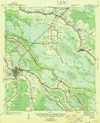
 1941 Houma1941 Print · USGSIn the bayou country just before the war, the region around Houma shows a complex web of water-based trade and rail-linked industry. Researchers can trace historic parish life through family-named landmarks and institutions like Aragon Plantation, St Elie Cem, and the Prairie Sch.
 - 1941 Map of Gibson
 1941 Gibson1941 Print · USGSCajun country and the sugarcane belt are mapped here just before the war, showing the rail-and-water corridors of the southern parishes. Genealogists can trace family names and local landmarks through sites like Beattleville Gray P O, Bull Run Sch, and Halfway Cem.
 - 1944 Map of Houma
 1944 Houma1944 Print · USGSCoastal Louisiana during the mid-forties reveals a landscape shaped by its bayous and the early expansion of the Intracoastal Waterway. Researchers can trace genealogical roots through local landmarks like Aragon Plantation, St Elie Cem, and St Louis Chapel.
 - 1944 Map of Gibson
 1944 Gibson1944 Print · USGSCoastal Louisiana during the mid-forties reveals a landscape defined by delta bayous and early industrial rail lines. Genealogists can locate family landmarks like Mt Pilgrim Ch, St Johns Ch, and the Beattieville Gray PO.
 - 1945 Map of New Orleans
 1945 New Orleans1945 Print · USGSCoastal Louisiana and the Mississippi delta are captured here just after the war, showing the region's transition into a modern industrial and transit hub. Genealogists can trace family settlements along Bayou Teche or identify rail stops for the Illinois Central and Texas & Pacific lines.
 - 1963 Map of New Orleans
 1963 New Orleans1963 Print · USGSCoastal Louisiana in the mid-twentieth century reveals a complex world of bayou settlements, expanding oil fields, and vital rail networks. Genealogists and historians can trace family roots through river towns like Thibodaux or follow the Southern Pacific line through Franklin and Patterson.4 unique versions available
 - 1963 Map of Houma, 1964 Print
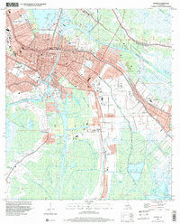
 1963 Houma1964 Print · USGSLouisiana's bayou country is captured here during a period of industrial and infrastructure growth in the early sixties. Genealogists and local historians can trace family locations near Woodlawn Cem, St John Cem, and the specialized South Terrebonne High Sch.4 unique versions available
 - 1963 Map of Houma, 1964 Print
 1963 Houma1964 Print · USGSCoastal Louisiana in the early sixties is a landscape of complex bayous and expanding energy fields. Trace family history at Myrtle Grove Cem and Aragon Plantation, or follow the industrial growth around the Hollywood Gas Field.4 unique versions available
 - 1964 Map of Gibson, 1965 Print
 1964 Gibson1965 Print · USGSSouthern Louisiana in the mid-1960s was a landscape defined by the intersection of the energy industry and historic plantations. Genealogists can trace family roots through sites like Magnolia Cem, Buzzard Roost Ch, and the Edward Daigle Drive-in Theater.3 unique versions available
 - 1964 Map of Humphreys, 1965 Print
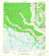
 1964 Humphreys1965 Print · USGSTerrebonne Parish settlements and oil fields thrive along the wetlands in the mid-sixties. Genealogists and historians can trace local landmarks like St Anthonys Cem, the Bayou Black Sch, and the rail siding at Hollywood.3 unique versions available
 - 1966 Map of New Orleans
 1966 New Orleans1966 Print · USGSCoastal Louisiana in the mid-1960s reveals a transition from traditional bayou life to an intensive offshore oil and gas economy. Researchers can trace the rail lines of the Southern Pacific RR through Morgan City or locate the Eugene Island Lighthouse among the delta's shifting marshes.
 - 1983 Map of New Orleans
 1983 New Orleans1983 Print · USGSSoutheast Louisiana in the early eighties reveals a landscape where the urban density of New Orleans meets the vast wetlands of the Salvador State Wildlife Management Area. Genealogists and historians can trace the traditional bayou settlements of Houma and Thibodaux alongside major rail lines like the Southern Pacific.2 unique versions available
 - 1998 Map of Houma, 2000 Print
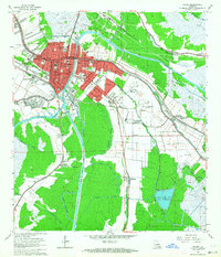
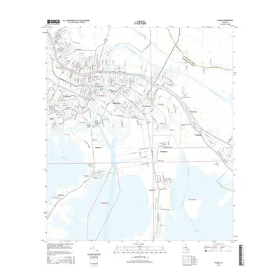
 1998 Houma2000 Print · USGSCoastal Louisiana settlement patterns are on full display in this late-nineties survey of the Terrebonne Parish hub. Researchers can trace family history through a network of local landmarks like Myrtle Grove Cem, Jerusalem Ch, and the Agricultural Experiment Station.
 - 1998 Map of Humphreys, 2000 Print
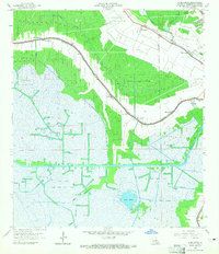
 1998 Humphreys2000 Print · USGSCoastal Terrebonne Parish in the late nineties showcases a landscape shaped by petroleum and the winding bayous of southern Louisiana. Genealogists and historians can trace local landmarks like Bayou Black Sch, St Lukes Ch, and the settlements of Humphreys and Waterproof.
 - 2012 Map of Humphreys, 2012 Print
 2012 Humphreys2012 Print · USGSCovers Houma, including Humphreys, Hollywood, and other nearby areas
 - 2012 Map of Houma, 2012 Print
 2012 Houma2012 Print · USGSCovers Houma, including Argyle, Mulberry, and other nearby areas
 - 2015 Map of Humphreys, 2015 Print
 2015 Humphreys2015 Print · USGSCovers Houma, including Humphreys, Hollywood, and other nearby areas
 - 2015 Map of Houma, 2015 Print
 2015 Houma2015 Print · USGSCovers Houma, including Argyle, Mulberry, and other nearby areas
 - 2018 Map of Humphreys, 2018 Print
 2018 Humphreys2018 Print · USGSCovers Houma, including Humphreys, Hollywood, and other nearby areas
Showing maps 1-25 of 30
Top cities near Houma
- Thibodaux historical maps
- Chauvin historical maps
- Lockport historical maps
- Dulac historical maps
- Montegut historical maps
Top neighborhoods of Houma
Frequently asked questions
- What are the different types of historical maps available for Houma?
- What is the oldest map of Houma?
- Where can I purchase historical maps of Houma for my home or office?
- Where can I download high-res historical maps of Houma?
- Are there historical topographic maps available for Houma?
- Is there historical aerial imagery available for Houma?
- Where are historical maps of Houma sourced from?