1970s Maps of Independence Historic District, Independence
Explore 2 historic maps of Independence Historic District from the 1970s. These maps offer a rare glimpse into what life looked like during the 1970s — showing old roads, neighborhoods, homes, and landmarks that have changed or disappeared over time.
Whether you're researching your family's past, planning a metal detecting trip, or studying how Independence Historic District's landscape evolved across the 1970s, these high-resolution maps are a powerful tool for exploring the history of this region.
- Focus on a specific era: All maps on this page are from the 1970s, giving you a focused view of this time period.
- See what’s changed: Compare century-old streets, trails, and buildings to today's modern landscape using overlays and satellite layers.
- Research with precision: Use these maps for genealogy, historical research, land use analysis, or educational projects.
- View, download, or print: Maps are fully viewable online in high resolution, and can be downloaded or printed for your own records.
Start exploring Independence Historic District's history through authentic maps from the 1970s. This is your window into the past.
Independence Historic District, Independence maps
(2)- 1974 Map of Amite, 1978 Print
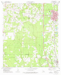 1974 Amite1978 Print · USGSThe Tangipahoa Parish landscape in the mid-seventies shows the steady growth of Amite and Independence along the vital Illinois Central Gulf rail corridor. Genealogists and historians can trace numerous family landmarks, from Baham Cem and Durbin Cem to local spiritual centers like Harris Chapel.
 - 1974 Map of Amite, 1978 Print
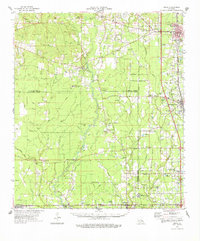 1974 Amite1978 Print · USGSSoutheastern Louisiana’s parish boundaries and river bottoms come into focus in the mid-seventies. Genealogists can trace family names through rural landmarks like Sharkey Cem, Leonard Chapel, and the Illinois Central Gulf rail corridor.
End of results
Showing maps 1-2 of 2
Frequently asked questions
- What are the different types of historical maps available for Independence Historic District?
- What is the oldest map of Independence Historic District?
- Where can I purchase historical maps of Independence Historic District for my home or office?
- Where can I download high-res historical maps of Independence Historic District?
- Are there historical topographic maps available for Independence Historic District?
- Is there historical aerial imagery available for Independence Historic District?
- Where are historical maps of Independence Historic District sourced from?