Old Maps of Forked Island, Louisiana for Academic Research
Study the evolution of Forked Island with 15 high-resolution historic maps. Whether you're teaching, researching, or modeling changes in land use, these maps provide essential visual documentation of urban, environmental, and geographic change.
- Analyze long-term change: Track patterns in development, transportation, and natural features.
- Ideal for environmental or urban studies: Support academic projects with primary historical map data.
- Use in the classroom or lab: Educators and researchers rely on these maps to bring historical context to life.
These maps are a powerful tool for teaching, research, and visualizing how Forked Island has changed over the decades.
Forked Island, LA maps
(15)- 1946 Map of Schooner Bayou SE
 1946 Schooner Bayou SE1946 Print · USGSVermilion Parish coastal marshes were undergoing significant transformation in the mid-forties as navigation projects reshaped the wetlands. Genealogists and local historians can trace the residents of Forked Island, find the local Sch, and locate ferry points near Pevley and Isle Marrone.
 - 1954 Map of Schooner Bayou SE
 1954 Schooner Bayou SE1954 Print · USGSCoastal Vermilion Parish in the mid-fifties is a landscape of maritime navigation and isolated prairie ridges. Researchers can trace the water-dependent settlement patterns of Forked Island, the strategic U S Locks, and family-named landmarks like Thannas Island.
 - 1954 Map of Port Arthur
 1954 Port Arthur1954 Print · USGSThe Texas and Louisiana coastlines meet here in the mid-fifties, showing the industrial rise of Port Arthur alongside vast wildlife preserves. Researchers can trace remote coastal settlements and infrastructure like Pecan Island, the Sabine Pass Lighthouse, and the North Island School.
 - 1955 Map of Forked Island, 1956 Print
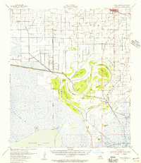 1955 Forked Island1956 Print · USGSCoastal Vermilion Parish marshlands come to life in the 1950s, showing the intersection of new industry and old maritime routes. Genealogists can trace family roots through sites like St Davids Ch, Hebert Cem, and the private airstrips at Kaplan.2 unique versions available
 - 1956 Map of Port Arthur, 1965 Print
 1956 Port Arthur1965 Print · USGSThe Texas and Louisiana coastlines meet here in the mid-fifties, showing a landscape of sprawling marshes and growing refinery towns. Genealogists and historians can trace ridge settlements like Grand Cheniere or find the Sabine Pass Lighthouse and Pecan Island.3 unique versions available
 - 1958 Map of Port Arthur
 1958 Port Arthur1958 Print · USGSThe Texas and Louisiana coastlines meet in the late fifties at the busy industrial port of Port Arthur. Historians and genealogists can trace the early rail networks of the Southern Pacific and locate coastal settlements like Cameron, Pecan Island, and Abbeville.
 - 1959 Map of Port Arthur
 1959 Port Arthur1959 Print · USGSThe Texas and Louisiana coastlines meet in this late-fifties study of a landscape defined by industry and wildlife preserves. Trace the Intracoastal Waterway past Pecan Island and Abbeville, or locate the shipping channels at Sabine Pass.
 - 1973 Map of Port Arthur, 1974 Print
 1973 Port Arthur1974 Print · USGSThe Texas-Louisiana borderlands in the early seventies reveal an intricate landscape of coastal marshes and heavy industry. Trace the growth of Port Arthur, the extent of the oil and gas fields, and old ridge settlements like Pecan Island.
 - 1979 Map of Forked Island, 1980 Print
 1979 Forked Island1980 Print · USGSVermilion Parish in the late 1970s shows a complex landscape of rice agriculture and marshland navigation. Genealogists and local historians can locate Harrington Cem, the settlement of Marrone, and private aviation sites like the Hebert Landing Strip.
 - 1983 Map of White Lake
 1983 White Lake1983 Print · USGSCoastal Louisiana at the start of the 1980s reveals a world of remote chenier settlements and vast marshlands. Genealogists and historians can trace family locations along Grand Chenier Ridge or explore the hubs of Abbeville and Intracoastal City.2 unique versions available
 - 2012 Map of Forked Island, 2012 Print
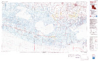
 2012 Forked Island2012 Print · USGSCovers Forked Island, including Vermilion Parish, United States, and other nearby areas
 - 2015 Map of Forked Island, 2015 Print
 2015 Forked Island2015 Print · USGSCovers Forked Island, including Vermilion Parish, United States, and other nearby areas
 - 2018 Map of Forked Island, 2018 Print
 2018 Forked Island2018 Print · USGSCovers Forked Island, including Vermilion Parish, United States, and other nearby areas
 - 2020 Map of Forked Island, 2020 Print
 2020 Forked Island2020 Print · USGSCovers Forked Island, including Vermilion Parish, United States, and other nearby areas
 - 2024 Map of Forked Island, 2024 Print
 2024 Forked Island2024 Print · USGSCoastal Vermilion Parish in the early 2020s reveals a marshland landscape of isolated islands and essential waterways. Genealogists and researchers can trace the locations of Harrington, Suire Cem, and the Immaculate Conception Cem along the Intracoastal Waterway.
End of results
Showing maps 1-15 of 15
Top cities near Forked Island
Frequently asked questions
- What are the different types of historical maps available for Forked Island?
- What is the oldest map of Forked Island?
- Where can I purchase historical maps of Forked Island for my home or office?
- Where can I download high-res historical maps of Forked Island?
- Are there historical topographic maps available for Forked Island?
- Is there historical aerial imagery available for Forked Island?
- Where are historical maps of Forked Island sourced from?