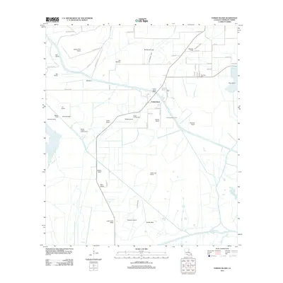
2012 Map of Forked Island
USGS Topo · Published 2012About this map
Forked Island centers this coastal Louisiana landscape where the wetlands of Vermilion Parish meet a complex network of artificial and natural waterways. The settlement at Oak Point and the residential stretch of Little Prairie Ridge are defined by their proximity to Canal Number Ten, Warren Canal, and the Isle Marrone Canal. This era is characterized by an economy balancing agriculture with energy extraction, as evidenced by the Forked Island Gas Field. Genealogy researchers will find significant family-named sites, including Harrington Cem and Suire Cem, alongside private aviation facilities like the Hebert Landing Strip and Flying J Ranch Landing Strip. The southern portion of the map is dominated by the marshy expanse of Schooner Island, Turtle Lake Island, and the winding Schooner Bayou, illustrating the intricate land-and-water interface of the Cajun prairie and coastal marsh.
Find a feature on this map
67 named features on this map. Tap any name to fly to it.
Don’t see what you’re looking for? This feature index may not catch every label — zoom into the map to look around manually.
Map Details
Editions of this 2012 Forked Island Map
This is the sole edition of this map. No revisions or reprints were ever made.
Other maps of this area

1932 · Abbeville SW
USGS Topo · 1:31,680

1932 · Abbeville NW
USGS Topo · 1:31,680

1945 · Pecan Island NW
USGS Topo · 1:31,680

1945 · Pecan Island NE
USGS Topo · 1:31,680

1946 · Schooner Bayou SE
USGS Topo · 1:31,680

1946 · Schooner Bayou NE
USGS Topo · 1:31,680

1946 · Redfish Point NW
USGS Topo · 1:31,680

1946 · Schooner Bayou NW
USGS Topo · 1:31,680

1946 · Schooner Bayou SW
USGS Topo · 1:31,680

1951 · Pecan Island
USGS Topo · 1:62,500