Old Maps of Haddens, Louisiana for Academic Research
Study the evolution of Haddens with 14 high-resolution historic maps. Whether you're teaching, researching, or modeling changes in land use, these maps provide essential visual documentation of urban, environmental, and geographic change.
- Analyze long-term change: Track patterns in development, transportation, and natural features.
- Ideal for environmental or urban studies: Support academic projects with primary historical map data.
- Use in the classroom or lab: Educators and researchers rely on these maps to bring historical context to life.
These maps are a powerful tool for teaching, research, and visualizing how Haddens has changed over the decades.
Haddens, LA maps
(14)- 1944 Map of Wiergate
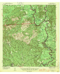 1944 Wiergate1944 Print · USGSNewton County and the Sabine River borderlands are captured here in the mid-1940s during the peak of the local timber era. Genealogists and researchers can trace family landmarks like Toledo Cem, the Gulf Northern rail line, and the rural Mayflower Sch.2 unique versions available
 - 1948 Map of Wiergate, 1954 Print
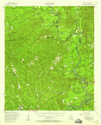
 1948 Wiergate1954 Print · USGSThe Sabine River bottomlands and the timbered hills of Newton County are mapped here in the late 1940s. Genealogists and historians can trace rural life through landmarks like Anthonys Ferry, Scott Cem, and the old Sycamore Sch in the heart of the Sabine National Forest.
 - 1953 Map of Alexandria, 1963 Print
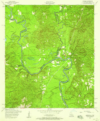
 1953 Alexandria1963 Print · USGSCentral Louisiana during the early fifties is mapped here at the intersection of the piney woods and the Red River valley. Genealogists and historians can trace the rail-and-river network connecting towns like Alexandria, Natchitoches, and the grounds of Camp Beauregard.3 unique versions available
 - 1954 Map of Wiergate, 1958 Print
 1954 Wiergate1958 Print · USGSThe Sabine River bottomlands and the pine forests of Newton County are shown here in the mid-1950s. Genealogists and local historians can trace family locations through sites like Anthonys Ferry, Fairmount Cemetery, and the Survey School.3 unique versions available
 - 1954 Map of Haddens, 1958 Print
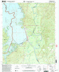
 1954 Haddens1958 Print · USGSThe Sabine River basin at the Louisiana-Texas border comes to life in this mid-century survey. You can trace old river crossings and family landmarks like Anthonys Ferry, Toledo Cemetery, and Freedom Rest Church.3 unique versions available
 - 1955 Map of Alexandria
 1955 Alexandria1955 Print · USGSCentral Louisiana in the mid-fifties is a landscape of river-port cities, sprawling timberlands, and massive military reservations. Genealogists and historians can trace the rail networks of the Texas & Pacific RR and locate sites like Camp Polk Military Reservation and Natchitoches.
 - 1985 Map of Haddens
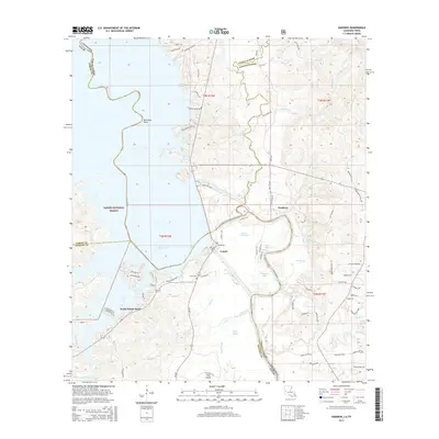
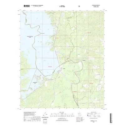
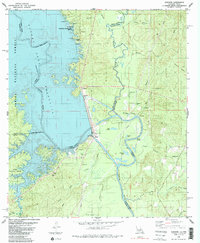 1985 Haddens1985 Print · USGSThe Sabine River borderlands in the mid-eighties show a landscape shaped by the reservoir and forest. Researchers can locate the Toledo Mission, trace the Bayou Toro drainage, or find family-named sites like Scott Cem and Haddens.2 unique versions available
 - 1986 Map of Leesville, 1988 Print
 1986 Leesville1988 Print · USGSThe Louisiana-Texas borderlands in the mid-eighties centered on the vast Toledo Bend Reservoir and the timber-rich piney woods. Researchers can trace the Kansas City Southern RR corridor or locate old communities like Wiergate, Rosevine, and Sandel.
 - 2003 Map of Haddens, 2004 Print
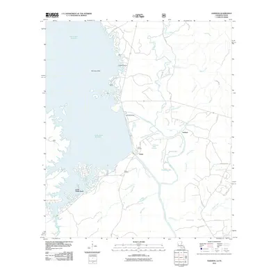
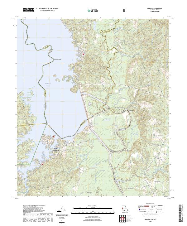
 2003 Haddens2004 Print · USGSThe Louisiana-Texas borderlands are captured here in the early 2000s, centered on the engineering of the Toledo Bend Reservoir. Genealogists and local historians can locate the Scott Cem, Mt Olive Ch, and the small settlement at Haddens.
 - 2010 Map of Haddens, 2010 Print
 2010 Haddens2010 Print · USGSCovers Haddens, including South Toledo Bend, Toledo, and other nearby areas
 - 2015 Map of Haddens, 2015 Print
 2015 Haddens2015 Print · USGSCovers Haddens, including South Toledo Bend, Toledo, and other nearby areas
 - 2018 Map of Haddens, 2018 Print
 2018 Haddens2018 Print · USGSCovers Haddens, including South Toledo Bend, Toledo, and other nearby areas
 - 2020 Map of Haddens, 2020 Print
 2020 Haddens2020 Print · USGSCovers Haddens, including South Toledo Bend, Toledo, and other nearby areas
 - 2024 Map of Haddens, 2024 Print
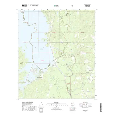
 2024 Haddens2024 Print · USGSThe Sabine River borderlands in the 2020s are defined by the massive reach of the Toledo Bend Reservoir and the surrounding pine forests. Researchers can trace local landmarks like Scott Cem, the community of Haddens, and the intricate wetlands of Packer Swamp.
End of results
Showing maps 1-14 of 14
Top cities near Haddens
Frequently asked questions
- What are the different types of historical maps available for Haddens?
- What is the oldest map of Haddens?
- Where can I purchase historical maps of Haddens for my home or office?
- Where can I download high-res historical maps of Haddens?
- Are there historical topographic maps available for Haddens?
- Is there historical aerial imagery available for Haddens?
- Where are historical maps of Haddens sourced from?