1980s Maps of Webster Parish, Louisiana
Explore 19 historic maps of Webster Parish from the 1980s. These maps offer a rare glimpse into what life looked like during the 1980s — showing old roads, neighborhoods, homes, and landmarks that have changed or disappeared over time.
Whether you're researching your family's past, planning a metal detecting trip, or studying how Webster Parish's landscape evolved across the 1980s, these high-resolution maps are a powerful tool for exploring the history of this region.
- Focus on a specific era: All maps on this page are from the 1980s, giving you a focused view of this time period.
- See what’s changed: Compare century-old streets, trails, and buildings to today's modern landscape using overlays and satellite layers.
- Research with precision: Use these maps for genealogy, historical research, land use analysis, or educational projects.
- View, download, or print: Maps are fully viewable online in high resolution, and can be downloaded or printed for your own records.
Start exploring Webster Parish's history through authentic maps from the 1980s. This is your window into the past.
Webster Parish, LA maps
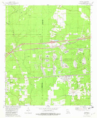
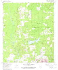
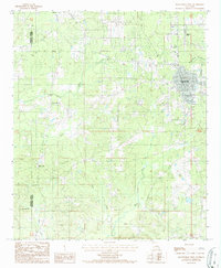
(19)- 1981 Map of Cotton Valley
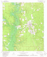 1981 Cotton Valley1981 Print · USGSLouisiana's energy landscape and timberlands are captured here in the early eighties, centered on the oil and gas operations of Cotton Valley. Genealogists can trace family landmarks and rural congregations at Mt Sariah Ch, Hodges Cem, and Greenville Ch.
 - 1981 Map of Shongaloo
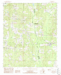
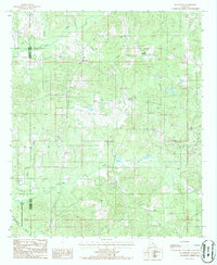
 1981 Shongaloo1981 Print · USGSIn the piney woods of Webster Parish during the early eighties, this survey captures an era defined by petroleum extraction and rural community roots. Local historians can trace family locations near Old Shongaloo, the Shongaloo Lookout Tower, and historical crossings like Sykes Ferry.
 - 1981 Map of Carterville
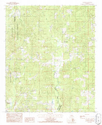
 1981 Carterville1981 Print · USGSNorthwestern Louisiana oil and gas country meets the conservation lands of the Bodcau valley as they appeared in the late seventies. Researchers can trace rural lineages through family-named sites like Walker Chapel and Rogers Cem or locate the Plain Dealing Lookout Tower.
 - 1981 Map of Cullen
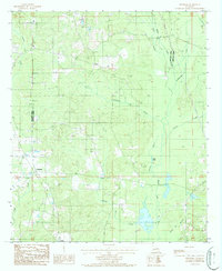
 1981 Cullen1981 Print · USGSNorthwestern Louisiana in the early eighties shows a landscape of industrial development and managed wetlands. Genealogists and historians can trace family sites at Slack Memorial Cem or Taylor Cem, alongside the operations of the South Sarepta Oil and Gas Field.2 unique versions available
 - 1981 Map of Doyline, 1982 Print
 1981 Doyline1982 Print · USGSNorthwest Louisiana at the start of the eighties reveals a complex landscape of military industry and rural settlement. Genealogists and historians can trace family locations near the Louisiana Army Ammunition Plant and old burying grounds like Allen Town Cem and Raine Cem.2 unique versions available
 - 1981 Map of Leton, 1982 Print
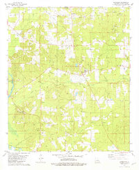
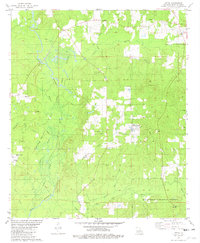 1981 Leton1982 Print · USGSWebster Parish in the early eighties shows a landscape of rural industry and timberland at the edge of the Kisatchie National Forest. Researchers can trace old family sites and local centers such as Old Union Ch, Hodge Cem, and the village of Leton.
 - 1981 Map of Hortman, 1982 Print
 1981 Hortman1982 Print · USGSNorthwest Louisiana during the early eighties shows a landscape of conservation and industry along the Bossier Parish Webster Parish line. Genealogists can trace family landmarks like Hires Chapel, Baten Cem, and Ratcliff Cem near the Bellevue Oil and Gas Field.2 unique versions available
 - 1981 Map of Minden South, 1982 Print
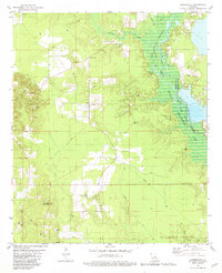
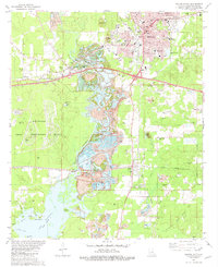 1981 Minden South1982 Print · USGSLouisiana's timber and rail heritage is on display in the early 1980s as the Minden area balances heavy industry with its bayou landscape. Genealogists and historians can locate numerous rural burial grounds like Antioch Cem and landmarks such as the Indian Mound near LAKE BISTINEAU.2 unique versions available
 - 1981 Map of Minden North, 1982 Print
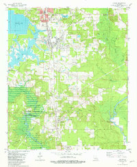
 1981 Minden North1982 Print · USGSWebster Parish at the start of the 1980s reveals a landscape of wooded forest and expanding infrastructure north of Minden. Genealogists can locate family landmarks such as Shady Grove Cems, Blue Run Ch, and the Allen Cem.2 unique versions available
 - 1984 Map of Shreveport
 1984 Shreveport1984 Print · USGSNorthern Louisiana at the peak of the 1980s reveals a landscape of massive water management projects and Cold War military hubs. Trace the rail lines of the Kansas City Southern Ry past Barksdale Air Force Base and the high ground of Driskill Mountain.2 unique versions available
 - 1985 Map of Shreveport South
 1985 Shreveport South1985 Print · USGSNorthwest Louisiana in the mid-eighties shows a landscape defined by the Red River and a transition from urban centers to deep timberland. Researchers can trace the rail-and-river economy through landmarks like Barksdale Air Force Base, the Sligo Oil and Gas Field, and Lake Bistineau.2 unique versions available
 - 1986 Map of Ada
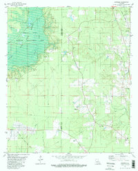
 1986 Ada1986 Print · USGSWebster Parish and the surrounding borderlands are captured here in the mid-1980s, documenting a landscape of rural settlements and winding bayous. Genealogists and local historians can trace the foundations of Ada, Dubberly, and Nine Forks alongside features like Black Lake Bayou and Leatherman Creek.
 - 1986 Map of Langston
 1986 Langston1986 Print · USGSNorth Louisiana during the mid-1980s is defined by the intersection of timberlands and rural crossroads. You can trace the boundaries of the Kisatchie National Forest and locate family landmarks such as the Cem near Langston and Germantown.
 - 1986 Map of Fryeburg
 1986 Fryeburg1986 Print · USGSThe borderlands of Webster and Bienville Parish are captured here in the mid-1980s, showing a rural landscape defined by creek bottoms and local industry. Researchers can trace the communities of Fryeburg and Lawhon, or locate Salt Dome Wells and the Cem near the banks of Black Lake Bayou.
 - 1986 Map of Haynesville West
 1986 Haynesville West1986 Print · USGSThe northern reaches of Claiborne Parish are captured in the mid-1980s, centered on the growing town of Haynesville and its surrounding woodlands. Researchers can trace rural settlement patterns near Millerton, find old gravel operations, or locate landmarks like the Haynesville Airport.
 - 1986 Map of Blackburn
 1986 Blackburn1986 Print · USGSNorthern Louisiana parish life is captured here in the mid-1980s, centered on the communities of Blackburn and Ruple. Local historians can trace family locations near several Cem sites and explore the wooded reaches of the Kisatchie National Forest.
 - 1986 Map of Magnolia
 1986 Magnolia1986 Print · USGSThe Arkansas-Louisiana borderlands in the mid-1980s are defined by the river systems and the reach of the petroleum industry. Genealogists and historians can trace the St Louis Southwestern Railroad through Stamps or locate rural sites like Cleveland Cem and Brightstar.2 unique versions available
 - 1986 Map of Shreveport North
 1986 Shreveport North1986 Print · USGSNorthern Louisiana in the mid-eighties shows a landscape of expansive river bottoms and growing suburban centers. Genealogists and historians can trace the development of Shreveport, the infrastructure of Barksdale Air Force Base, and rural life in Rocky Mount.2 unique versions available
 - 1989 Map of El Dorado, 1990 Print
 1989 El Dorado1990 Print · USGSThe Arkansas-Louisiana borderlands in the late eighties show a landscape of heavy industry and wildlife conservation centered on the Ouachita River. Researchers can trace the legacy of timber and transport via the Missouri Pacific RR, Poison Springs State Forest, and the vast Felsenthal Pool.
End of results
Showing maps 1-19 of 19
Top cities of Webster Parish
- Minden historical maps
- Springhill historical maps
- Cullen historical maps
- Cotton Valley historical maps
- Sibley historical maps
- Sarepta historical maps
See more
Frequently asked questions
- What are the different types of historical maps available for Webster Parish?
- What is the oldest map of Webster Parish?
- Where can I purchase historical maps of Webster Parish for my home or office?
- Where can I download high-res historical maps of Webster Parish?
- Are there historical topographic maps available for Webster Parish?
- Is there historical aerial imagery available for Webster Parish?
- Where are historical maps of Webster Parish sourced from?