2000s (21st Century) Maps of Couley, Louisiana
Explore 6 historic maps of Couley from the 2000s (21st Century). These maps offer a rare glimpse into what life looked like during the 2000s — showing old roads, neighborhoods, homes, and landmarks that have changed or disappeared over time.
Whether you're researching your family's past, planning a metal detecting trip, or studying how Couley's landscape evolved across the 2000s, these high-resolution maps are a powerful tool for exploring the history of this region.
- Focus on a specific era: All maps on this page are from the 2000s, giving you a focused view of this time period.
- See what’s changed: Compare century-old streets, trails, and buildings to today's modern landscape using overlays and satellite layers.
- Research with precision: Use these maps for genealogy, historical research, land use analysis, or educational projects.
- View, download, or print: Maps are fully viewable online in high resolution, and can be downloaded or printed for your own records.
Start exploring Couley's history through authentic maps from the 2000s. This is your window into the past.
Couley, LA maps
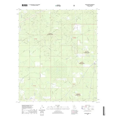
(6)- 2003 Map of Coochie Brake, 2005 Print
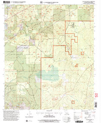 2003 Coochie Brake2005 Print · USGSWinn Parish at the turn of the millennium shows a landscape of timbered forest and lowland swamps. Trace local family history through Bethlehem Ch and Kimbrell Cem, or explore the hydrology of Coochie Brake.
 - 2012 Map of Coochie Brake, 2012 Print
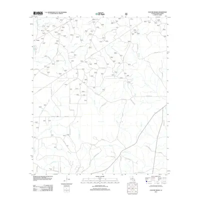 2012 Coochie Brake2012 Print · USGSCovers Couley, including Atlanta, Winn Parish, and other nearby areas
 - 2015 Map of Coochie Brake, 2015 Print
 2015 Coochie Brake2015 Print · USGSCovers Couley, including Atlanta, Winn Parish, and other nearby areas
 - 2018 Map of Coochie Brake, 2018 Print
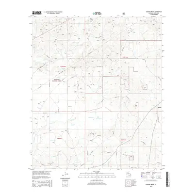
 2018 Coochie Brake2018 Print · USGSCovers Couley, including Atlanta, Winn Parish, and other nearby areas
 - 2020 Map of Coochie Brake, 2020 Print
 2020 Coochie Brake2020 Print · USGSCovers Couley, including Atlanta, Winn Parish, and other nearby areas
 - 2024 Map of Coochie Brake, 2024 Print
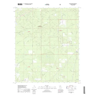
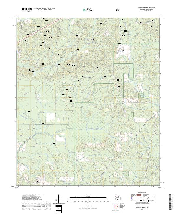 2024 Coochie Brake2024 Print · USGSWinn Parish in the early twenty-first century is defined by its deep woods and the wetlands of the Coochie Brake. Researchers can trace old family sites near Kimbrell Cem or follow the paths of Nantachie Creek and Mars Hill Creek through the Kisatchie National Forest.
End of results
Showing maps 1-6 of 6
Top cities near Couley
- Natchitoches historical maps
- Winnfield historical maps
- Montgomery historical maps
- Natchez historical maps
- Clarence historical maps
- Goldonna historical maps
See more
Frequently asked questions
- What are the different types of historical maps available for Couley?
- What is the oldest map of Couley?
- Where can I purchase historical maps of Couley for my home or office?
- Where can I download high-res historical maps of Couley?
- Are there historical topographic maps available for Couley?
- Is there historical aerial imagery available for Couley?
- Where are historical maps of Couley sourced from?