Old Maps of Winn Parish, Louisiana
Explore 215 old maps of Winn Parish, spanning from 1932 to today. These high-resolution historic maps reveal how streets, neighborhoods, landmarks, and natural features evolved over time — perfect for genealogy, metal detecting, research, and local history exploration.
What you can do with these maps:
- See how Winn Parish changed over time: Compare historical maps to modern-day views to trace roads, homesites, rail lines & more.
- View detailed metadata: Each map includes creators, publishers, year, scale, and archive source.
- Overlay maps with satellite & LiDAR: Visualize the past alongside modern tools to explore terrain & human change.
- Trusted historical sources: Maps sourced from the USGS, Library of Congress, and other archives.
- Access maps your way: View online, download high-res files, or order prints for personal or research use.
Start exploring old maps of Winn Parish to uncover forgotten places, hidden landmarks, and the deep history beneath your feet.
Winn Parish, LA maps
(215)- 1932 Map of Colfax NE
 1932 Colfax NE1932 Print · USGSGrant Parish was undergoing significant forestry management and rural development in the early 1930s. Genealogists and historians can locate the Williana Sch, Zion Hill Ch, and trace the path of the Louisiana and Arkansas railroad.
 - 1932 Map of Colfax NW
 1932 Colfax NW1932 Print · USGSGrant and Winn Parishes come into focus during the early thirties, showing a rural Louisiana landscape defined by its bayous and creek bottoms. Local researchers can trace the locations of the Oak Grove School, Latt Church, and the winding course of Parasol Bayou.
 - 1935 Map of Verda
 1935 Verda1935 Print · USGSThe northern pine woods of Grant and Winn Parishes are documented here during the mid-1930s. Researchers can locate early homestead sites near Lanes Store, the old rail stop at Hargis, and the curiously named Six Bits Cem.
 - 1936 Map of Colfax
 1936 Colfax1936 Print · USGSGrant Parish in the mid-1930s is defined by the sweeping course of the Red River and the expanding reaches of Lake Iatt. Local researchers can trace old family sites and rural institutions like Parsons Cem, Summerfield, and the Oak Grove Sch.2 unique versions available
 - 1937 Map of Montgomery
 1937 Montgomery1937 Print · USGSThe Red River valley in the late thirties is captured here at the junction of three parishes during a period of active river commerce. Trace family roots and local history at Montgomery, Creola Cem, and rural school sites like Ebenezer Sch or Borden Sch.
 - 1942 Map of Montgomery, 1956 Print
 1942 Montgomery1956 Print · USGSCentral Louisiana parish borders meet along the shifting bends of the Red River during the early 1940s. Genealogists and historians can trace the dense settlement of the Cane River valley through landmarks like Cloutierville, St Augustines Ch, and Melrose.
 - 1945 Map of Montgomery
 1945 Montgomery1945 Print · USGSCentral Louisiana life during the 1940s centered on the Red River and the expanding timber industry. Researchers can trace historic family landmarks through schools like Cockfield Sch, churches such as Mt Zion Ch, and the numerous bayous of the Kisatchie National Forest.
 - 1947 Map of Goldonna
 1947 Goldonna1947 Print · USGSNorth Louisiana's timber and rail country is captured here just after the war, showing the rural communities of Natchitoches and Bienville Parishes. Researchers can locate local landmarks like Blooms Mill, trace the Louisiana and Arkansas Railroad, or find old school sites like Readhimer Sch.
 - 1949 Map of Calvin SE
 1949 Calvin SE1949 Print · USGSWinn Parish enters the post-war era as a timber and rail corridor deeply integrated with the Kisatchie National Forest. Genealogists can trace rural community life through the Kimbrell Cem, Couley Ch, and the long-lost Emden Sch.
 - 1949 Map of Calvin NE
 1949 Calvin NE1949 Print · USGSWinn Parish at the end of the 1940s reveals a landscape of dense national forest and dispersed rural life. Researchers can locate family landmarks such as Sanders Ch, the CCC Camp, and the Gum Springs Lookout along the winding parish creeks.
 - 1949 Map of Calvin NW
 1949 Calvin NW1949 Print · USGSThe rural marshlands of Natchitoches Parish are documented here in the late 1940s, showing the eastern edge of the Kisatchie National Forest. Genealogists and historians can trace local landmarks like Evergreen Ch, Clear Lake Sch, and the winding Saline Bayou.
 - 1949 Map of Calvin SW
 1949 Calvin SW1949 Print · USGSThe parish line of Natchitoches and Winn follows the twisting course of Saline Bayou during the late Forties. Researchers can trace the rural layout of churches and schools like Christian Harmony Ch, Pace Sch, and St Maurice along the river.
 - 1949 Map of Jonesboro, 1958 Print
 1949 Jonesboro1958 Print · USGSJackson and Winn Parish come alive in the late 1940s, showing a landscape of timberlands and rail-centered settlements. Researchers can trace rural life through landmarks like Gaars Mill Sch, Zion Hill Ch, and the Winona Lookout Tower.3 unique versions available
 - 1950 Map of Jonesboro
 1950 Jonesboro1950 Print · USGSJackson and Winn Parish communities are captured here in the mid-twentieth century as the timber and rail economy flourished. Researchers can trace the Chicago Rock Island and Pacific rail line between Jonesboro and Dodson, locating rural landmarks like Mt Hebron Sch and Zion Hill Ch.2 unique versions available
 - 1950 Map of Winnfield, 1960 Print
 1950 Winnfield1960 Print · USGSNorth-central Louisiana centers on the timber and rail hub of Winnfield in the years following World War II. Genealogists and local historians can trace rural roots through landmarks like Sardis Ch, Crockett Cem, and the old rail siding at Carla.3 unique versions available
 - 1951 Map of Winnfield
 1951 Winnfield1951 Print · USGSMid-century Winn Parish is a landscape of timber and transit, where major rail lines intersect in the piney woods. Genealogists can locate family sites like McCarty Sch No 1, Morning Star Cem, and the small settlement at Tannehill.2 unique versions available
 - 1953 Map of Alexandria, 1963 Print
 1953 Alexandria1963 Print · USGSCentral Louisiana during the early fifties is mapped here at the intersection of the piney woods and the Red River valley. Genealogists and historians can trace the rail-and-river network connecting towns like Alexandria, Natchitoches, and the grounds of Camp Beauregard.3 unique versions available
 - 1954 Map of Sikes, 1955 Print
 1954 Sikes1955 Print · USGSThe North Louisiana timber and rail corridor comes to life in the mid-fifties, centered on the community of Sikes. Genealogists and historians can trace family burial grounds like Womack Cem and Newsom Cem or locate rural landmarks such as Asbury Sch and Sikes Spur.4 unique versions available
 - 1954 Map of Tullos, 1955 Print
 1954 Tullos1955 Print · USGSLouisiana's timber and oil heartland comes to life in this mid-century survey of LaSalle and Winn Parishes. Genealogists and researchers can trace family roots through numerous rural landmarks like Zion Hill Ch, Adams Cem, and the rail settlements of Urania and Tullos.4 unique versions available
 - 1955 Map of Shreveport
 1955 Shreveport1955 Print · USGSNorthern Louisiana in the mid-fifties is captured here as a landscape of military bases, vast oil fields, and burgeoning college towns. Genealogists and historians can trace the rail-and-river economy through the Monroe Gas Field, Grambling College, and Barksdale Air Force Base.3 unique versions available
 - 1955 Map of Alexandria
 1955 Alexandria1955 Print · USGSCentral Louisiana in the mid-fifties is a landscape of river-port cities, sprawling timberlands, and massive military reservations. Genealogists and historians can trace the rail networks of the Texas & Pacific RR and locate sites like Camp Polk Military Reservation and Natchitoches.
 - 1955 Map of Calvin, 1956 Print
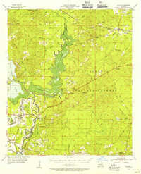 1955 Calvin1956 Print · USGSAcross the bayous and timberlands of Winn and Natchitoches Parishes in the mid-fifties, rural life was defined by the Kisatchie National Forest. Trace family roots through local landmarks like Bethlehem Ch, Emden Sch, and the Kansas City Southern rail line near St Maurice.3 unique versions available
 - 1956 Map of Shreveport
 1956 Shreveport1956 Print · USGSNorthern Louisiana during the mid-fifties presents a complex landscape of booming oil fields and strategic military installations. Genealogists and historians can trace the infrastructure of the Monroe Gas Field and family-named locales from Cotton Valley to Jonesboro.
 - 1956 Map of Colfax, 1957 Print
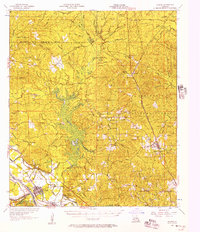 1956 Colfax1957 Print · USGSGrant and Winn Parishes come into focus during the mid-1950s, showing a landscape defined by forest reserves and rail-line settlements. Genealogists and historians can trace local roots through landmarks like Hebron Ch & Cem, Summerfield Sch, and McNeeley.3 unique versions available
 - 1957 Map of Montgomery
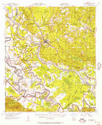 1957 Montgomery1957 Print · USGSThe Red River valley in the mid-1950s was a landscape of intricate bayous and established river towns. Genealogists can trace family footprints through sites like Cloutierville, Glaizes Cem, and the many rural schools such as St Matthews Sch.3 unique versions available
Showing maps 1-25 of 215
Top cities of Winn Parish
- Winnfield historical maps
- Dodson historical maps
- Calvin historical maps
- Atlanta historical maps
- Sikes historical maps
Frequently asked questions
- What are the different types of historical maps available for Winn Parish?
- What is the oldest map of Winn Parish?
- Where can I purchase historical maps of Winn Parish for my home or office?
- Where can I download high-res historical maps of Winn Parish?
- Are there historical topographic maps available for Winn Parish?
- Is there historical aerial imagery available for Winn Parish?
- Where are historical maps of Winn Parish sourced from?