1980s Maps of Winn Parish, Louisiana
Explore 31 historic maps of Winn Parish from the 1980s. These maps offer a rare glimpse into what life looked like during the 1980s — showing old roads, neighborhoods, homes, and landmarks that have changed or disappeared over time.
Whether you're researching your family's past, planning a metal detecting trip, or studying how Winn Parish's landscape evolved across the 1980s, these high-resolution maps are a powerful tool for exploring the history of this region.
- Focus on a specific era: All maps on this page are from the 1980s, giving you a focused view of this time period.
- See what’s changed: Compare century-old streets, trails, and buildings to today's modern landscape using overlays and satellite layers.
- Research with precision: Use these maps for genealogy, historical research, land use analysis, or educational projects.
- View, download, or print: Maps are fully viewable online in high resolution, and can be downloaded or printed for your own records.
Start exploring Winn Parish's history through authentic maps from the 1980s. This is your window into the past.
Winn Parish, LA maps
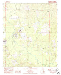
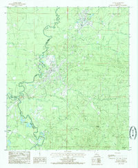
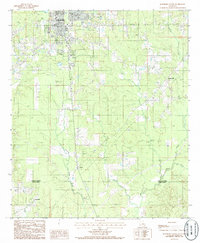
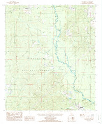
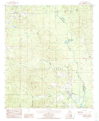
(31)- 1983 Map of Coochie Brake
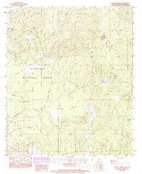 1983 Coochie Brake1983 Print · USGSCentral Winn Parish in the 1980s and early 1990s reveals a landscape of dense pine woods and wetland basins. Researchers can trace rural landmarks like Kimbrell Cem, Double Ch, and the extensive swamp waters of Coochie Brake.2 unique versions available
 - 1983 Map of Calvin, 1984 Print
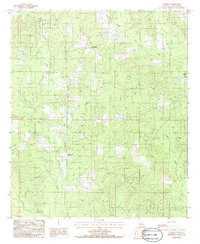
 1983 Calvin1984 Print · USGSWinn Parish in the early 1980s reveals a landscape where the Kisatchie National Forest and local timber industry meet small-town life. Researchers can trace deep family roots through Old Harmony Cem, Bethlehem Ch, and the rail-side community of Calvin.
 - 1983 Map of St. Maurice, 1984 Print
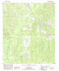
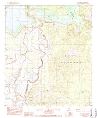 1983 St. Maurice1984 Print · USGSCentral Louisiana in the early eighties was a landscape of bayous and timberlands where the parish line followed the winding Saline Bayou. Trace the history of small communities and rural life through St Maurice Plantation, Pace Cem, and the New Enterprise Sch.2 unique versions available
 - 1983 Map of Coup Point, 1984 Print
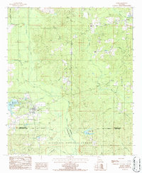
 1983 Coup Point1984 Print · USGSNatchitoches Parish was a landscape of industry and wilderness in the early eighties, defined by extensive energy development and protected forest lands. Genealogists and historians can trace family-named sites like Evergreen Cem alongside the Kansas City Southern line and the Black Lake Oil and Gas Field.
 - 1983 Map of Verda, 1984 Print
 1983 Verda1984 Print · USGSGrant and Winn Parishes come alive in the early 1980s, showcasing a landscape of pine forests and winding waterways. Researchers can trace the rails of the Kansas City Southern, locate old family sites near Dortigo Cem, or explore the shores of Nantachie Lake.
 - 1983 Map of Montgomery, 1984 Print
 1983 Montgomery1984 Print · USGSLouisiana's river country comes into focus in the early eighties as the Red River snakes past the hills of Montgomery. Genealogists and historians can trace the foundations of local communities at Pleasant Hill Cem, Crews, and the St Matthew Sch.2 unique versions available
 - 1984 Map of Shreveport
 1984 Shreveport1984 Print · USGSNorthern Louisiana at the peak of the 1980s reveals a landscape of massive water management projects and Cold War military hubs. Trace the rail lines of the Kansas City Southern Ry past Barksdale Air Force Base and the high ground of Driskill Mountain.2 unique versions available
 - 1984 Map of Flat Creek, 1985 Print
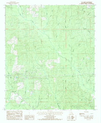 1984 Flat Creek1985 Print · USGSWinn Parish in the early 1980s is captured here through its intricate creek systems and timberland crossroads. Genealogists and local historians can trace the early road networks around Flat Creek, Murray Junction, and the winding banks of Beech Creek.
 - 1984 Map of Packton, 1985 Print
 1984 Packton1985 Print · USGSThe piney woods of Winn and Grant Parishes are captured here in the mid-1980s, showcasing a landscape shaped by forestry and small rural settlements. Researchers can trace local homesteads and crossroads near Packton, Jordan Hill, and New Moore while following the winding course of the Dugdemona River.
 - 1984 Map of Olla West, 1985 Print
 1984 Olla West1985 Print · USGSThe rural timberlands of Winn and La Salle parishes are captured in the mid-1980s just as these backcountry landscapes were being precisely surveyed. Researchers can trace the winding paths of Castor Creek, Yellow Jacket Creek, and the upland area of Richland.
 - 1984 Map of Winnfield East, 1985 Print
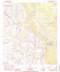
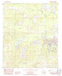
 1984 Winnfield East1985 Print · USGSWinn Parish in the early eighties shows a landscape shaped by timber processing and river bottomlands. Researchers can locate the eastern neighborhoods of Winnfield, the industrial presence at Creosote, and several small communities like Joyce and Colgrade.
 - 1984 Map of Winnfield West, 1985 Print
 1984 Winnfield West1985 Print · USGSWinn Parish in the mid-1980s reveals a center of Louisiana timber and industry as the city of Winnfield expands westward. Researchers can trace rural school locations like the Schoolhouse, the extent of the Kisatchie National Forest, and small outposts at Kyiales and Carla.
 - 1984 Map of Atlanta, 1985 Print
 1984 Atlanta1985 Print · USGSWinn Parish at the peak of the 1980s reveals a landscape shaped by timber and water within the Kisatchie National Forest. Genealogists and historians can trace old community hubs like Atlanta, Sardis, and historic stream fords at Beal Crossing.
 - 1984 Map of Georgetown, 1985 Print
 1984 Georgetown1985 Print · USGSGeorgetown and the surrounding forest lands are captured in the mid-1980s as the regional timber and oil economies matured. Researchers can trace family-named landmarks like Pardon Hills or locate old community centers such as Zion and Curry.
 - 1984 Map of Tullos, 1985 Print
 1984 Tullos1985 Print · USGSLa Salle Parish at the height of its mid-century oil and timber era is captured here, centered on the rail-linked towns of Tullos and Urania. Researchers can trace old transportation routes via Old R R Rd and locate several active Oil Field sites.
 - 1985 Map of Monroe South
 1985 Monroe South1985 Print · USGSNorth Central Louisiana in the mid-1980s was a hub of timber production and rail transport spanning from the Dugdemona River to the Ouachita valley. Family researchers and historians can trace the rail lines of the Midsouth Railroad through Jonesboro or find local landmarks like Mineral Springs and Punkin Center.2 unique versions available
 - 1985 Map of Williana
 1985 Williana1985 Print · USGSGrant Parish is shown as a heavily forested interior in the mid-eighties, dominated by public lands and small creek-side settlements. Researchers can locate the Williana community, the prominent Spanish Mound, and a local Cem near the forest interior.
 - 1985 Map of Savage Creek
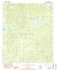
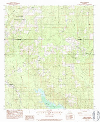
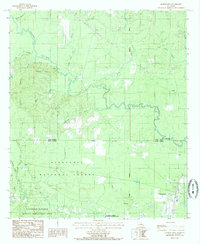
 1985 Savage Creek1985 Print · USGSGrant and Winn Parishes are captured here in the mid-1980s, showing a landscape defined by the expansive Iatt Lake and protected timberlands. Researchers can trace the rural settlement of Hurley or locate historic landmarks like Potato Hill and the Boat Ramp.
 - 1985 Map of Weston, 1986 Print
 1985 Weston1986 Print · USGSThe rural borderlands of Jackson and Winn Parishes come into focus in the mid-1980s, showcasing the piney woods landscape. Genealogists and historians can trace family locations near Weston, Walker, and the winding banks of Hurricane Creek.
 - 1985 Map of Jonesboro South, 1986 Print
 1985 Jonesboro South1986 Print · USGSJackson and Winn Parishes come to life in this mid-eighties survey of the north-central Louisiana timberlands. Genealogists and local historians can trace the rural landscape from the edge of Jonesboro down to smaller communities like Wyatt and Gansville.
 - 1985 Map of Hudson, 1986 Print
 1985 Hudson1986 Print · USGSWinn Parish in the mid-1980s remains a landscape of remote pine woods and small rural centers. Genealogists and local historians can trace the sites of Hudson, Gaars Mill, and Sikes, along with rural cemeteries and winding tributaries like Kiesche Creek.
 - 1985 Map of Dodson, 1986 Print
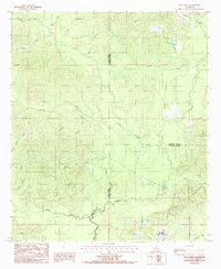
 1985 Dodson1986 Print · USGSThe community of Dodson is shown in the mid-1980s, nestled between the Kisatchie National Forest and the Dugdemona River. You can trace local landmarks like Antwine Creek, a rural Cem, and the winding path of Hurricane Creek.
 - 1986 Map of Saline
 1986 Saline1986 Print · USGSIn the mid-1980s, the village of Saline and the nearby community of Friendship served as the hubs of this three-parish border region. Local historians can trace family land near the Kisatchie National Forest or locate landmarks like Mill Creek Reservoir and Blewer Pond.
 - 1986 Map of Iron Branch
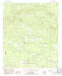
 1986 Iron Branch1986 Print · USGSThe Kisatchie National Forest in Winn Parish was a landscape of winding river bottoms and scattered timber settlements in the mid-1980s. Researchers can trace the area's rural development through landmarks like Brewtons Mill, the community of Bethlehem, and the banks of the Dugdemona River.
 - 1986 Map of Goldonna
 1986 Goldonna1986 Print · USGSThe Natchitoches and Winn Parish borderlands are captured here in the mid-eighties, centered on the village of Goldonna. Researchers can trace old family sites near Readheimer, locate secluded Cem plots, and explore recreational sites like the Boat Ramp on Saline Bayou.
Showing maps 1-25 of 31
Top cities of Winn Parish
- Winnfield historical maps
- Dodson historical maps
- Calvin historical maps
- Atlanta historical maps
- Sikes historical maps
Frequently asked questions
- What are the different types of historical maps available for Winn Parish?
- What is the oldest map of Winn Parish?
- Where can I purchase historical maps of Winn Parish for my home or office?
- Where can I download high-res historical maps of Winn Parish?
- Are there historical topographic maps available for Winn Parish?
- Is there historical aerial imagery available for Winn Parish?
- Where are historical maps of Winn Parish sourced from?