Old Maps of Dodson, Louisiana for Genealogy
Trace your family roots with 13 historic maps of Dodson. These high-res maps reveal old neighborhoods, homesites, landmarks, and streets — helping you uncover where your ancestors lived and how the area evolved over time.
- Explore historic neighborhoods: Identify where your relatives may have lived in the 1800s or 1900s.
- Compare maps over time: Trace the changes in streets, buildings, and landmarks for multi-generational research.
- Perfect for genealogy & ancestry research: Used by family historians and researchers to map out lineage and migration.
These maps are an incredible resource for exploring your personal connection to Dodson's past.
Dodson, LA maps
(13)- 1949 Map of Jonesboro, 1958 Print
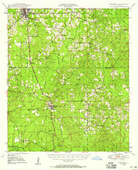 1949 Jonesboro1958 Print · USGSJackson and Winn Parish come alive in the late 1940s, showing a landscape of timberlands and rail-centered settlements. Researchers can trace rural life through landmarks like Gaars Mill Sch, Zion Hill Ch, and the Winona Lookout Tower.3 unique versions available
 - 1950 Map of Jonesboro
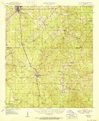 1950 Jonesboro1950 Print · USGSJackson and Winn Parish communities are captured here in the mid-twentieth century as the timber and rail economy flourished. Researchers can trace the Chicago Rock Island and Pacific rail line between Jonesboro and Dodson, locating rural landmarks like Mt Hebron Sch and Zion Hill Ch.2 unique versions available
 - 1955 Map of Shreveport
 1955 Shreveport1955 Print · USGSNorthern Louisiana in the mid-fifties is captured here as a landscape of military bases, vast oil fields, and burgeoning college towns. Genealogists and historians can trace the rail-and-river economy through the Monroe Gas Field, Grambling College, and Barksdale Air Force Base.3 unique versions available
 - 1956 Map of Shreveport
 1956 Shreveport1956 Print · USGSNorthern Louisiana during the mid-fifties presents a complex landscape of booming oil fields and strategic military installations. Genealogists and historians can trace the infrastructure of the Monroe Gas Field and family-named locales from Cotton Valley to Jonesboro.
 - 1984 Map of Shreveport
 1984 Shreveport1984 Print · USGSNorthern Louisiana at the peak of the 1980s reveals a landscape of massive water management projects and Cold War military hubs. Trace the rail lines of the Kansas City Southern Ry past Barksdale Air Force Base and the high ground of Driskill Mountain.2 unique versions available
 - 1985 Map of Monroe South
 1985 Monroe South1985 Print · USGSNorth Central Louisiana in the mid-1980s was a hub of timber production and rail transport spanning from the Dugdemona River to the Ouachita valley. Family researchers and historians can trace the rail lines of the Midsouth Railroad through Jonesboro or find local landmarks like Mineral Springs and Punkin Center.2 unique versions available
 - 1985 Map of Dodson, 1986 Print
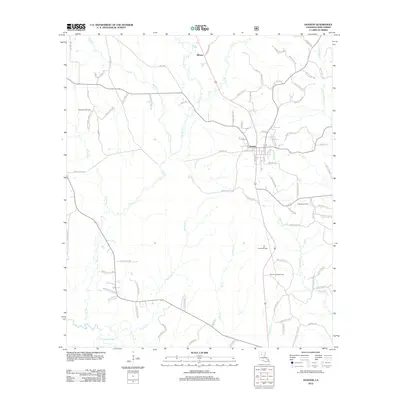
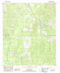 1985 Dodson1986 Print · USGSThe community of Dodson is shown in the mid-1980s, nestled between the Kisatchie National Forest and the Dugdemona River. You can trace local landmarks like Antwine Creek, a rural Cem, and the winding path of Hurricane Creek.
 - 2003 Map of Dodson, 2005 Print
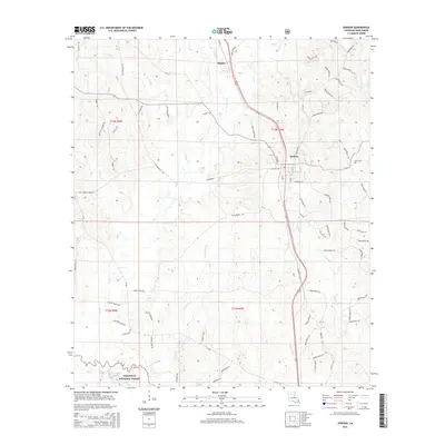
 2003 Dodson2005 Print · USGSWinn Parish at the turn of the millennium shows a landscape defined by timber, water, and rural growth. Researchers can trace the layout of Dodson and Winona or locate landmarks like the Lookout and Cem near the Dugdemona River.
 - 2012 Map of Dodson, 2012 Print
 2012 Dodson2012 Print · USGSCovers Dodson, including Milams, Winn Parish, and other nearby areas
 - 2015 Map of Dodson, 2015 Print
 2015 Dodson2015 Print · USGSCovers Dodson, including Milams, Winn Parish, and other nearby areas
 - 2018 Map of Dodson, 2018 Print
 2018 Dodson2018 Print · USGSCovers Dodson, including Milams, Winn Parish, and other nearby areas
 - 2020 Map of Dodson, 2020 Print
 2020 Dodson2020 Print · USGSCovers Dodson, including Milams, Winn Parish, and other nearby areas
 - 2024 Map of Dodson, 2024 Print
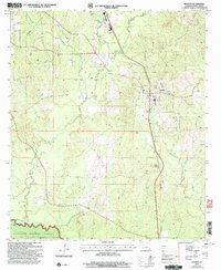
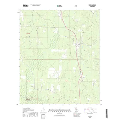
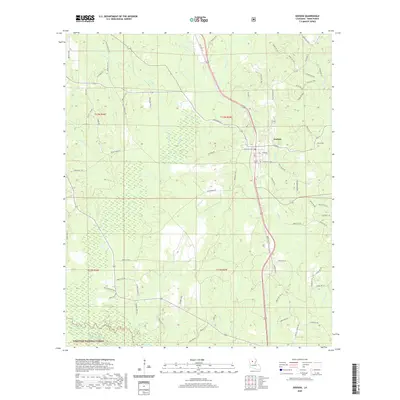
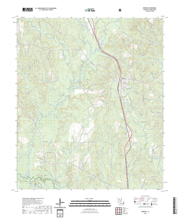 2024 Dodson2024 Print · USGSWinn Parish life in the piney woods is centered around the village of Dodson and its network of timber and parish roads. Genealogists and local historians can trace family-named sites like Moffett Cem and the boundaries of the Kisatchie National Forest.
End of results
Showing maps 1-13 of 13
Top cities near Dodson
- Winnfield historical maps
- Jonesboro historical maps
- Chatham historical maps
- Hodge historical maps
- North Hodge historical maps
- East Hodge historical maps
See more
Frequently asked questions
- What are the different types of historical maps available for Dodson?
- What is the oldest map of Dodson?
- Where can I purchase historical maps of Dodson for my home or office?
- Where can I download high-res historical maps of Dodson?
- Are there historical topographic maps available for Dodson?
- Is there historical aerial imagery available for Dodson?
- Where are historical maps of Dodson sourced from?