Old Maps of Dickey, Allagash for Academic Research
Study the evolution of Dickey with 10 high-resolution historic maps. Whether you're teaching, researching, or modeling changes in land use, these maps provide essential visual documentation of urban, environmental, and geographic change.
- Analyze long-term change: Track patterns in development, transportation, and natural features.
- Ideal for environmental or urban studies: Support academic projects with primary historical map data.
- Use in the classroom or lab: Educators and researchers rely on these maps to bring historical context to life.
These maps are a powerful tool for teaching, research, and visualizing how Dickey has changed over the decades.
Dickey, Allagash maps
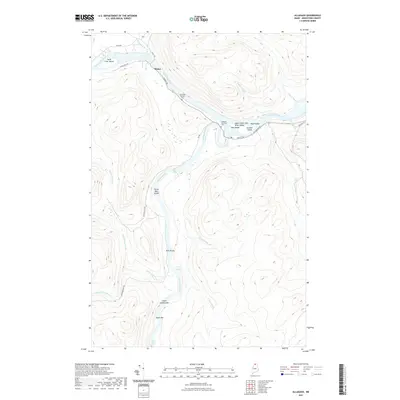
(10)- 1930 Map of Allagash
 1930 Allagash1930 Print · USGSThe northern Maine frontier at the turn of the 1930s was a landscape of remote river settlements and deep woods. Genealogists and historians can trace family locations along the St John River at Dickey, and find community landmarks like St Paul Ch and Henderson Sch.4 unique versions available
 - 1933 Map of Allagash
 1933 Allagash1933 Print · USGSThe northern Maine borderlands come alive in this early 1930s survey of the river confluences near Dickey. Genealogists and historians can trace the locations of the Log Cabin Sch, Kelly Sch, and landings like Boat Landing Camp along the wild rapids of the Allagash River.3 unique versions available
 - 1962 Map of Edmundston, 1966 Print
 1962 Edmundston1966 Print · USGSThe international borderlands of northern Maine and Canada come alive here during the early sixties, centered on the river-and-rail economies of the day. Genealogists and historians can trace the paths of the Bangor and Aroostook railroad through river towns like Fort Kent and St Agatha.2 unique versions available
 - 1986 Map of Allagash, 1987 Print
 1986 Allagash1987 Print · USGSNorthern Maine's remote river country comes into focus in the mid-1980s at the confluence of two legendary waterways. Trace the riverside settlements of Allagash and Dickey, or locate wilderness landmarks like Ghost Landing Bar and Eliza Hole Rapids.
 - 1993 Map of Allagash, 1994 Print
 1993 Allagash1994 Print · USGSThe Maine-Quebec borderlands in the early nineties show a landscape of deep timber and international riverways. Researchers can trace the remote settlements of Allagash and Dickey or locate historic river features like Castonia Rapids and Beau Lake.
 - 2011 Map of Allagash, 2011 Print
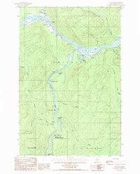
 2011 Allagash2011 Print · USGSCovers Dickey, including Allagash, T15 R10 WELS, and other nearby areas
 - 2014 Map of Allagash, 2014 Print
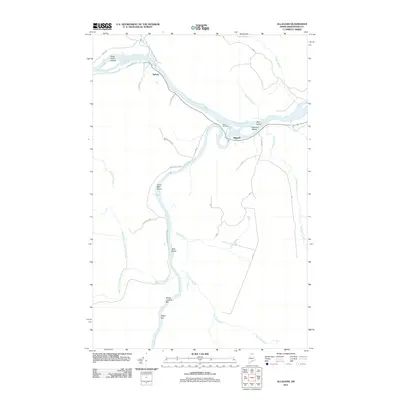
 2014 Allagash2014 Print · USGSCovers Dickey, including Allagash, T15 R10 WELS, and other nearby areas
 - 2018 Map of Allagash, 2018 Print
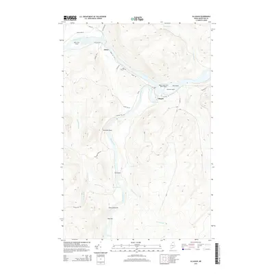
 2018 Allagash2018 Print · USGSCovers Dickey, including Allagash, T15 R10 WELS, and other nearby areas
 - 2021 Map of Allagash, 2021 Print
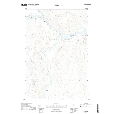
 2021 Allagash2021 Print · USGSCovers Dickey, including Allagash, T15 R10 WELS, and other nearby areas
 - 2024 Map of Allagash, 2024 Print
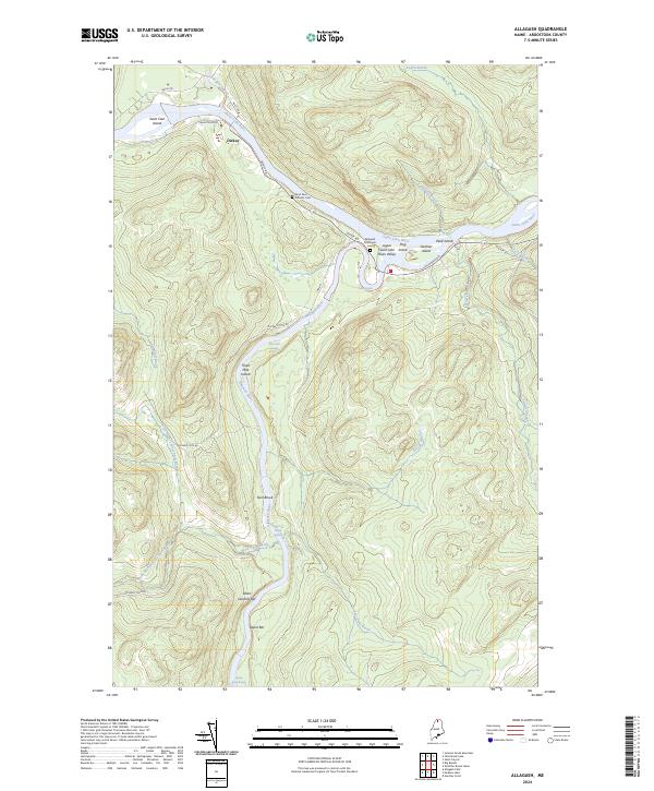 2024 Allagash2024 Print · USGSThe northern Maine wilderness comes into focus at the confluence of the St. John and Allagash rivers in this contemporary survey. Genealogists and historians can locate the riverside settlement of Dickey, the Allagash Municipal Cem, and numerous river bars like Ghost Landing Bar.
End of results
Showing maps 1-10 of 10
Frequently asked questions
- What are the different types of historical maps available for Dickey?
- What is the oldest map of Dickey?
- Where can I purchase historical maps of Dickey for my home or office?
- Where can I download high-res historical maps of Dickey?
- Are there historical topographic maps available for Dickey?
- Is there historical aerial imagery available for Dickey?
- Where are historical maps of Dickey sourced from?