Old Maps of Robinson, Blaine for Academic Research
Study the evolution of Robinson with 15 high-resolution historic maps. Whether you're teaching, researching, or modeling changes in land use, these maps provide essential visual documentation of urban, environmental, and geographic change.
- Analyze long-term change: Track patterns in development, transportation, and natural features.
- Ideal for environmental or urban studies: Support academic projects with primary historical map data.
- Use in the classroom or lab: Educators and researchers rely on these maps to bring historical context to life.
These maps are a powerful tool for teaching, research, and visualizing how Robinson has changed over the decades.
Robinson, Blaine maps
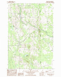
(15)- 1934 Map of Bridgewater
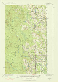
 1934 Bridgewater1934 Print · USGSAroostook County's border with New Brunswick is detailed here during the mid-1930s, highlighting the Bangor and Aroostook rail network. Genealogists can locate family landmarks like Jewells Corner, Snow Settlement, and Robinson Sta.
 - 1938 Map of Bridgewater
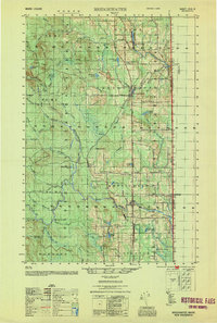
 1938 Bridgewater1938 Print · USGSEastern Aroostook County is shown here during the mid-1930s, documenting the vital rail and border connections of the era. Researchers can trace the old paths of the Bangor and Ar00stook railroad and locate community landmarks like Snow Settlement and Flagstaff Sch.3 unique versions available
 - 1951 Map of Bridgewater, 1952 Print
 1951 Bridgewater1952 Print · USGSAroostook County's borderlands are captured here at mid-century, showing the vital rail and road networks connecting Maine to New Brunswick. Genealogists can locate old rural landmarks like Flagstaff Sch, Snow Settlement, and the Monticello Sta.3 unique versions available
 - 1953 Map of Bridgewater
 1953 Bridgewater1953 Print · USGSThe Maine-New Brunswick borderlands are captured here in the early 1950s, showing a landscape shaped by the Bangor and Aroostook rail line. Researchers can trace historic school sites like Bratton Sch and family-named corners such as Jewells Corner or Snow Settlement.
 - 1959 Map of Woodstock, 1975 Print
 1959 Woodstock1975 Print · USGSNorthern Maine and New Brunswick meet along the river valleys in the late fifties, showcasing an era of international rail and river commerce. Genealogists can trace family roots through border towns like Woodstock and Houlton, or along the lines of the Bangor & Aroostook railroad.
 - 1963 Map of Woodstock
 1963 Woodstock1963 Print · USGSThe Maine-New Brunswick borderlands come alive in the early sixties, showing the vital river-and-rail connection between Houlton and Woodstock. Genealogists and historians can trace the paths of the Canadian Pacific RR and locate rural communities like Stickney and Upper Kent.
 - 1975 Map of Bridgewater NE, 1981 Print
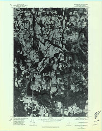 1975 Bridgewater NE1981 Print · USGSAroostook County farmland and forest meet the international border during the mid-seventies in this detailed orthophoto. Researchers can trace rural property layouts and settlements like Bridgewater, Robinsons, and the quiet waters of Portland Lake.
 - 1981 Map of Brooklin
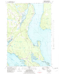 1981 Brooklin1981 Print · USGSCoastal Hancock County is captured here in the early 1980s, showcasing the traditional maritime settlements between Blue Hill Bay and Eggemoggin Reach. Genealogists can trace family names at Pine Grove Cemetery and Freethy Cemetery or explore the docks at Center Harbor.
 - 1984 Map of Bridgewater, 1985 Print
 1984 Bridgewater1985 Print · USGSThe Maine-New Brunswick border comes to life in the early 1980s, documenting the international boundary between Aroostook County and Carleton County. Researchers can trace the Bangor and Aroostook rail line through Bridgewater or locate rural landmarks like Smith Cem and the Fish Hatchery.
 - 1993 Map of Houlton
 1993 Houlton1993 Print · USGSThe Maine-New Brunswick borderlands are captured here in the early 1990s, centered on the transit and trade hub of Houlton. Genealogists and historians can trace family-named locales and crossroads like Porter Settlement, Jackson Settlement, and Bridgewater Corner.
 - 2011 Map of Bridgewater, 2011 Print
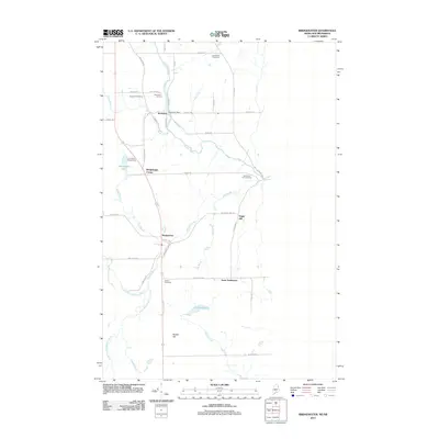 2011 Bridgewater2011 Print · USGSCovers Robinson, including Blaine, Bridgewater, and other nearby areas
 - 2014 Map of Bridgewater, 2014 Print
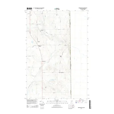 2014 Bridgewater2014 Print · USGSCovers Robinson, including Blaine, Bridgewater, and other nearby areas
 - 2018 Map of Bridgewater, 2018 Print
 2018 Bridgewater2018 Print · USGSCovers Robinson, including Blaine, Bridgewater, and other nearby areas
 - 2021 Map of Bridgewater, 2021 Print
 2021 Bridgewater2021 Print · USGSCovers Robinson, including Blaine, Bridgewater, and other nearby areas
 - 2024 Map of Bridgewater, 2024 Print
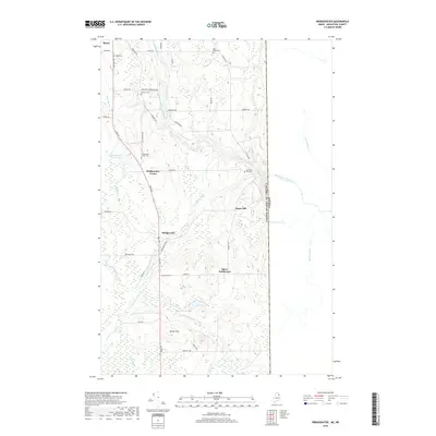
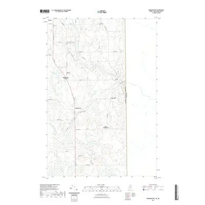
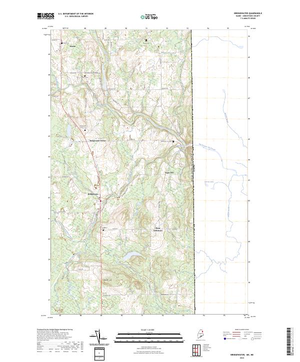 2024 Bridgewater2024 Print · USGSAroostook County's eastern edge is detailed here in the present day, showing the rural settlements of Bridgewater and Blaine along the Canadian border. Genealogists can trace local roots through numerous family and community sites like Snow Settlement, Smith Cem, and Boundary Line Cem.
End of results
Showing maps 1-15 of 15
Frequently asked questions
- What are the different types of historical maps available for Robinson?
- What is the oldest map of Robinson?
- Where can I purchase historical maps of Robinson for my home or office?
- Where can I download high-res historical maps of Robinson?
- Are there historical topographic maps available for Robinson?
- Is there historical aerial imagery available for Robinson?
- Where are historical maps of Robinson sourced from?